Sveta Katarina (Zgornja Kapla) - Sršenov vrh
Starting point: Sveta Katarina (Zgornja Kapla) (777 m)
| Lat/Lon: | 46,63627°N 15,37496°E |
| |
Time of walking: 1 h
Difficulty: easy marked way
Altitude difference: 186 m
Altitude difference po putu: 235 m
Map: Pohorje 1:50.000
Recommended equipment (summer):
Recommended equipment (winter): ice axe, crampons
Views: 454
 | 1 person likes this post |
Access to the starting point:
a) From the Maribor - Dravograd road, drive almost to the Ožbalt settlement (from the route of Dravograd, a little beyond the settlement). A few 100 m before (from the route of Dravograd, after) this settlement, the road to Gradišče and Kapla branches off to the right (from the route of Dravograd, to the left), and then at the junctions, follow the road towards Kapla. Follow the road to Zgornja Kapla, where you park in the centre of the village, below the Church of St Catherine of Alexandria, in the cemetery parking lot. From the main road to the starting point is just under 15 km.
b) From the Dravograd - Maribor road, drive to the Ožbalt settlement, where you turn left at the parish church (right from Maribor) onto a side road that continues by the branch primary school and then climbs along the Ožbaltski brook. Follow the crossroads towards Kaple, and we drive to the centre of Zgornja Kapla, where we park in the cemetery parking lot below the Church of St Catherine of Alexandria. From the main road to the starting point is just under 8 km.
Path description:
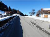
From the parking lot, walk to the red mountain direction signs, turn left in the route Sršenov vrh and climb across the meadow to the edge of the forest, where a beautiful view opens up as you look back.
Continue straight ahead on the marked path into the woods, and we climb through the woods for a few minutes, then continue along the edge of the woods. A little further on, we cross an asphalt road and return to the forest, through which we continue our moderate ascent. After a few minutes, we return to the asphalt road and follow it to the right, passing the Pokržnik homestead, and after the homestead, we cross Pokržnikov vrh on the left (eastern) side, from where we have a view towards the transmitters on Sršenovem vrh. There is a gentle downhill and a beautiful view opens up to the right, reaching to the Koroška 2,000m, and with good visibility you can see even further.
At this viewpoint, the trail stops descending and then climbs gently up to the forest, where the Sršenov vrh markers direct us left into the forest. There is a short steeper climb through a fairly dense forest, and higher up you reach cart track and follow it to the right. Cart track quickly leads to the next tarmac road, which is crossed across to the right, then bear slightly left into the forest, through which you continue on the waymarked path. A little higher, at a small crossroads, we reach another road, and we go left on the upper road, and after a few steps to the right. There is only a short moderate climb and we reach the transmitters at Sršenov Top.
Description and pictures refer to January 2022.

Pictures:
 1
1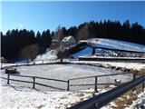 2
2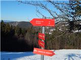 3
3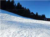 4
4 5
5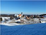 6
6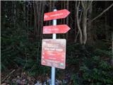 7
7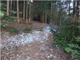 8
8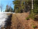 9
9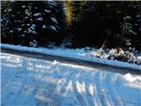 10
10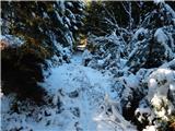 11
11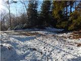 12
12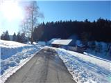 13
13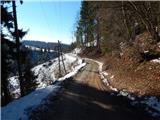 14
14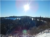 15
15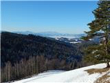 16
16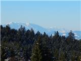 17
17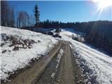 18
18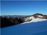 19
19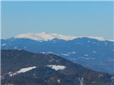 20
20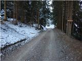 21
21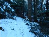 22
22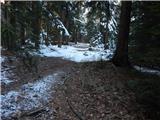 23
23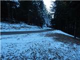 24
24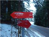 25
25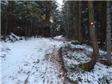 26
26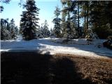 27
27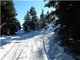 28
28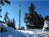 29
29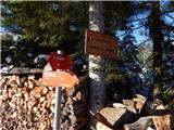 30
30 31
31
Discussion about the trail Sveta Katarina (Zgornja Kapla) - Sršenov vrh