Studenice - Plešivec (pri Boču) (final part on forest road)
Starting point: Studenice (260 m)
| Lat/Lon: | 46,2999°N 15,6138°E |
| |
Name of path: final part on forest road
Time of walking: 2 h
Difficulty: easy marked way
Altitude difference: 562 m
Altitude difference po putu: 600 m
Map: Posavsko hribovje Boč - Bohor 1:50.000
Recommended equipment (summer):
Recommended equipment (winter):
Views: 1.693
 | 2 people like this post |
Access to the starting point:
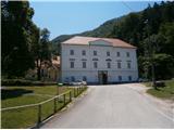
a) From the route of Ljubljana, leave the motorway at Slovenske Konjice and drive through Žič, Loč and Zbelovo to the centre of Poljčany. In the centre, turn right in the direction of Studenice and after about three kilometres reach Studenicee, where you continue to the right over the bridge over the Dravinja River into the central part of the settlement. Park safely in front of the monastery complex.
b) From Maribor, leave the motorway at Slovenska Bistrica, where signs direct you to Poljčane. In the centre, turn left towards Studenice and after about three kilometres reach Studenice, where you continue right over the bridge over the Dravinja River into the central part of the settlement. Park safely in front of the monastery complex.
c) From the direction of Ptuj, Kidričevo via Ptujska gora, Majšperk and Makole, arrive at Studenice, where you continue left over the bridge over the Dravinja river into the central part of the settlement. Park safely in front of the monastery complex.
Path description:
After a short tour of the central part of Studenice, we continue to the left of the monastery complex by the parish. In the passageway/underpass between the parish and the Studenicee Vineyarders' Association, continue up the cart track along the stone walls and the Nun's Cemetery. Soon reach the spring(s) of the Warm Studenica Stream on the left of the path and cross the stream on a narrow footbridge. Continue uphill, now on the old Roman road, which has retained its original form over the centuries as a basic route higher up to Boč. At the exit to the forest road turn left, the road to the right leads to the settlement Podboč or Zgornje Poljčane.
Follow the forest road and at the first major crossroads/fork continue to the right, the road to Makol leads off to the left. Further on, the log cabin of the hunters of LD Poljčane on Golnik is reached on the right side of the road. Continue along the road, which levels out for a few metres. After a short flat area, continue ascending and soon reach a crossroads again, where you turn left onto a narrow forest road, and to the right the path continues towards the tower at Boč. Following the narrow forest road between Kisovec to the left and Drevesnica to the right, you soon reach the 645-metre high pass above Formila. Continue downwards, Formila is already in sight to the right of us, soon joined on the left by the marked mountain trail from Makoli.
Formila is reached and there is a short extension to the crossroads, left for the partisan hospital, Gavez, Grillo's chapel, Plešivec. . . and right for the mountain lodge at Boč. The crossroads is also the contact with the Styrian - Zagorje or ,,B,, - Brother trail.
At the crossroads, continue left along the forest road and after a good two hundred metres, turn left slightly below the route of the road to reach the intermediate destination of the route, the partisan hospital at Formila. It is still well hidden, although it lies directly next to the road. The wooden sign with the inscription is on a trunk but unfortunately it has also been removed several times, knocked to the ground and so on.
After a short visit to the point along the trail, continue along the forest road for a few hundred metres and at the first turning to the right continue along the forest path. There is no direction sign at the turn-off, but there is an easy-to-follow mountain path through a mixed deciduous and partly coniferous forest. During the growing season there is a lot of hellebores. Soon you reach a forest road opposite a small football field and turn left. Continue along the hunters' home LD Rogaška Slatina, which is on the right side of the path, and the Gavez homestead, which is on the left side of the path. The asphalt road from Rogaška Slatina soon joins from the right. Continue higher along the forest road, the route signs are also helpful and after a few hundred metres, by an abandoned forestry ramp, continue to the right, the return road to Formila, Makole, Ravnocerje. . . leads off to the left.
To the right leads the mountain forest path to the top of Plešivec (also direction signs) while we continue up the wide forest road. There are more and more conifers and the road winds pleasantly. There is a small clearing along the path, a few tens of metres in size, and further on through a distinct section of conifers to the left and right of the path. The road lays down and somewhere to the right and left three or four forestry logging trail join in a few metres. Here, a few metres into the woods to the left, is an old, partially damaged cast-iron cross, somewhere on the "spiritual" top of Plešivec. After a short visit, continue along the forest road a little to the left and to the right above the road, also somewhere the highest point/peak of Plešivec. After a few dozen metres, exit onto a small partially cut clearing or plateau and somewhere the unofficial "cycling" peak of Plešivec. Another extension to the right for less than a hundred metres and the contact with the forest mountain path, which is somewhere the "mountain/hiking" peak of Plešivec. Unfortunately, there are no views.
The length of the route from Studenice is about 8500 metres, 600 positive vertical metres and 30 negative vertical metres.

Pictures:
 1
1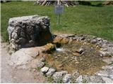 2
2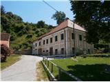 3
3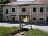 4
4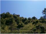 5
5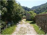 6
6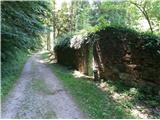 7
7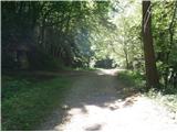 8
8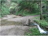 9
9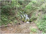 10
10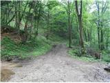 11
11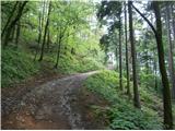 12
12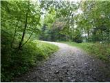 13
13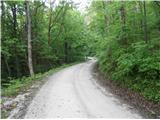 14
14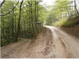 15
15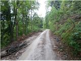 16
16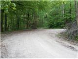 17
17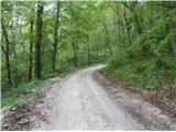 18
18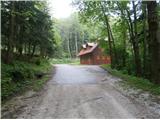 19
19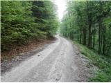 20
20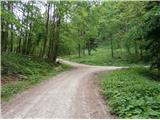 21
21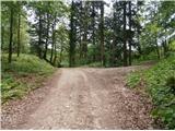 22
22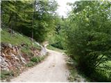 23
23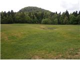 24
24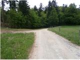 25
25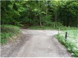 26
26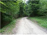 27
27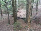 28
28 29
29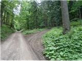 30
30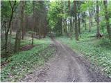 31
31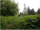 32
32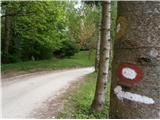 33
33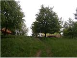 34
34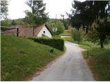 35
35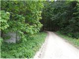 36
36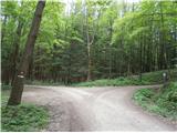 37
37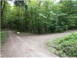 38
38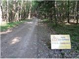 39
39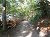 40
40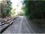 41
41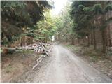 42
42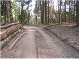 43
43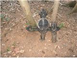 44
44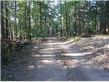 45
45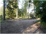 46
46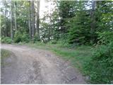 47
47 48
48
Discussion about the trail Studenice - Plešivec (pri Boču) (final part on forest road)
|
| bruny31. 10. 2015 |
Po opisani poti danes vzpon in tudi sestop nazaj v Studenice. Na fotkah je veliko zelenila, realnost danes bolj v oranžno/rjavih jesenskih barvah. Tudi na gozdni cesti, ki predstavlja glavnino trase je prevladovala listnata podlaga. Pot v glavnem suha, srečal nikogar. Na treh štirih pozicijah nekoliko v daljavi se je slišal zvok motorke...Ja pravi dan za delanje drv... Trasa poti/822 metrov visoki Plešivec iz Studenic in nazaj, 31.10.2015 Lp
|
|
|