Stogovci (Vabča vas) - Jelovice
Starting point: Stogovci (Vabča vas) (232 m)
| Lat/Lon: | 46,33584°N 15,75337°E |
| |
Time of walking: 1 h 40 min
Difficulty: easy marked way
Altitude difference: 391 m
Altitude difference po putu: 430 m
Map:
Recommended equipment (summer):
Recommended equipment (winter): ice axe, crampons
Views: 138
 | 1 person likes this post |
Access to the starting point:
a) Exit the Štajerska motorway at exit Slovenska Bistrica - South, then follow the road to Poljčane and from there to Makole, Majšperk and Ptuj. At the end of Majšperk exit the roundabout in the direction of Žetale and Jurovci. Continue along the main road to Stanečka vas and a little further. At the end of Stanečka vas, turn right towards Žetale and Naraplje. At this crossroads, we see the first signs for Jelovice, and we drive a little further to the hamlet of Vabča vas, where the route described above begins at the bus stop. There are no parking spaces at the starting point.
b) Leave the Podravje motorway at exit Lancova vas, then follow the signs for Podlehnik and Jurovce. At the end of Tržec go right out of the roundabout towards Jurovci and continue towards Majšperk. In Stogovci turn left towards Žetale and in the direction of the mountain trails for Jelovice and Kupčinji Vrh. Just a little further on from the crossroads, you will arrive in the hamlet of Vabča vas, where the trail described above begins. There are no parking spaces at the starting point.
Path description:
From the hamlet of Vabča, we continue along the asphalt road that leads us along the Jesenice stream and quickly leads us to the beginning of the Naraplje settlement. A little further on from the marked crossroads, continue right towards the marked path to Jelovice (straight through the centre of Naraplje), where the path continues along the gently ascending asphalt road, which leads us to a few houses. At the houses the road turns right and we continue straight on cart track, which leads us to the Vondušek stream, which we cross over a wooden bridge. On the other side of the stream, the path enters the forest and climbs steeply up the slope. We climb steeply through the forest for a while, then return to the asphalt road, which continues the climb, leading us under the nearby hamlet. At a small crossroads, continue straight on (if you go left, you will join the marked path from the Naraplje settlement), where you will then pass a chapel. Higher up, the path turns left, and at the right-hand bend it joins the marked path from Naraplje.
Continue along the asphalt road for a short distance, and when the road forks, continue straight on the footpath, which will take you up to the church of St. Bolfenko in a few minutes.
From the church, continue south and follow the dirt road down to the nearby chapel, where you will reach an asphalt road.
Continue left towards the top of Jelovice and Donačka gora (descend to the right to Stogovci) and follow the asphalt road, which turns to the right. After a few minutes, we reach the registration box (checkpoint 8 on the Halo Mountain Route) and we continue along the road that leads us along the eastern slopes of Kerješet Peak. At the next crossroads, by the NOB memorial, continue to the right, and then the signs for the Jelovice peak direct you to the right on the footpath. The ascent through the forest follows, and after a few minutes you join the cart track, which continues the cross-climb. When you reach the ridge connecting the top of Jelovice with Kerješetov vrh, go left (right Kerješetov vrh) and take the minor road. Continue on the minor road, which climbs gently at first and then moderately. The nearby meadow, which offers a beautiful view, is passed on the left, and after the nearby hut you arrive at a marked crossroads in the immediate vicinity of the top of Jelovice.
Here, turn right onto a less well-marked path, which takes a few steps to reach the highest peak of the Halos.
Stogovci - St. Bolfenk 1:00, St. Bolfenk - top Jelovice 0:40.
Description and pictures refer to the situation in April 2022.

Pictures:
 1
1 2
2 3
3 4
4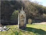 5
5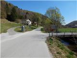 6
6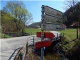 7
7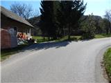 8
8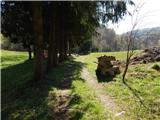 9
9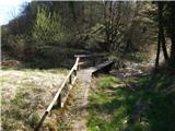 10
10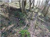 11
11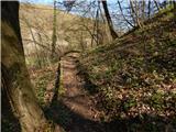 12
12 13
13 14
14 15
15 16
16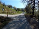 17
17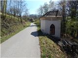 18
18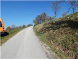 19
19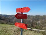 20
20 21
21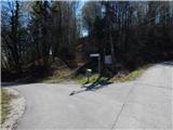 22
22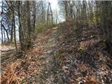 23
23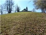 24
24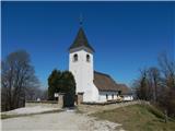 25
25 26
26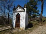 27
27 28
28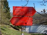 29
29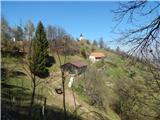 30
30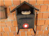 31
31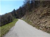 32
32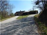 33
33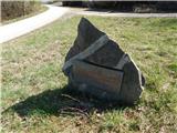 34
34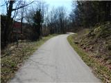 35
35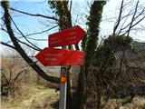 36
36 37
37 38
38 39
39 40
40 41
41 42
42 43
43 44
44 45
45 46
46 47
47 48
48 49
49 50
50
Discussion about the trail Stogovci (Vabča vas) - Jelovice