Srednji vrh - Techantinger Mittagskogel (Trupejevo poldne) (via Grajšca)
Starting point: Srednji vrh (960 m)
| Lat/Lon: | 46,4894°N 13,8371°E |
| |
Name of path: via Grajšca
Time of walking: 4 h
Difficulty: easy unmarked way
Altitude difference: 971 m
Altitude difference po putu: 1100 m
Map: Kranjska Gora 1:30.000
Recommended equipment (summer):
Recommended equipment (winter): ice axe, crampons
Views: 15.897
 | 3 people like this post |
Access to the starting point:
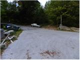
From the motorway Ljubljana - Jesenice, take the exit Jesenice - west (Hrušica) and continue in the direction of Kranjska Gora. When you reach Gozd-Martuljek, turn right in the direction of Srednji Vrho and follow the narrow and steep road to the above-mentioned place. When the road levels out a bit, you will come to a crossroads of several roads and a turning point. Park here in a suitable space at the junction.
Path description:
From the turning point at Srednji Vrh, continue north, where you will immediately reach a small crossroads. From the junction, continue along the lower right-hand road, which is closed to public traffic by a traffic sign. The road first gently descends and then begins to climb gently past a few houses, after which the asphalt ends. At two successive small crossroads just above the village, bear left and continue for some time along a gently ascending road which crosses a number of torrents, ravines and streams. In the lower part of the path, we get some more views of the Martuljkovo group of mountains, and then the road turns into a forest. For the first hour of the walk, the road climbs gently to moderately, then flattens out and even descends slightly a few times. In the last part of the ascent along the road, the forest thins out and the path leads to the Hladnik hunting lodge, which is situated in the middle of a large meadow.
After the hunting lodge, continue to the left, and the path immediately leads to an unmarked crossroads. Here, continue right into the forest and continue climbing up the relatively steep cart track. At a slightly higher altitude, you reach the next fork in the track, where you continue along the right-hand track, which continues to climb cross-country to the right. The above-mentioned cart track soon becomes completely flat and leads to a small valley where the Hladnik stream is crossed. Immediately after the stream, turn left and climb moderately along it for a while, then the path passes into a dense forest where it starts to climb steeply. After 15 minutes of steep ascent, the path leads us out of the forest, which then lays down and slowly begins to disappear on the grassy slopes of Grajšca. In a few places, the less visible path, which runs along the valley, leads us higher up past the animal watering point, and the valley splits into two parts just above the watering point.
Continue along the left-hand side of the much longer and steeper valley, which slowly turns more and more to the left. Here, if we are quiet enough and lucky enough, we may spot a marmot. In the middle of the upper part of Grajšca, a passage to the right branches off towards the boundary ridge, and we continue straight ahead and begin to climb through a sparse larch forest in an increasingly narrow valley. Higher up, the valley narrows into a torrential gully, which leads to a small pass north-west of Murnovec. Continue slightly left (right Maloško poldne) along the path, which continues with some slight ascents and descents, crossing overloking and partly grassy slopes. The way forward gradually begins to climb and after a while leads us to the saddle between Lepim vrh (so on the maps, otherwise the peak has other names Bele peči, Peči and Na Pečeh) on the left and Techantinger Mittagskogel on the right.
From the saddle, where the path from Železnica joins, continue right and, following the increasingly scenic slope surrounded by dwarf pines, reach the summit in a few minutes.
The last metres below the summit are slightly exposed and dangerous to slip in the snow.

Pictures:
 1
1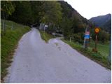 2
2 3
3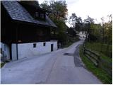 4
4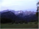 5
5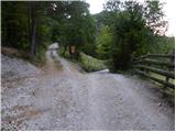 6
6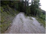 7
7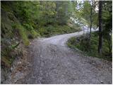 8
8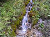 9
9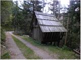 10
10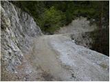 11
11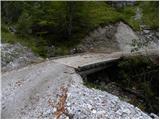 12
12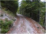 13
13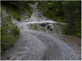 14
14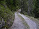 15
15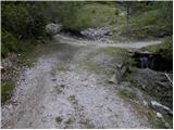 16
16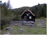 17
17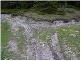 18
18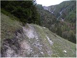 19
19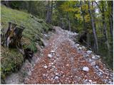 20
20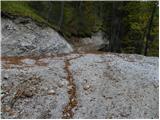 21
21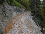 22
22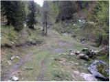 23
23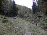 24
24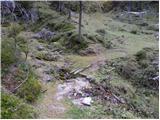 25
25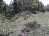 26
26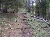 27
27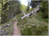 28
28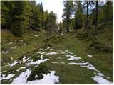 29
29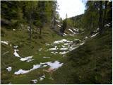 30
30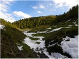 31
31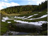 32
32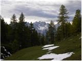 33
33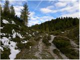 34
34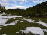 35
35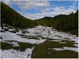 36
36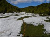 37
37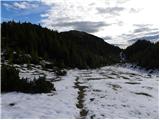 38
38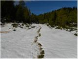 39
39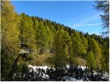 40
40 41
41 42
42 43
43 44
44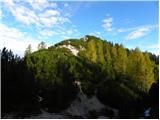 45
45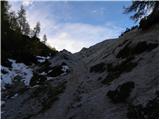 46
46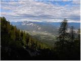 47
47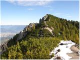 48
48 49
49 50
50 51
51 52
52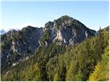 53
53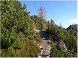 54
54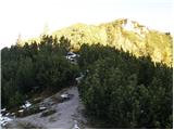 55
55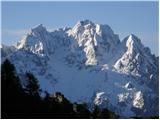 56
56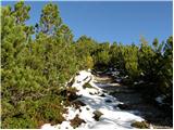 57
57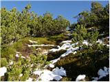 58
58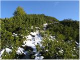 59
59 60
60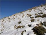 61
61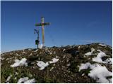 62
62 63
63
Discussion about the trail Srednji vrh - Techantinger Mittagskogel (Trupejevo poldne) (via Grajšca)
|
| majdicst29. 09. 2008 |
Prijetna pot, le začetek je nekoliko dolgočasen, saj kakšno uro praktično ne pridobiš nobenega višinskega metra (vse do lovske koče). Na zadnjem sedlu je potrebno malo pazljivosti, saj se znajdeš na razpotju štirih poti, a le ena je "tista prava" in to skrajno desna.
Vrh je izjemno razgleden, a ima še eno drugo, manj prijetno lastnost - očitno so si ga za opravljanje velike potrebe izbrale prav vse ovce, ki se pasejo v Karavankah, saj je na debelo in popolnoma pokrit z njihovimi iztrebki. Ne na vrhu, ne kakšnih dvajset metrov pod njim ni mogoče najti niti kvadratnega centimetra, na katerega bi lahko odložil nahrbtnik. Počitek si lahko privoščiš na grebenu, na katerem se nahaja tudi mejni kamen.
Sestopili smo po železnici (le od kod so dobili to ime?) - tudi ta pot je prijetna, razen nekaj prvih metrov.
Priporočljiv izlet za vse pohodnike, ki imajo vsaj majčkeno smisla za orientacijo.
|
|
|
|
| fpetel111. 11. 2008 |
Tudi prvo uro in 15', kolikor smo rabili mi do koče, pridobiš dobrih 200 metrov na višini in uživaš v žuborenju potočka pot tabo, tolmunčkov od malo dalje, slapičev, ki tečejo nad cesto in lepe narave. Planina Grajšca je prav idilična, vrhovi Kresišče , Trupejevo poldne in Maloško poldne pa zelo razgledni - predvsem na koroško stran.
Pri vzponu na Kresišče smo šli kar direkt s planine. Tako smo se do vrha vsi vsah malo seznanili z rušjem.
Sestopili smo mimo planine Blekova in po Železnici mimo Jureževe kmetije.
Orientacija je v lepem vremenu enostavna - večinoma poteka tako in tako po grebenu. (primerjava z nekaterimi neoznačenimi potmi in brezpotji v KS alpah) Pot po grebenu je dobro ohranjena in vseskozi zelo razgledna.
|
|
|
|
| žl12. 11. 2008 |
Od kdaj ima Trupejevo poldne na vrhu zvonček namesto velikega križa?Maloško poldne bi bilo bolj pravilno .POzdrav.
|
|
|
|
| viharnik12. 11. 2008 |
Tudi meni se zdi,da slika kaže na Maloško poldne,ker je zadnji del poti iz smeri mimo murnovca na greben,precej zaraščen z rušjem.Tudi sam vrh nima zvonca,ampak star križ.
|
|
|
|
| Tadej12. 11. 2008 |
Na zadnji sliki, desno od mejnega kamna je stojalo, kjer je stal križ. Križ so vrgli v prepad zato na sliki ni križa. Križ so naslednje leto ponovno postavili kar lahko vidite na tej sliki http://www.hribi.net/slika.asp?gora=2353
|
|
|
|
| viharnik12. 11. 2008 |
Izgleda,da me že dolgo ni bilo tu gori...Nazadnje,se spominjam starega,rjavega križa oz. palice,ki je komaj nekako služila označbi vrha.
|
|
|
|
| pohodnica5312. 11. 2008 |
je zelo izpostavljen, ker imam vrtoglavico, sicer pa me mika ta tura
|
|
|
|
| Kriška12. 11. 2008 |
Ne, ni, razen mogoče zadnjih nekaj 10 metrov, ko greš blizu roba grebena.
|
|
|
|
| žl13. 11. 2008 |
Križ z vrha Trupeja so že pred leti vrgli v prepad.Ponovno je bil postavljen kar velik ,z jeklenicami pripet na betonskem podstavku.Pri mojem zadnjem obisku pred tremi leti je bilo še tako .Torej spet spremenba.Le zakaj ga ne pustijo pri miru?Pohodnica 53 ,priporočam prelepa tura.
|
|
|
|
| jaz14. 11. 2008 |
V križ je udarila strela, ostanke so vrgli čez steno.Lp!
|
|
|
|
| Fazo28. 09. 2009 |
Super izlet, odlična tura, nobenih ljudi, edino od ovc je vse pokakano na vrhu, tako da se je nemogoče izognit hoji po dreku če se hočeš vpisat  Naredili smo pa krožno turo čez grajšco gor in čez železnico dol. Pot čez železnico je kar precej zrita zaradi spravila lesa in v kekšnem bolj deževnem dnevu kar težko prehodna. Že včeraj je bila na veliko delih popolnoma pod vodo/blatom. Lp, matevž P.S. tako prijaznih ljudi, kot smo jih srečali na srednjem vrhu pa že res dolgo nisem srečal! Res prijetno presenečen!
|
|
|
|
| Flora124. 10. 2010 |
Včeraj opravili pot vas Srednji vrh, lovska koča, Kresišče, po grebenu na Maloško poldne, do Trupejevega poldna in dol ob potoku do lovske koče in do vasi Srednji vrh. Mrzlo, a ne tako kot prejšnji teden, veter. Pot je na grebenu na mestih zasnežena, potrebna previdnost, drugače krasen ambient z rumenimi macesni in snegom. Lovci so spet nekaj streljali. Na Kresišču sva še srečali ljudi, naprej po grebenu in do lovske koče nikogar.
|
|
|
|
| Flora124. 10. 2010 |
vas Srednji Vrh 
|
|
|
|
| trdi19. 08. 2019 |
Od manjše dolinice, kjer prečimo potok Hladnik je sedaj narejen nov kolovoz do napajališča za živali, malo preden se začne Grajšca in se lahko gre po njem.
|
|
|