Spodnja Idrija - Gradišče (above Spodnja Idrija) (ridge path)
Starting point: Spodnja Idrija (305 m)
| Lat/Lon: | 46,0323°N 14,0257°E |
| |
Name of path: ridge path
Time of walking: 2 h
Difficulty: partly demanding unmarked way
Altitude difference: 693 m
Altitude difference po putu: 693 m
Map: Idrijsko in Cerkljansko 1: 50.000
Recommended equipment (summer):
Recommended equipment (winter): ice axe, crampons
Views: 4.420
 | 1 person likes this post |
Access to the starting point:
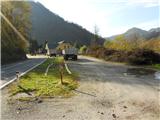
From Ljubljana, we drive towards Idrija. In Idrija, turn right at the second traffic lights towards Spodnja Idrija (4 km). Pass through Spodnja Idrija in the direction of Tolmin. Just before the end of Spodnja Idrija, you will see Čar's sawmill on your left. Park at the beginning of the large area next to the main road so as not to interfere with the work at the sawmill.
From Tolmin, drive towards Ljubljana, through the places along the Soča and Idrijca rivers (Most na Soči, Slap ob Idrijci, Stopnik, Želin, Travnik, etc. . . ) until Spodnja Idrija. At the beginning of Spodnja Idrija, on the right we see Čarjeva sawmill, where we park at the end of a large area along the main road.
Path description:
Head past Čar's sawmill towards the little bridge by the main road (Kogejeva grapa), cross it and continue slightly uphill, where you will see a path going into the forest. Right at the start there is a steep climb, which after 10 minutes passes and we are at the top of a small ridge, where there is also a trim trail. Along the way, we see some tols set up for the purpose of the trim track. The path leads upwards and we are already at a crossroads where the path from Meliny joins from the right (two branches to the right). Continue left or straight up, and a few steps later, where there is a makeshift resting bench by the path, is our junction, where we take the rightmost turn above the bench and up onto an unmarked ridge path.
The path climbs steadily along a wide ridge and after about 30 minutes from the start of the walk we reach the cart track, which leads from the Staje farm towards the abandoned Mrkejce. Calmly cross cart track and take the path leading straight up. After 5 minutes, the path from Mrkejce joins us from the left and immediately afterwards we enter the serpentine of the wider cart track.
Beware, on the left side of the serpentine there is a faintly visible path leading to a ridge, where we continue walking. Walk left for a while over the track you see below you. The path along the ridge is not very visible, so simply follow the ridge upwards, always loking behind the path where it is more distinct. After a distinct branching beech tree, climb steeply again on a shorter ridge levelling and shortly afterwards reach a tribute chapel standing on the edge of the Šnit hay meadow in Laz (the chapel belongs to the Kladnik farm). It is a 30-minute walk from cart track to the chapel in Laz.
Our further direction leads directly after the chapel steeply up almost to the edge of the ridge, where at first the path is not visible anymore (later on in some sections the path is visible at the edge of the ridge), but the edge of the ridge is our orientation and we continue. In between there is a short steep part up between the rocks, otherwise nothing difficult, and after about 20 min we reach the edge of Šnit. An excellent viewpoint towards the Julian Mountains.
From here we continue on a beautifully graded path, which leads us after a one-minute walk to a crossroads. We always have the ridge in mind and here we continue up the ridge (to the left we reach the Kladnik farm and Ledine, and to the right we follow cart track to the farm at Šnit and to Spodnje Idrija). The path gets a little lost, but the ridge is our ally and so we follow it up to the cut for the electricity supply, where we follow the ridge path again. Join the road from Kladnik Farm, which leads straight to the top of Gradišče, where the TV converter is located.

Pictures:
 1
1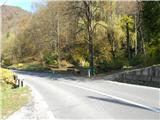 2
2 3
3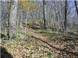 4
4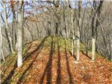 5
5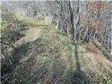 6
6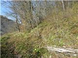 7
7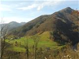 8
8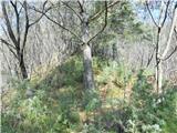 9
9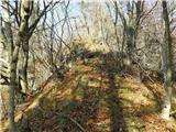 10
10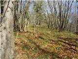 11
11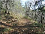 12
12 13
13 14
14 15
15 16
16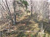 17
17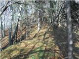 18
18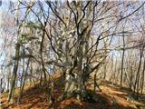 19
19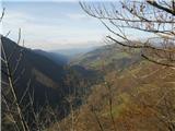 20
20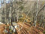 21
21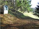 22
22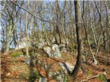 23
23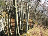 24
24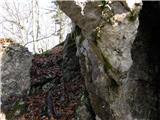 25
25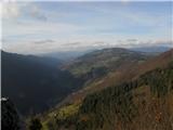 26
26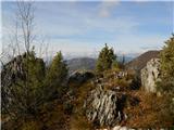 27
27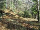 28
28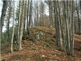 29
29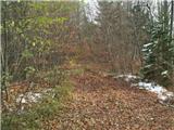 30
30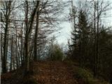 31
31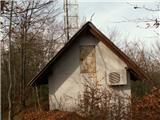 32
32
Discussion about the trail Spodnja Idrija - Gradišče (above Spodnja Idrija) (ridge path)