Solkan - Dom na Sabotinu (southern way)
Starting point: Solkan (100 m)
| Lat/Lon: | 45,9751°N 13,6484°E |
| |
Name of path: southern way
Time of walking: 1 h 40 min
Difficulty: easy marked way
Altitude difference: 460 m
Altitude difference po putu: 550 m
Map: Goriška 1:50.000
Recommended equipment (summer):
Recommended equipment (winter):
Views: 11.783
 | 1 person likes this post |
Access to the starting point:
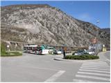
First we drive to Nova Gorica and then continue our drive to Tolmin. At the end of the village Solkan, turn left into a large parking area in front of the Solkan Bridge.
From Tolmin, drive towards Nova Gorica, but only as far as the village of Solkan. At the beginning of the village, turn right and park in the large parking lot behind the Solkan bridge.
The starting point is at the parking lot at the end of Solkan, which can be reached by public bus from Nova Gorica or Šempeter.
Path description:
From the parking lot, cross the Solkan bridge and then on the other side of the bridge, notice the mountain signs for Sabotin (southern and northern route). To climb Sabotin, follow the "southern" route along the edge of the asphalted road, which after a few minutes of climbing leads to a sharp right turn.
In the middle of the bend you will see a signpost for Sabotin, which directs you to a steep footpath that climbs through lane of bushes. A little higher up, the marked path crosses the road and then climbs steep steps on the other side. Further on, the steepness eases slightly and after a few more minutes of walking, the path leads to an old military mule track which is followed for only a short time. During the short walk along the mulatier, the path leads us to a pleasant "resting place" and lookout point, after which the path starts to climb steeply again. Next, we climb along a partly stony path, which occasionally offers beautiful views of Goriška.
After about 1 hour of walking, the path leads us to the main ridge Sabotin, where we see the ruins of the church of St Valentine.
Next, the path descends slightly and leads us through a rare lane of bushes to the next headland of Sabotino. We continue our ascent along a very scenic ridge from which we have beautiful views of the Soča River and Sveto Mountain. The path along which we see many remnants of the First World War leads us after an hour and a half to the top of the scenic Sabotino.
From the top, continue along the ridge on the path, which leads us after a few minutes to a crossroads. Continue straight in the direction of the Sabotin home along the path, which continues to descend gently and leads us after a further 10 minutes to the mountain home.
You can descend via the 'northern' route, which leads you through a number of caverns to the starting point (a torch and helmet are recommended for descending this route).

Pictures:
 1
1 2
2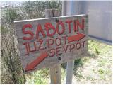 3
3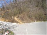 4
4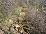 5
5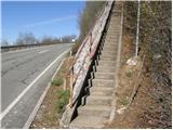 6
6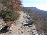 7
7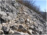 8
8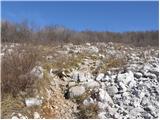 9
9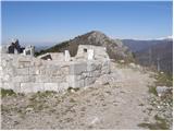 10
10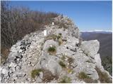 11
11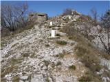 12
12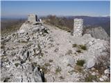 13
13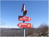 14
14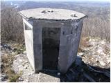 15
15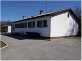 16
16
Discussion about the trail Solkan - Dom na Sabotinu (southern way)