Slevo - Kamniški vrh (direct way)
Starting point: Slevo (650 m)
| Lat/Lon: | 46,274°N 14,5709°E |
| |
Name of path: direct way
Time of walking: 1 h 30 min
Difficulty: difficult unmarked way
Altitude difference: 609 m
Altitude difference po putu: 609 m
Map: Kamniške in Savinjske Alpe 1:50.000
Recommended equipment (summer):
Recommended equipment (winter): ice axe, crampons
Views: 36.314
 | 6 people like this post |
Access to the starting point:
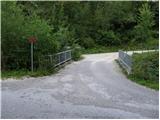
First, we drive to Kamnik, then we continue our drive to Stahovica. Before arriving in Stahovica, more precisely after the village Godič, leave the main road and continue driving to the left in the direction of Županjih Njiv. At the next crossroads, turn left towards Bistričica, and follow the road to the village of Klemenčevo, where you turn right over a small bridge towards the village of Slevo (there are signs for Kamniški vrh and Krvavec at the crossroads or bridge). Continue along the ascending road, which then leads through the village of Slevo, and after about 1km from the small bridge we arrive at a small quarry, next to which we can park in a suitable place. It is more convenient for locals to park just after the small bridge over Bistričica, this will extend our journey by about 15 minutes.
Path description:
If you have parked at the bottom of the bridge, first walk to the quarry above the village Slevo, and from there, at the fork in the tracks, continue along the left one, which is also marked for Kamniški vrh and Krvavec. The track then ascends gently on rolling grassy hay meadows. After about 15 minutes' walk from the quarry, we reach a place where a path from the valley joins us from the left, and we leave the marked path at this point, which continues towards Krvavec and Kamniški vrh via mountain pasture Osredek, and continue to the right along a well-trodden but unmarked path. The easy path then leads over a folded hayfield, after which you will reach a dilapidated shack in a few minutes.
Above the shack, the slope gradually straightens out and the path starts to climb steeply. From the gently sloping grassy slopes, you quickly reach the slope called Strme hay meadows. The ascent continues on a slightly vegetated slope, and the path leads directly above a distinct ravine, in the middle of which is a narrow scree slope (part of the descent is possible on the scree slope).
The rather steep path, which is very dangerous to slip on in the wet, lays down after about 30 minutes, and then quickly leads to a saddle between Planjava on the left and Kamniški vrh on the right.
Here we return to the marked path, and we follow it to the right in the direction of Kamniški vrh (Planjava on the left, mountain pasture Osredek, Krvavec and the Korošica valley). From here it is a moderate climb for about 15 minutes and the partly scenic route leads to the registration box on Kamnice Peak.
From the summit you can continue a few 10 metres further to the nearby bivouac.

Pictures:
 1
1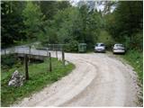 2
2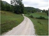 3
3 4
4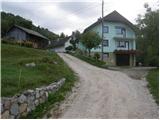 5
5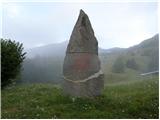 6
6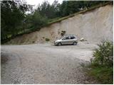 7
7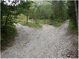 8
8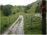 9
9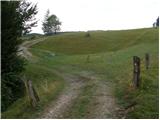 10
10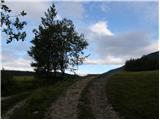 11
11 12
12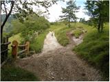 13
13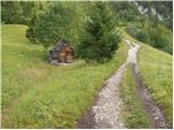 14
14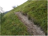 15
15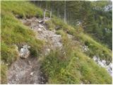 16
16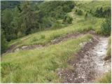 17
17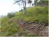 18
18 19
19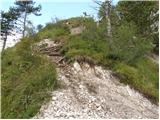 20
20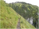 21
21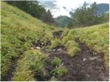 22
22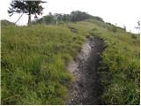 23
23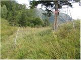 24
24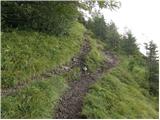 25
25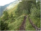 26
26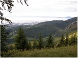 27
27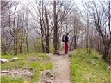 28
28 29
29
Discussion about the trail Slevo - Kamniški vrh (direct way)
|
| Guest16. 06. 2007 |
Imam eno pripombo na zgornji opis poti do Sleva - v Stahovici zavijemo na levo v vas Kogejevo. Vas Klemenčevo je višje gor vsaj 2 km. Pa tudi v Bistričici ne boste zagledali cerkve, ker jo zakriva gosto drevje.  Drugače pa je iz Sleva lepa pot, vseskozi se vzpenja, ko pa se vračamo iz Kamniškega vrha po drugi strani (če želimo zašpilit klobaso  ) pa resnično zelo drsi - v lepem vremenu, ne morem si predstavljati, kaj je šele v dežju. Je pa veliko raznih potk, ki nas na koncu vse pripeljejo do Sleva.
|
|
|
|
| geppo23. 02. 2008 |
Danes 23.2.2008 smo obiskali ta vrh. Pot je res v zadnjemu delu zelo strma. Vrnili smo se preko planine Osredek. Tudi spust je zelo strm in zna biti kar nevaren v drugačnih vremenskih razmerah, kot so bile danes ( kopno, brez snega in lepo sončno ).Drugače , zelo lep izlet in ne preveč zahteven - zelo zanimiva pokrajina! Parkirali pri mostu!
|
|
|
|
| fpetel128. 10. 2008 |
Zelo lep izlet. Spust po drugi strani vzhodno od vrha mimo klopce se mi je zdel še nekoliko bolj strm in zdrsn, vendar sta oba v snegu in mokrem lahko precej nevarna.
|
|
|
|
| tejca12. 03. 2012 |
Zelo lepa turca, samo na povratku, med skalami mislim, da bi lahko pot malo bolj zavarovali in utrdili. Je kar nevarno.
|
|
|
|
| Batistuta15. 08. 2022 17:49:38 |
Danes sem prehodil tole pot, osebno bi jo klasificiral kot izjemno lahko dobro vidno pot. Ne vidim razloga, da bi bila to zahtevna pot, veliko družin z otroki sem srečal, na poti ni popolnoma nič zahtevnega. Razen če seveda nimate nič kondicije .
|
|
|