Starting point: Selo (710 m)
| Lat/Lon: | 46,1017°N 14,296°E |
| |
Time of walking: 1 h
Difficulty: easy marked way
Altitude difference: 311 m
Altitude difference po putu: 315 m
Map: Ljubljana - okolica 1:50.000
Recommended equipment (summer):
Recommended equipment (winter):
Views: 51.783
 | 6 people like this post |
Access to the starting point:
From Horjul or Dobrova, drive to Polhov Gradec, then continue to Črnji vrh. A little above Polhovi Gradec, at the junction at the confluence of the Mala and Velika Bozna, continue straight on towards Sela and Škofja Loka (on the left, Črni Vrh). Continue along the Mala Božna stream, then after a while continue to the right towards the village of Selo (the second turn-off to the right of the town, after leaving the road leading to Črni Vrh). Continue along a fairly steep road, which climbs higher, and then after a short descent leads to Selo. Here, continue to the right (straight on to Sv. Ožbolt) and follow the road for just over 100 m to the parking area next to the chapel.
It is also possible to access from the Škofjeloško side.
Path description:
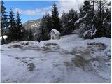
From the parking lot next to the chapel, we focus on the road along which we see the signs for Tošč and the church of St. Jedert. The road, which is hardly climbing significantly, quickly leads us out of the forest, where we see the church of St. Jedert in front of us, only to reach it after a few minutes of further walking.
From St Jedert's, continue left, initially across a grassy hayfield, which ends at a strip of sparse wodland. The ascent continues along a well-traced path which climbs for a while along the edge of the increasingly steep grassy hay meadows, then passes into a dense forest, where it gradually flattens out. Higher up, the path turns slightly to the right and gradually passes onto the north-west forested ridge of Tošč. The path continues on a moderate ascent, crosses some scenic slopes and then begins to climb steeply. Follow this slightly steeper path in the last part all the way to the top of Tošč, which is reached after a few minutes of further walking.

Pictures:
 1
1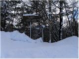 2
2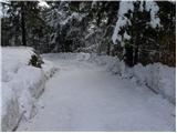 3
3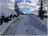 4
4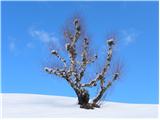 5
5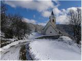 6
6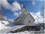 7
7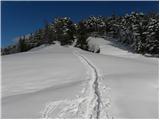 8
8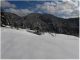 9
9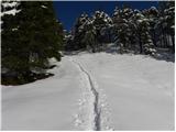 10
10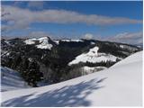 11
11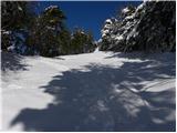 12
12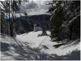 13
13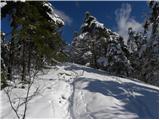 14
14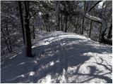 15
15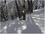 16
16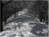 17
17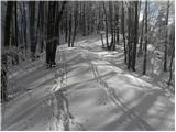 18
18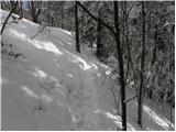 19
19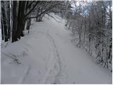 20
20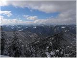 21
21 22
22 23
23 24
24 25
25
Discussion about the trail Selo - Tošč
|
| Guest17. 04. 2007 |
 o mene je začel mikat tale tošč
|
|
|
|
| nacka125. 02. 2010 |
Pozdravljeni,
če s Tošča sestopate po isti poti, kot ste se vzpeli in je tule opisana, lahko naredite ovinek. Pri oznaki 'VODNIK' na bukvi (v opisu poti je fotografija), nadaljujete pot desno po lovski stezi. Po nekaj minutah, ko ste na grebenu in na levi zagledate kmetijo, krenete po strmem travniku mimo hiše navzdol na gozdno pot. Držite se leve in pridete nazaj na izhodišče pri kapelici. Ta pot je morda nekoliko bolj senčna in torej dobrodošla v poletnem času.
|
|
|
|
| Breda24. 01. 2011 |
Pot je popolnoma kopna. Sicer pa prijetna, lahka in kratka tura. Pozimi, ko ni listja na drevju, se med potjo odpirajo lepi razgledi na polhograjsko in škofjeloško stran. 
|
|
|
|
| Lisica9. 03. 2011 |
Ker je bila danes zg. opisana cesta iz PG do Sela na enem ovinku tako poledenela, da nisem mogla z avtom naprej do vrha, sem se spustila nazaj nekaj 100m in pri tabli (Gabrje?) pri oznaki za 'Tošč 2h' pustila avto in šla po tisti poti gor. Super, lepa, suha, sončna pot. V prvem sp. delu je markacij dovolj, potem se pa zavije v hrib proti vasi, pred vasjo pa desno, mimo ene hiše, kmalu pridemo do kapelice in parkirišča opisanega zgoraj.
|
|
|
|
| donat17. 12. 2012 |
Včeraj šel po tej poti. Cesta iz PG do Sela je v spodnjem koncu na prvih dveh ovinkih ( 2. odcep desno) zelo poledenela, zato sem šel nazaj raje na Škofjo loko.
V zimskem času je boljši dostop iz Škofje Loke, brez verig na avtu iz PG težko prideš, navzdol, zaradi strme ovinkaste ceste, je pa še bolj nevarno. l.p.
|
|
|
|
| ljubitelj gora16. 05. 2014 |
Si ni potrebno vozt na Selo (ovinki, klanci neasfaltirani), ampak se avto pusti Mala Božna (asfaltirano cca 3km) je označeno to je iz Polhovega Gradca še naprej v smeri Zaloga-Črnega vrha. Tud iz smeri Škofje Loke ni v celoti asfaltirana cesta. Tega opisa kot vidim še ni.
|
|
|
|
| ljubitelj gora9. 01. 2018 |
Iz smeri Škofje Loke do Sela je po novem v celoti asfalt.
|
|
|