Selo pri Vodicah - Rašica (Vrh Staneta Kosca) (old path)
Starting point: Selo pri Vodicah (335 m)
| Lat/Lon: | 46,158°N 14,5172°E |
| |
Name of path: old path
Time of walking: 1 h 15 min
Difficulty: easy marked way
Altitude difference: 306 m
Altitude difference po putu: 325 m
Map: Ljubljana - okolica 1:50.000
Recommended equipment (summer):
Recommended equipment (winter):
Views: 10.989
 | 1 person likes this post |
Access to the starting point:
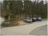
a) From the Ljubljana - Jesenice motorway, take the Ljubljana - Šmartno exit, then continue driving towards Šmartno. In Šmartno, turn right towards Vodice, and follow the main road towards Vodice for a few kilometres, then just before the beginning of Skaručna, turn right towards Vojsko and Selo pri Vodicah. Follow the main road along the Skaruška polje, then before the beginning of Selo pri Vodicah, you will see the signs for the Strahovica Ski Association, which will direct you to the right onto the local road. Continue through the village and we follow the road to the parking lot at the foot of the ski jump.
b) Take the motorway Jesenice - Ljubljana to the Vodice exit and continue driving towards Vodice. At the traffic lights in Vodice, go straight ahead and then right at the next junction in the direction of Bukovica pri Vodicah and Utika. At the end of Utik, turn right towards Selo pri Vodicah and then right again at the bus stop at the edge of Sele. From the bus stop, follow the main road for just over 100 m and then the signs for the Strahovica Ski Association direct you left onto the local road. Continue through the village and we follow the road to the parking lot at the foot of the ski jump.
c) First we take the road to Mengeš, then we continue driving towards Komenda. At the end of Mengeš, just after crossing the stream Pšata, turn left onto the local road towards Topole. Before you reach the point, turn left again, this time towards Utik. Continue on the local road, and we follow it to the hamlet of Koseze, where we turn left in the direction of Sela pri Vodice. Soon we reach the bus stop at the edge of Sele, where we continue straight ahead. From the bus stop, follow the main road for just over 100 m, and then the signs for the Strahovica Ski Association will direct you left onto the local road. Continue through the village and we follow the road to the parking lot at the foot of the ski jump.
Path description:
At the start of the parking lot, you'll see a beaten track with faded markings leading into the woods. Follow the path up a moderate incline and then to a forest road, which you follow to the right. The road quickly leads to a ski jump, from where we have some views. We quickly return to the forest and continue our ascent along a winding road, which is moderately steep at times, until we reach a long right-hand bend, in the middle of which a wide cart track road branches off to the left, at the side of which there is a memorial. From this bend, continue along the road for about 50 m, then notice the old faded markings which direct you off the road to the left onto a moderately steep track. After a few minutes, the track lays down and joins the forest track logging trail, which you follow to the right or straight ahead. There are a few small forks and some faded markings here and there. At the crossroads, we mostly stick to the left directions, and then a rather gently sloping path leads us to a more well-beaten and well-marked ridge path from Mengeš hut to Rašica.
Follow this path to the right, and we begin a moderate ascent. Higher up, the trail gently descends, and at the crossroads that follow, we follow the signs for the tower at Rašice, which we reach after a few minutes of further walking.
The 17 m high lookout tower is also worth climbing for a nice view.

Pictures:
 1
1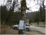 2
2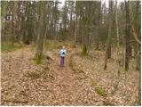 3
3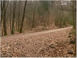 4
4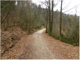 5
5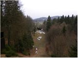 6
6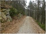 7
7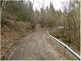 8
8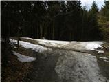 9
9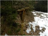 10
10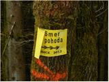 11
11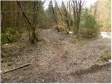 12
12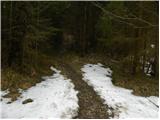 13
13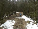 14
14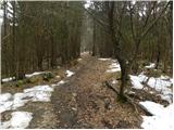 15
15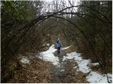 16
16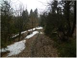 17
17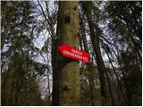 18
18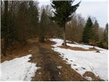 19
19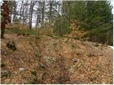 20
20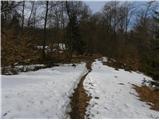 21
21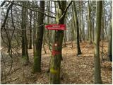 22
22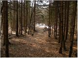 23
23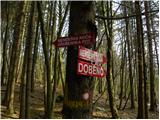 24
24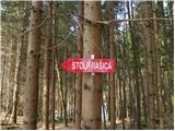 25
25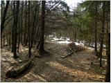 26
26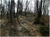 27
27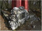 28
28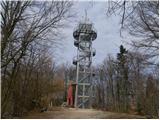 29
29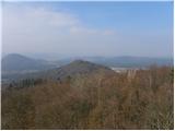 30
30 31
31
Discussion about the trail Selo pri Vodicah - Rašica (Vrh Staneta Kosca) (old path)