Sella Nevea - Punta Plagnis (unmarked mule track)
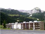
Starting point: Sella Nevea (1188 m)
| Lat/Lon: | 46,4147°N 13,4755°E |
| |
Name of path: unmarked mule track
Time of walking: 4 h 30 min
Difficulty: partly demanding unmarked way
Altitude difference: 1223 m
Altitude difference po putu: 1223 m
Map: Tabacco 019 1:25000 ali Julijske Alpe -Zahodni del (PZS) 1:50000
Recommended equipment (summer): helmet, lamp
Recommended equipment (winter): helmet, ice axe, crampons, lamp
Views: 10.276
 | 3 people like this post |
Access to the starting point:
a)Cross the Rateče border crossing and drive to Trbiz/Tarvisio. Just before Trbiz, turn left towards Predel or Bovec and follow the road to the crossroads in front of Lake Rabeljsko Jezero. Here, continue to the right towards the pass with the beautiful Slovenian name Na Žlebeh, which the Italians have translated into Sella Nevea. At the saddle, you can park on the gravel parking lot under the small ski slope on the right, higher side.
b)From Bovec, descend via Predel to the Italian side. Just after Lake Rabeljsko, turn left at the crossroads towards Sella Nevea/Na Žlebeh.
c)It is also possible to access the Reklanica valley from Cluj/Chiusaforte (a place on the Videm - Trbiz road).
Path description:
Along the road you will see several signs indicating route 625 towards the Corsi hut. Go up the slope on the less well-trodden track, which leads to a dirt road that climbs up the right-hand side of the ski slope. Follow the road for a short distance before signs point you left into the forest. After a short climb, you reach a crossroads where you continue to the right on route 625, and a path branches off to the left towards mountain pasture Krni dol/Cragnedul and on towards Pecol and the Brazza hut. The path then continues to climb through the forest and crosses the mountain road a few times, leading to a crossroads where another path branches off to the left, leading to the Brazza hut. At 1610 m you come across ruins. Here, leave the marked trail 625, which leads to the right onwards towards the saddle Passo degli Scalini (2022 m), and follow the well-trodden path - the mulatier - into the slopes below Špik nad Špranjo/Modeon del Buinz. The unmarked path zigzags over grassy slopes where, in summer, it is a paradise for flower lovers and photographers, and there are usually lots of ibex. The Mulatiera passes just below the 2351 m high summit of Krnega Dol, which the Italians have ingeniously translated as Monte Cregnedul, crosses the ridge and, alongside the remains of military structures, reaches the summit. Just below the summit is a cavern with a view of Koštrunove špice and Viš, and an easy climb along the cavern will take you to the top in a few minutes. There is a larger cairn. Continue along the mulatier to a distinct notch, where the markings of the Ceria Merlone protected route emerge from the Stub of the Front Spur. Follow the path (and the wire) to the left along an exposed shelf, around the summit building of Špica in Planja, which is climbed on rough terrain. At the top is a larger cairn on a concrete base. Both ascents to the top are a notch more difficult than walking on the partially broken mulatier.
Starting point - Monte Cregnedul 4h; top of Krný dol - Špica v Planji 30 min.

Pictures:
 1
1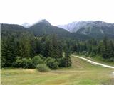 2
2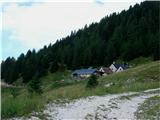 3
3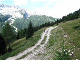 4
4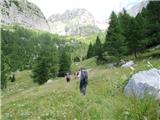 5
5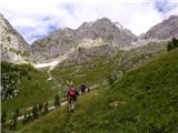 6
6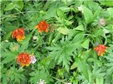 7
7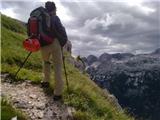 8
8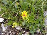 9
9 10
10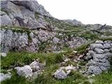 11
11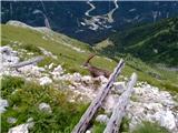 12
12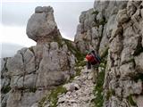 13
13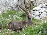 14
14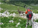 15
15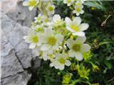 16
16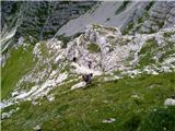 17
17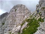 18
18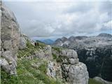 19
19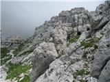 20
20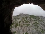 21
21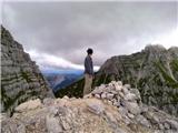 22
22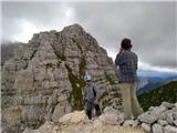 23
23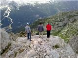 24
24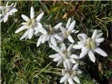 25
25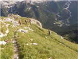 26
26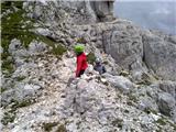 27
27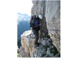 28
28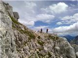 29
29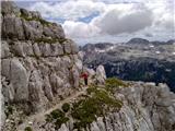 30
30 31
31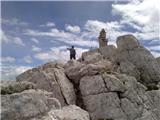 32
32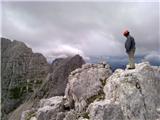 33
33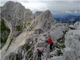 34
34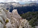 35
35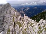 36
36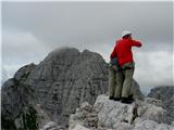 37
37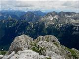 38
38
Discussion about the trail Sella Nevea - Punta Plagnis (unmarked mule track)
|
| Robie6. 09. 2022 15:27:49 |
Zadnji del od kaverne se pot nadaljuje po zaščiteni poti - vzorno stanje jeklenic in skob, bi pa vseeno priporočal komplet za samovarovanje. Prav tako je ta del kar lepo zračen in opis delno zahtevna pot ravno ne drži... Glede časovnice pa je vrh dosegljiv pri normalnem ritmu hoje v cca 3,5 ure.
|
|
|