Selce - Gregorčič waterfall
Starting point: Selce (382 m)
| Lat/Lon: | 46,21636°N 13,64891°E |
| |
Time of walking: 1 h
Difficulty: difficult unmarked way
Altitude difference: 8 m
Altitude difference po putu: 230 m
Map: Krn 1:25000
Recommended equipment (summer):
Recommended equipment (winter): ice axe, crampons
Views: 11.340
 | 2 people like this post |
Access to the starting point:
From Tolmin, drive towards Kobarid, but only until the road to the village Kamno turns off to the right (and left from Kobarid). Follow the relatively narrow road through the village and follow the signs for Vrsno. After a short climb to the right at a crossroads, turn towards the hamlet of Selce. After about 20 metres, you will see a small parking place on the right (fortunately rarely occupied).
Path description:
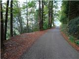
From where we left the car, continue along the road to the village. When you are between the houses, turn right onto a narrower road. Behind the houses you will see signs directing you to cart track climbing up the meadow. You quickly come to a horse paddock which you have to pass through. On the other side, after a gate, look for the start of a narrow path. This immediately starts descending steeper and steeper slopes. After crossing a small but very steep scree slope, the path descends even more steeply. Soon you reach the bottom of the gorge and cross a dry riverbed most of the time. On the other side we see the grave of an unidentified Russian soldier and a crossroads. Continue right (Brinta waterfall on the left, 3 minutes away) onto a narrow path that begins to climb through the forest. Very quickly we are at another crossroads, continue left (partisan hospital on the right). The very narrow and in some places less well-paved path starts to cross a very steep slope (especially dangerous to slip on in wet weather!). After a few minutes, you reach a clearing with a view of the waterfall and the continuation of the path on the scree. After crossing the former, climb steeply through the vegetation, then cross the latter. After it, descend steeply in a few serpentines almost to the stream bed. At one point a rope helps us over a steep rock jump. Then climb over another jump alongside a rope and two wedges. After a short steep climb, we see a waterfall and a pool below. Three minutes of scrambling on rocks and boulders separate us from the waterfall.

Pictures:
 1
1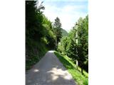 2
2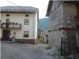 3
3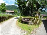 4
4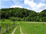 5
5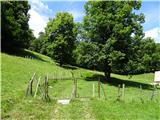 6
6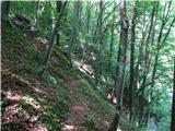 7
7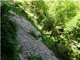 8
8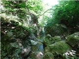 9
9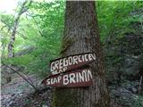 10
10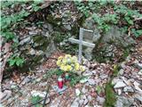 11
11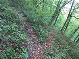 12
12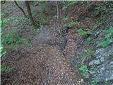 13
13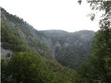 14
14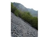 15
15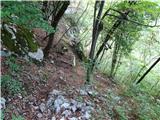 16
16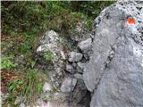 17
17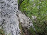 18
18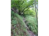 19
19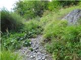 20
20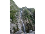 21
21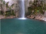 22
22
Discussion about the trail Selce - Gregorčič waterfall
|
| ljubitelj gora5. 09. 2018 |
No, tale pot definitivno ni za družine z majhnimi otroci. Že 2x obiskal oba slapa.
|
|
|