Sant'Uberto - Vallon Bianco
Starting point: Sant'Uberto (1421 m)
| Lat/Lon: | 46,60229°N 12,1072°E |
| |
Time of walking: 5 h 5 min
Difficulty: very difficult marked way
Altitude difference: 1267 m
Altitude difference po putu: 1410 m
Map: Tabacco 03 1:25.000
Recommended equipment (summer): helmet
Recommended equipment (winter): helmet, ice axe, crampons
Views: 248
 | 2 people like this post |
Access to the starting point:
Via Border crossing Rateče, take the road to Trbiž / Tarvisio, where you take the motorway towards Udine. Leave the motorway at the exit for Tolmezzo and follow the road to the above-mentioned place. From Tolmezzo, continue in the direction of Ampezzo and the Passo della Mauria mountain pass. The road then begins to descend and leads into the Cadore valley, where you continue to the right (Belluno and Cortina d'Ampezzo on the left) in the direction of Auronzo. After a few more km of driving, you reach the next major crossroads, where you turn right towards Misurina (left Tre Croci Pass). From here, follow the road down to a major crossroads, where you turn left towards Cortina d'Ampezzo (right Austria). From this crossroads, you continue for about 10 km towards Cortina d'Ampezzo, and then, at a sharp left turn, you turn right onto the road towards the Rifugio Ra Stua hut. Park in the parking lot at the very beginning of the road.
Path description:
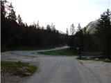
From the parking lot, turn left onto cart track after the "Valle di Fanes" signs (route No 10). Cart track starts descending from the parking lot and quickly leads to a marked crossroads. At the crossroads, turn right onto the footpath, following the signs for "Valle di Fanes". From the crossroads, the path descends through the forest and leads to a tarmac road.
Continue right along the road and cross the bridge over the Rio di Fanes stream. The road along the stream then leads to a crossroads.
To the right is a more difficult path called Sentiero dei Canyons, and we turn left (path 10) onto a road that is paved for a short distance and then becomes gravel. The road then climbs gently through the forest, with occasional views of the nearby peaks.
Later, a footpath branches off to the left towards the Posporcora saddle, and we continue along the dirt road. The road then turns slightly to the right and crosses the deep gorge of Gola di Fanes via a bridge. We continue along the road and soon we are at the crossroads again. There are also some benches and tables near the crossroads.
At the crossroads we continue left along the road, straight ahead is the Scorciatoia (short cut), which is slightly steeper and later rejoins the road. At the crossroads on the right, the path leads to the Cascata di Fanes waterfall, which is only a few minutes' walk along an exposed ledge (self-propelled vehicles are recommended).
We continue to the left and continue climbing on the dirt road, which is also suitable for mountain bikers. After a short climb, we come to another crossroads where the 401 trail branches off to the left towards the Forcella Posporcora notch. We continue to the right and continue climbing along the road through the forest, from which views of the surrounding peaks become more and more frequent. The road climbs steeply a few times and is occasionally paved. Higher up, the Sentiero dei Canyons trail branches off to the left, also leading to the Val Travenanzes valley.
The trail then turns slowly to the right and approaches the Rio di Fanes again. Here, the Scorciatoia trail joins from the right, and shortly afterwards the trail to the last waterfall on the Rio di Fanes branches off to the right. The waterfall is only a few minutes' walk along an exposed path. Here again, self-propulsion is recommended.
At the crossroads, the road turns slightly left and continues along the stream. The path then soon leads us out of the forest and opens up to wonderful views of the surrounding peaks. The scenic route then leads to Lago di Fanes.
At the end of the lake, cross the bridge and continue along the cart track along the stream. The path leads to a fence where you leave the Dolomites d'Ampezzo Nature Park and enter the Fanes-Senes-Braies Nature Park. This is also the border between the Veneto and the South Tyrol (Trentino-Alto Adige). Continue along the cart track, which follows the stream for a short distance and then climbs a little more steeply and leads from the grassy slope into the woods. The woods become thinner and thinner and from the path we have a fine view of the peaks above the Valle di Fanes. Our path follows the stream again for a while and leads us to a crossroads.
Path 10A leads to the right towards hut Rifugio Fanes, and we continue left along the road towards mountain pasture Malga Fanes Grande. The road continues in a gentle ascent to the south-west. Later, the road begins to descend gently and the road from the Rifugio Fanes hut joins us on the right. There is only a short descent along the scenic road to the Ütia de Gran Fanes hut.
From the hut, continue along the mountain pasture scenic road and descend a little further. The road then crosses a small bridge and soon leads to a marked crossroads.
At the crossroads we turn left onto the Fridensweg (Fridensweg / Via della pace), route number 17, or the Peace Trail. From the crossroads the path initially follows a grassy slope and then leads into a lane of very sparse larch and pine woods. The path is marked with the number 17 and with the VB and FR markings, which indicate the Vallon Bianco and Furcia Rossa peaks. The trail continues to climb gently and follows an old military causeway to the south-east. The path slowly curves slightly to the left and the view to the east of the Valle di Fanes begins to open up. The mulatiera here leads us onto more rocky terrain, which soon leads to a crossroads.
Route 17 leads to the right towards Monte Castello or bivouac Bivacco della Pace, and we continue left along the path towards the peaks of Furcia Rossa and Vallon Bianco. From the crossroads, the path then crosses the slopes a little more to the east for some time and leads to slightly steeper slopes. The ascent is mostly in switchbacks up a steep slope and the path leads to the next crossroads.
To the right, a protected climbing route branches off towards the Furcia Rossa III summit and on towards the Bivacco della Pace bivouac. At the crossroads, we continue left and climb for some time along the scenic route. The path then turns slightly to the right and leads us along a wide shelf and then along the top edge of the scree again to a crossroads where a path branches off to the right towards the Furcia Rossa III peak, next to which there is also a small bivouac called Bivacco Baccon Barborka. The bivouac is about 10 minutes' walk away.
At the crossroads we continue left towards the Vallon Bianco peak and after a short crossing the path leads us to the northern slopes of the mountain. Further on, we cross the slopes to the east and the path also becomes somewhat exposed, with a few small rocks to help us. Here we also enter the Parco Naturale delle Dolomites d'Ampezzo. The path then turns to the right, crosses a short bridge and soon leads to a saddle where you will see many ruins from the First World War.
At the saddle, continue left and the well-groomed military trail, which is carved into the steep hillside, then climbs in a few switchbacks. The path then crosses some more exposed slopes to the east and then crosses an interesting narrow bridge. The path then continues to cross exposed slopes to the east, mostly in a gentle ascent, with numerous ruins from the First World War along the way. Just below the summit, the path leads us to a small crossroads where we turn sharp right and climb steeper with the help of a few staples. It is then only a short climb to the top, along the mountain's scenic summit slope. From the top, where there is a registration box and a few small benches, you have an exceptional view over most of the Dolomites. The view of the nearby Tofane is particularly beautiful.
Let's go down the ascent route.

Pictures:
 1
1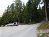 2
2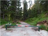 3
3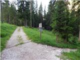 4
4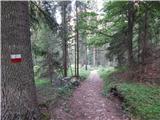 5
5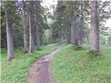 6
6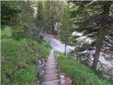 7
7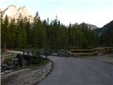 8
8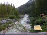 9
9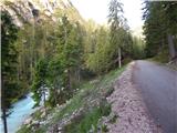 10
10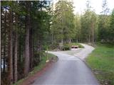 11
11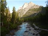 12
12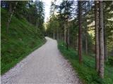 13
13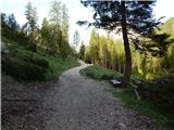 14
14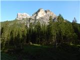 15
15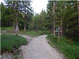 16
16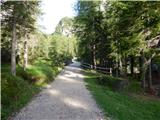 17
17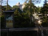 18
18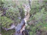 19
19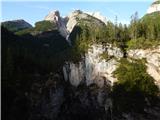 20
20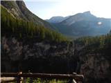 21
21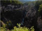 22
22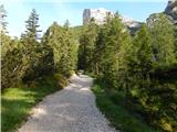 23
23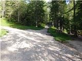 24
24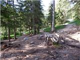 25
25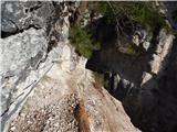 26
26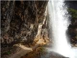 27
27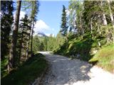 28
28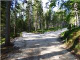 29
29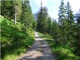 30
30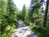 31
31 32
32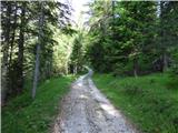 33
33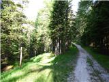 34
34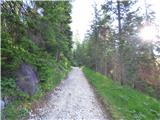 35
35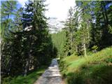 36
36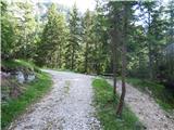 37
37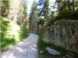 38
38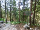 39
39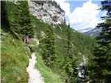 40
40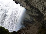 41
41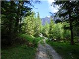 42
42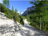 43
43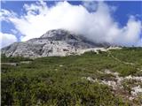 44
44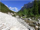 45
45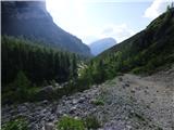 46
46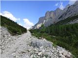 47
47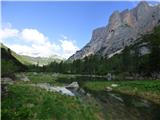 48
48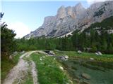 49
49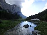 50
50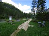 51
51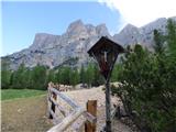 52
52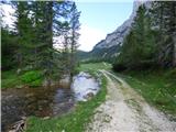 53
53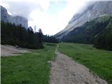 54
54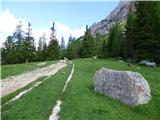 55
55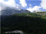 56
56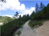 57
57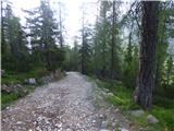 58
58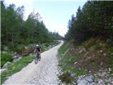 59
59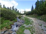 60
60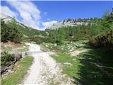 61
61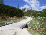 62
62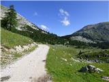 63
63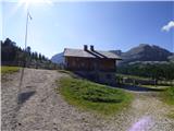 64
64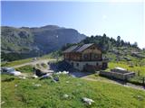 65
65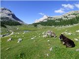 66
66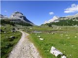 67
67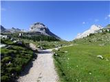 68
68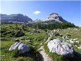 69
69 70
70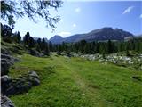 71
71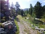 72
72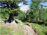 73
73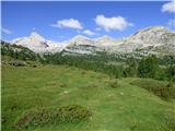 74
74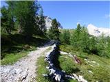 75
75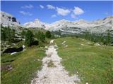 76
76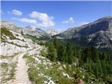 77
77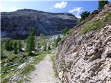 78
78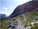 79
79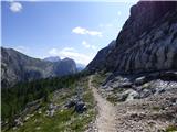 80
80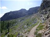 81
81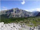 82
82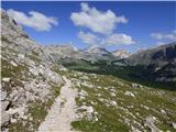 83
83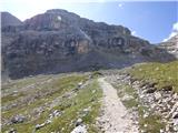 84
84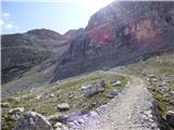 85
85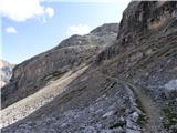 86
86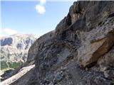 87
87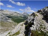 88
88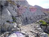 89
89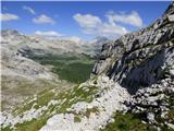 90
90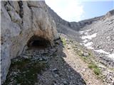 91
91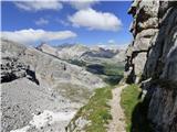 92
92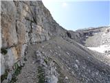 93
93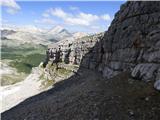 94
94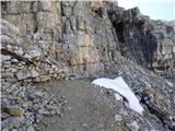 95
95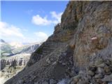 96
96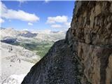 97
97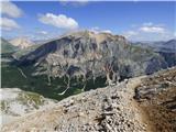 98
98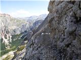 99
99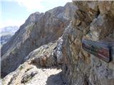 100
100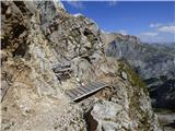 101
101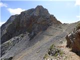 102
102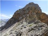 103
103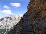 104
104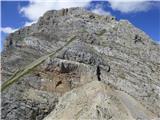 105
105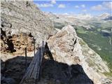 106
106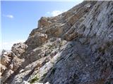 107
107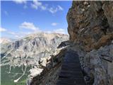 108
108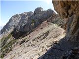 109
109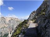 110
110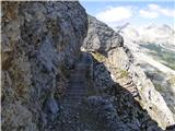 111
111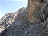 112
112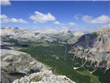 113
113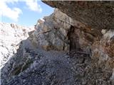 114
114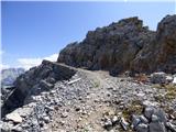 115
115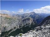 116
116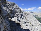 117
117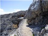 118
118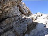 119
119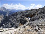 120
120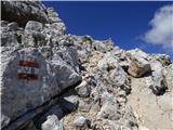 121
121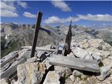 122
122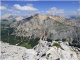 123
123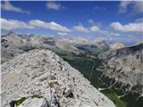 124
124 125
125
Discussion about the trail Sant'Uberto - Vallon Bianco