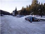
Rudno polje - Srednji Selišnik (snowy approach)
Starting point: Rudno polje (1340 m)
| Lat/Lon: | 46,3458°N 13,9236°E |
| |
Name of path: snowy approach
Time of walking: 2 h 15 min
Difficulty: easy pathless terrain
Altitude difference: 550 m
Altitude difference po putu: 550 m
Map: Triglav 1:25.000
Recommended equipment (summer):
Recommended equipment (winter): ice axe, crampons
Views: 6.303
 | 2 people like this post |
Access to the starting point:
Z avtoceste Ljubljana - Jesenice se usmerimo na izvoz Lesce in cesti naprej sledimo proti Bledu. Na Bledu pa nas pri semaforju oznake za Pokljuko usmerijo desno. Naprej se peljemo skozi Gorje in mimo opuščenega smučišča Zatrnik do Rudnega polja na Pokljuki (veliko parkirišče, vojašnica in strelišče).
Path description:
From the parking lot, head to the cross-country skiing trail heading towards the Viševnik ski resort. After a 10-minute walk, you will reach the ski slope. Here, continue along the road that runs along the left side of the ski slope. The road makes a sharp right turn and soon crosses the ski slope. While the ski slope is in operation, cross the ski slope carefully and continue on the other side of the road, which soon leads to a crossroads. Here take the upper road on the left, where there is a roadblock. Just a few minutes further on we come to mountain pasture, where a nice view opens up. The road goes round mountain pasture in a slight uphill on the left-hand side. After a good five minutes of further walking, leave the road and turn left onto the trackless road. The slope is quite steep at first but after a few minutes you reach a steep climb. In unfavourable conditions, a small to moderate avalanche may be triggered here, but as the slope is vegetated this is less likely. If you are unsure of the conditions, it is better to turn around. After about 20 minutes, the slope eases and we continue upwards towards an indistinct ridge. The path along this broad ridge soon leads to a gully on our right. Our route continues above the gully and we cross it at its start. The path climbs steeply again for a short time and leads us to the less vegetated slopes below Mali Selišnik. This is the only one we see on our right. It is recognisable by its rocky summit. Head towards this mountain and cross it on the left-hand side.
From here on, continue up the slopes covered with dwarf pines all the way up. When we reach the first hill, we have a view towards an indistinct peak. This peak, which is already very close, is Srednji Selišnik and can be reached in a few minutes of further walking. To the right behind is Veliki Selišnik.
Orientation on the trail is difficult in the fog, almost impossible. Part of the trail is exposed to avalanches.

Pictures:
 1
1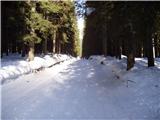 2
2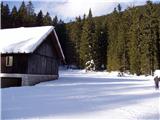 3
3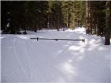 4
4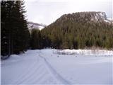 5
5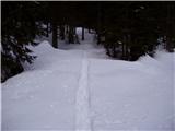 6
6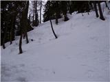 7
7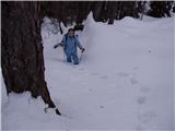 8
8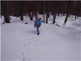 9
9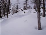 10
10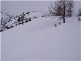 11
11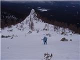 12
12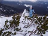 13
13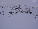 14
14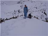 15
15
Discussion about the trail Rudno polje - Srednji Selišnik (snowy approach)
|
| Guest13. 02. 2007 |
Uh, lepi posnetki "deviškega" snega (gazenje je bilo najbrž malo manj lepo) 
|
|
|
|
| Tadej13. 02. 2007 |
Malo je bilo res naporno a ne toliko, da se nebi izplačalo. Res lepa pokrajina pobeljena s snegom. Turo priporočam vsem ljubiteljem brezpotij.
|
|
|