Rimske Toplice - Koča na Kopitniku (via Ogeški potok)
Starting point: Rimske Toplice (213 m)
| Lat/Lon: | 46,1208°N 15,2007°E |
| |
Name of path: via Ogeški potok
Time of walking: 1 h 40 min
Difficulty: easy marked way
Altitude difference: 652 m
Altitude difference po putu: 652 m
Map: Posavsko hribovje - zahodni del 1:50.000
Recommended equipment (summer):
Recommended equipment (winter): ice axe, crampons
Views: 7.831
 | 1 person likes this post |
Access to the starting point:
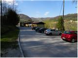
a) From the motorway Ljubljana - Maribor take the exit Celje - centre, then continue driving towards Laško and later Rimske Toplice. At the end of Rimske Toplice (just after the crossroads where the road to the village of Globoko and the railway station Rimske Toplice branches off to the left over a bridge), take a sharp right in the direction of Rimske terme. Continue for another 10 m and then you will reach the next crossroads, at which you will park (there is a Tuš shop near the starting point).
b) From Zasavje, first drive to Hrastnik, then continue towards Celje. When you arrive in Rimske Toplice, turn right at the main crossroads towards Zidanega Most. At the end of Rimske Toplice (just after the crossroads where the road to the village of Globoko and the railway station Rimske Toplice branches off to the left over a bridge), take a sharp right in the direction of Rimske terme. Continue for another 10 m and then you will reach the next crossroads, at which you will park (there is a Tuš shop near the starting point).
c) From the direction of Posavje, first drive to Zidani Most and then continue towards Celje. When you arrive in Rimske Toplice, pay attention, because at the beginning of the town you will turn left in the direction of Rimske terme (leave the main road just a few metres before the town, where the road to the village of Globoko branches off to the right over a bridge). Continue for another 10 m and then you will reach the next crossroads, at which you park (there is a Tuš shop near the starting point).
Path description:
From the starting point, focus on the road that continues along a small stream (direction Kopitnik). The road quickly leads us to a nearby residential house, after which it turns into a moderately steep mountain path. We continue along the stream for a short time, and then signs direct us to the right to a slope, over which we begin to climb steeply. A little higher up, the path leads us out of the woods, and then past a cross and the next dwelling house leads to an asphalt road. Follow the road uphill and then right at the next crossroads in the route Kopitnika. Continue along the road for a few minutes and then arrive at a marked crossroads.
At the crossroads, leave the asphalt road and continue right on the footpath in the direction of "Kopitnik - koča" (straight ahead Kopitnik and Stražnik). The path continues to climb crosswise to the right, soon becomes a footpath and joins a worse forest road, which you follow to its end.
From the end of the road, continue along the well-trodden path, which begins to climb moderately to occasionally steeply through the forest. Higher up, the path leads alongside "fields" of hemlock, then joins cart track, which you follow to the right. Cart track soon turns quite right and crosses a less steep slope, where you come to the edge of the forest. Here the path turns left and gradually widens into a dirt road. A little further on, the path from Šmarjeta joins us from the right, and we continue straight on to the nearby homestead at Izera.
At the homestead, the road becomes asphalt, and we walk along it for only a few metres, then a sign on a tree "cottage" directs us left into the forest. We continue climbing through the forest for a short distance and then join the path from the villages Marno and Turje. From the crossroads onwards, we step out of the forest, and the gently sloping path, which continues across a larger meadow, leads us in a few minutes to the Kopitnik Cottage.

Pictures:
 1
1 2
2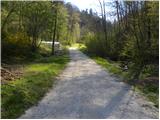 3
3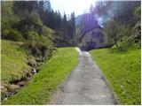 4
4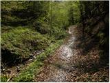 5
5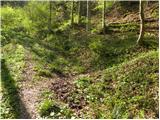 6
6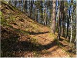 7
7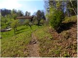 8
8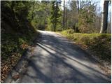 9
9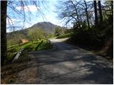 10
10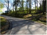 11
11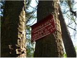 12
12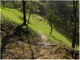 13
13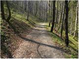 14
14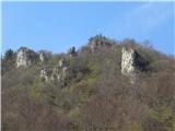 15
15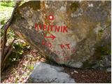 16
16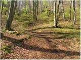 17
17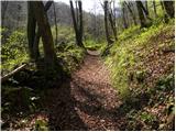 18
18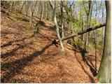 19
19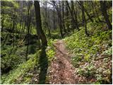 20
20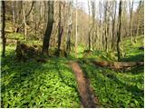 21
21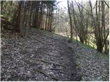 22
22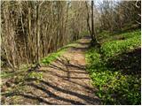 23
23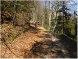 24
24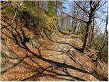 25
25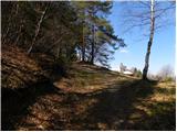 26
26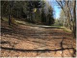 27
27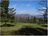 28
28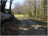 29
29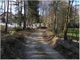 30
30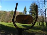 31
31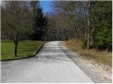 32
32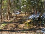 33
33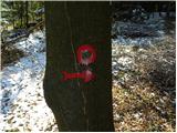 34
34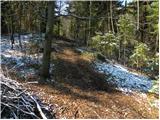 35
35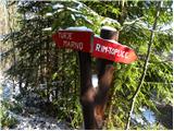 36
36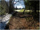 37
37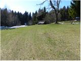 38
38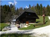 39
39
Discussion about the trail Rimske Toplice - Koča na Kopitniku (via Ogeški potok)
|
| slavkoo9. 06. 2017 |
Nameravam stopiti do Koče na Kopitniku pa me zanima ali je možna krožna pot. Recimo do koče iz izhodišča po dolini Ogeškega potoka,nazaj skozi Lurd in potem do avta....
|
|
|
|
| Ana Fila22. 04. 2019 |
Danes smo prehodili to pot do koče.
Kar je rahlo neprijetno je, da pri izhodišču in malo kasneje ljudem hodiš čez dvorišče poleg hiše. Pot je drugače dobro označena, velik del gozdna, v senci, tudi zmerno strma dobršen del.
|
|
|