Rifugio Gardeccia - Cima Scalieret (via north ridge)
Starting point: Rifugio Gardeccia (1950 m)
| Lat/Lon: | 46,43832°N 11,69319°E |
| |
Name of path: via north ridge
Time of walking: 3 h
Difficulty: partly demanding unmarked way
Altitude difference: 937 m
Altitude difference po putu: 950 m
Map: Tabacco 06 1:25.000
Recommended equipment (summer): helmet
Recommended equipment (winter): helmet, ice axe, crampons
Views: 1.390
 | 2 people like this post |
Access to the starting point:
Access from Gorenjska: Drive through the Karavanke Tunnel into Austria, then continue to Spittal and on to Lienz (the motorway ends a little after Spittal). We continue along a relatively nice and wide road through the Drava Valley, which leads us into Itali. The road continues past Dobbiaco/Toblach and Brunico/Bruneck. Just after the last-mentioned town, which is passed by a bypass road, we turn left into the Val Badia valley. Continue along the valley past La Vila and Corvara. Then climb over the Passo Campolongo and Passo Pordoi. From Passo Pordoi, descend to the west side of the valley of Val di Fassa. Continue to Pera di Fassa where you park in the large parking lot at the bottom station of the chairlift "Pera Vajolet 1".
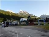
From here, a minibus transfer is organised to the Rifugio Gardeccia hut. The return ticket costs 10€ (July 2015). The minibus starts at 07:00 and the last ride from the Gardeccia hut is at 19:00. The road to the hut is closed to public transport.
From the coastal side. At Portogruaro, leave the motorway towards Venice and turn right on the motorway towards Pordenone. At the next motorway junction near Conegliano, turn right towards Belluno. Follow the motorway until you reach the exit for Belluno. When you leave the motorway, you come to a large roundabout, which you leave at the exit for Belluno and Feltre. At the small roundabout in Belluno, turn right towards Agordo. Follow this road until Moena in the Val di Fassa. In Moena, turn right towards Canazei, but only as far as Pera di Fassa, where you park in the large parking lot at the bottom station of the chairlift "Pera Vajolet 1".
From here there is a minibus service to the Rifugio Gardeccia hut. The return ticket is 10€ (July 2015). The minibus starts at 7:00 and the last ride from the Gardeccia hut is at 19:00. The road to the hut is closed to public transport.
Path description:
From the Rifugio Gardeccia, follow the dirt road towards the Vajolet hut. The road first leads past the Rifugio Stella Alpina hut and into a rare forest. Here the road climbs a little, but the sparse forest quickly ends and we can see the view towards hut Rifugio Preuss, which is clearly visible on the top of the cliff. Cottage Rifugio Vajolet is located next to the cottage. The scenic road then becomes flatter for a while, then turns left under the slopes of the summit of Cima Catinaccio and starts to climb a little more steeply. The road then climbs up to hut Rifugio Vajolet from where there is a very fine view of the Torri del Vajolet towers.
Just after the hut, the Sentiero Don Guido trail branches off to the right towards the top of Cima Scalieret, and we continue along a fairly wide path towards the Rifugio Passo Principe hut. The path then soon leads to another marked crossroads. This time, the path branches off to the left up towards Rifugio Re Alberto and Rifugio Passo Santner. We continue along the rather sloping route 584 towards the Rifugio Passo Principe. The path here runs northwards along the Val di Vajolet and the view towards the highest peak in the Catinaccio d'Antermoia mountain group (Kesselkogel) starts to get better and better. At the end of the valley, the slope becomes a shade steeper, but the climb is not difficult. The wide path then soon leads to the Passo Principe hut, located on the saddle of the same name on the west side of the Catinaccio d'Antermoia peak.
From the hut, continue along route 584 towards the Passo di Antermoia saddle. From the hut, the trail first crosses the scree below the buttresses of Catinaccio d'Antermoia and then begins to climb quite steeply. There is a lot of rubble on the trail and the trail is in a bit worse condition in this part. When you reach a nondescript saddle on the south side of the summit, the steepness eases a little and you continue on a gentle ascent, crossing the slopes towards the Passo di Antermoia saddle. Shortly before the saddle, the path leads to an unmarked crossroads.
Here, leave the marked path towards saddle Passo di Antermoia and take the unmarked path to the right. The path from the crossroads first crosses a fairly steep slope and then descends slightly. The slope then becomes less steep and the path turns slightly to the right, followed by a short, slightly steeper climb to the Passo Scalieret saddle. At the saddle, continue to the right and after a short traverse of the steep slope, you will reach the flatter slopes on the eastern side of the ridge. The path then climbs gently and later leads to the ridge. The path along the ridge is easy at first, but a few tens of metres below the summit the ridge becomes quite steep. Here the path follows the ridge to the right and crosses a steep slope. The slope is quite steep and there is some rubble on the way. Some caution is therefore needed when crossing. The more difficult crossing is relatively short and soon you reach the ridge again, after which you can easily reach the summit.
Descend by the ascent route or by the Sentiero Don Guido, which runs along the south-western slopes of the mountain via the Passo Pope saddle.

Pictures:
 1
1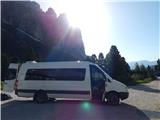 2
2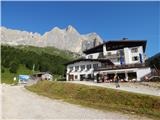 3
3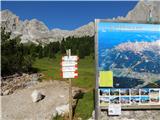 4
4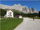 5
5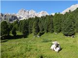 6
6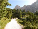 7
7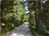 8
8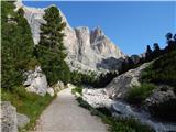 9
9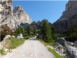 10
10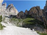 11
11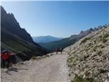 12
12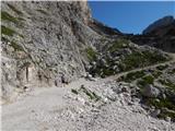 13
13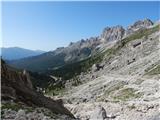 14
14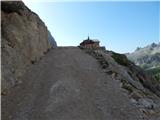 15
15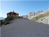 16
16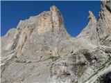 17
17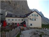 18
18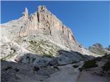 19
19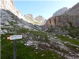 20
20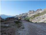 21
21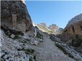 22
22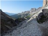 23
23 24
24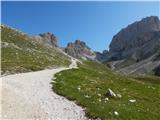 25
25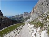 26
26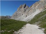 27
27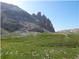 28
28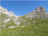 29
29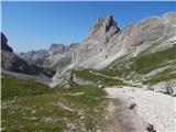 30
30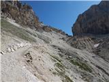 31
31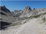 32
32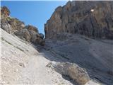 33
33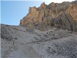 34
34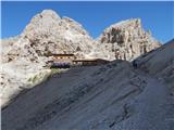 35
35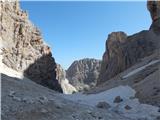 36
36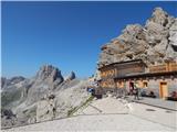 37
37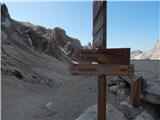 38
38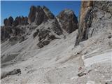 39
39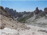 40
40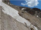 41
41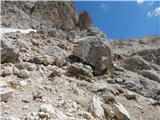 42
42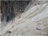 43
43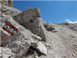 44
44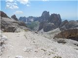 45
45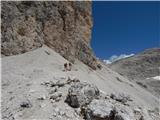 46
46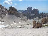 47
47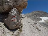 48
48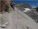 49
49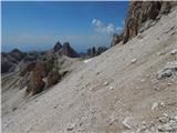 50
50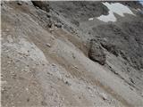 51
51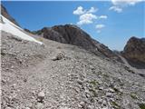 52
52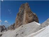 53
53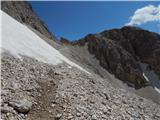 54
54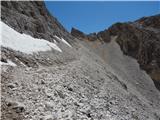 55
55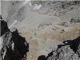 56
56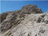 57
57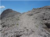 58
58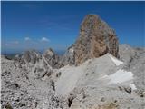 59
59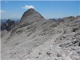 60
60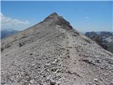 61
61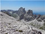 62
62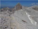 63
63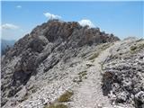 64
64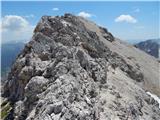 65
65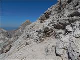 66
66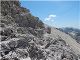 67
67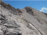 68
68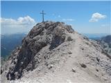 69
69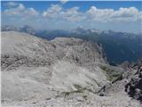 70
70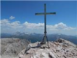 71
71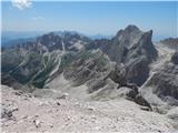 72
72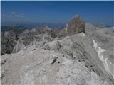 73
73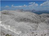 74
74
Discussion about the trail Rifugio Gardeccia - Cima Scalieret (via north ridge)
|
| Borut129. 07. 2021 21:57:10 |
Minibus od spodnje postaje sedežnice (kot piše v opisu dostopa do izhodišča) že nekaj let več ne vozi. Namesto tega prevoza lahko kupimo karto za sedežnico do druge postaje (povratna vozovnica za odraslega stane 13 Eur). Zadnja vožnja v dolino je ob 18 uri. Od druge postaje sedežnice do koče Gardeccia je še 40 minut hoje po široki in zložni poti.
|
|
|