Rifugio Nordio - Osternig (Ojstrnik) (via Sella Pleccia)
Starting point: Rifugio Nordio (1210 m)
| Lat/Lon: | 46,5506°N 13,4824°E |
| |
Name of path: via Sella Pleccia
Time of walking: 2 h 10 min
Difficulty: easy marked way
Altitude difference: 842 m
Altitude difference po putu: 900 m
Map: Julijske Alpe - zahodni del 1:50.000
Recommended equipment (summer):
Recommended equipment (winter): ice axe, crampons
Views: 8.434
 | 1 person likes this post |
Access to the starting point:
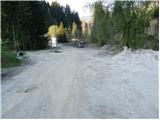
We drive to Trbiz / Tarvisio, which is just a few kilometres after the national border on the Italian side of the Rateče border crossing. You can also get to Trbiz/Tarvisio from Austria, where you must first drive to Bialystok/Villach and then cross the Thori-Coccau border crossing to Trbiz/Tarvisio. In Trbiz / Tarvisio, follow the signs for Udine along the old road (not the motorway). Shortly after Trbiz / Tarvisio, you will arrive in the village of Ukve / Ugovizza, where you turn right into the centre of the village. In the middle of the village you come to a stream, where a paved mountain road turns up alongside the stream. Follow this road to a crossroads where you go straight ahead (right), and just after this crossroads you will come to the next crossroads, where you go left. Follow this road, which is mostly asphalted, to the rifugio Nordio hut, where you park in the parking area next to the hut.
Path description:
Just below Nordio Cottage, a worse macadam road branches off to the right and climbs up the left side of the right-hand stream. After a few steps, the road branches off to the left at cart track, which then climbs parallel to the road. After five minutes' walk, cart track goes into the wods and turns into a footpath.
The path starts to climb steeply and leads us past an abandoned shack to a small well. Just a little further on, we come to a smaller mountain pasture on which stands an old shepherd's hut.
Further on, the steepness eases a little and the path passes through a forest with a few small clearings. Then cross a torrential ravine, and the path quickly emerges from the forest. It is only a few minutes' walk to the saddle, where you come across signposts and the end of the forest road coming from Austria.
Here, bear left onto grassy slopes surrounded by sparse forest. The path ascends moderately and after 15 minutes of ascent from the saddle leads to the Maria Schnee below Gozman chapel.
The path then descends gently and leads to grassy slopes. The path, which continues to descend gently, soon leads us to mountain pasture Bistrica, which we can already see in front of us.
At mountain pasture we come to a road which leads up to the signposts for "Osternig". Bear left on the footpath, which begins to climb steeply across the steep grassy slopes of the mountain. After about 15 minutes' walk from the road, the path climbs steeply and then joins an old military causeway, where you continue to the right. The steepness of the path and the slope subsides and the path leads to a crossroads of two paths. The right one goes to the top past the cross, the left one directly to the top. I recommend the right path, which is longer by about five minutes but is more scenic. The path that climbs only slightly takes you past the meteorological station to the cross, which stands on the eastern headland. At the cross, turn left and follow the path along the summit ridge. The summit is reached in five minutes from the cross.
Rifugio Nordio - Chapel Maria Schnee below Gozman 1:15, Chapel Maria Schnee below Gozman - mountain pasture Bistrica 15 minutes, mountain pasture Bistrica - Osternig 45 minutes.

Pictures:
 1
1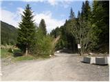 2
2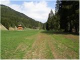 3
3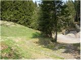 4
4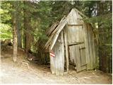 5
5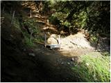 6
6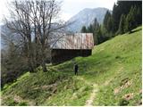 7
7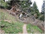 8
8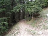 9
9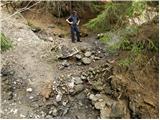 10
10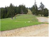 11
11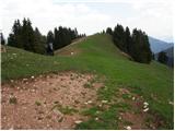 12
12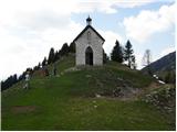 13
13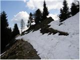 14
14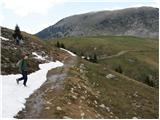 15
15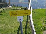 16
16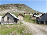 17
17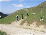 18
18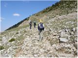 19
19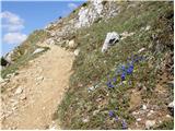 20
20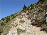 21
21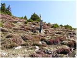 22
22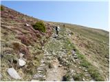 23
23 24
24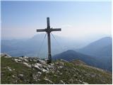 25
25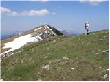 26
26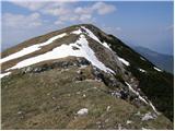 27
27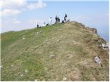 28
28
Discussion about the trail Rifugio Nordio - Osternig (Ojstrnik) (via Sella Pleccia)