Ribniška koča - Jezerski vrh
Starting point: Ribniška koča (1507 m)
| Lat/Lon: | 46,4974°N 15,2555°E |
| |
Time of walking: 15 min
Difficulty: easy marked way
Altitude difference: 30 m
Altitude difference po putu: 50 m
Map: Pohorje 1:50.000
Recommended equipment (summer):
Recommended equipment (winter): ice axe, crampons
Views: 7.911
 | 1 person likes this post |
Access to the starting point:
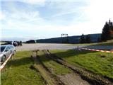
a) From the road Maribor - Dravograd, before the village of Brezno, turn left in the direction of Podvelka, Ribnica na Pohorju and Ribniška koča. After the bridge over the Drava River, we arrive at Podvelka, and we follow the road in the direction of Ribnica na Pohorju. After about 10 km from the bridge over the Drava, we reach the centre of Ribnica na Pohorju, where we turn left. There is a further climb of about 8 km, mostly on a dirt road, to Ribniška koča, where we park.
b) From Dravograd, drive towards Maribor, and after Radlje ob Dravi at the roundabout, leave the main road towards Maribor and continue driving towards Vuhred, Ribnica na Pohorje and Ribniška koča. After the bridge over the Drava River, we arrive at Vuhred, and we continue along the road in the direction of Ribnica na Pohorje. After about 10 km from the bridge over the Drava, we reach the centre of Ribnica na Pohorju, where we turn right. There is a further climb of about 8 km, mostly on a dirt road, to Ribniška koča, where we park.
Path description:
From Ribniška koča, take the path in the direction of Jezerski vrh and Ribniško jezero and initially walk along the road that led to the starting point and in a gentle downhill to the saddle between Mali Črni vrh and Jezerc peak. At the saddle, where it is also possible to park, we leave the road and take the marked footpath, which ascends first gently and then steeply to the monument at Jezerski vrh, which we reach in about 10 minutes of an increasingly scenic ascent.
Description and images refer to the situation in October 2022.
Pictures:
 1
1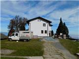 2
2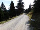 3
3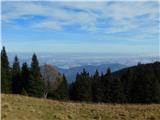 4
4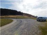 5
5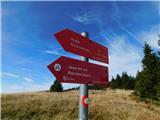 6
6 7
7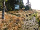 8
8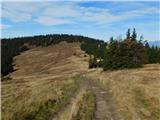 9
9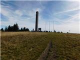 10
10 11
11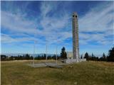 12
12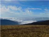 13
13
Discussion about the trail Ribniška koča - Jezerski vrh
|
| klavdy610. 01. 2009 |
neutrudljivo in prijetno 
|
|
|
|
| triglavski10. 01. 2009 |
Dejansko je izhodišče za Ribniško kočo vas Podvelka v dravski dolini. Ko pridemo čez most, zavijemo desno proti vasi Lehen. Vozimo se po ozki dolino potoka Velka, na desni je Janževski vrh, levo Rdeči breg, pri Lehnu se dolina razširi in proti Ribnici na Pohorju je že prav široka.
|
|
|