Starting point: Ribniška koča (1507 m)
| Lat/Lon: | 46,4974°N 15,2555°E |
| |
Time of walking: 40 min
Difficulty: easy marked way
Altitude difference: 36 m
Altitude difference po putu: 100 m
Map: Pohorje 1:50.000
Recommended equipment (summer):
Recommended equipment (winter): ice axe, crampons
Views: 22.242
 | 4 people like this post |
Access to the starting point:
a) From the road Maribor - Dravograd, before the village of Brezno, turn left in the direction of Podvelka, Ribnica na Pohorju and Ribniška koča. After the bridge over the Drava River, we arrive at Podvelka, and we follow the road in the direction of Ribnica na Pohorju. After about 10 km from the bridge over the Drava, we reach the centre of Ribnica na Pohorju, where we turn left. There is a further climb of about 8 km, mostly on a dirt road, to Ribniška koča, where we park.
b) From Dravograd, drive towards Maribor, and after Radlje ob Dravi at the roundabout, leave the main road towards Maribor and continue driving towards Vuhred, Ribnica na Pohorje and Ribniška koča. After the bridge over the Drava River, we arrive at Vuhred, and we continue along the road in the direction of Ribnica na Pohorje. After about 10 km from the bridge over the Drava, we reach the centre of Ribnica na Pohorju, where we turn right. There is a further climb of about 8 km, mostly on a dirt road, to Ribniška koča, where we park.
Path description:
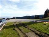
From the parking lot in front of Ribniška koča, follow the marked footpath in the direction of the Partisan Home, Koča pod Kremžarjevim vrhom, Črni vrh and Grmovškov dom below Veliko Kopo. At first, we climb up the cart track, and just a little further on we reach a worse macadam road, which in a few steps takes us to the reservoir lake at Mali Črni vrh, from where a beautiful view opens up, which reaches all the way to the Kamniško Savinjske Alps.
From Mali Črni vrh, continue in the direction of Kop and continue along the worse macadam road, passing a fenced private cottage on the left. The road ends and the path leads us along a well-trodden track, which initially descends a little further, and at an unmarked saddle at an altitude of 1477 m the path branches off slightly to the left towards Mislinja, and we continue straight on towards Črni vrh and Grmovšek's home. The way forward is mostly moderate climbing, and the marked path is followed to a marked crossroads.
From the crossroads go slightly left in the direction of Črni vrh (straight ahead to Grmovškov dom), where you initially walk through the forest, then along the edge of the vast meadows with beautiful views you reach the highest peak at Pohorje, where there is a skkorjanka, which today serves mainly as a shelter for mountaineers in case of bad weather, and used to be built by charcoal burners, and later also by foresters.
Description and pictures refer to the situation in October 2022.

Pictures:
 1
1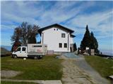 2
2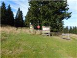 3
3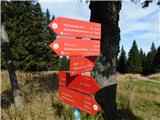 4
4 5
5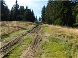 6
6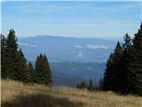 7
7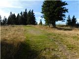 8
8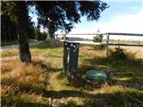 9
9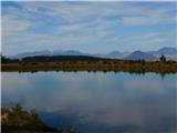 10
10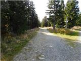 11
11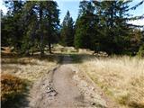 12
12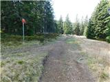 13
13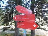 14
14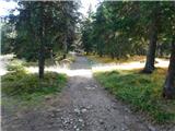 15
15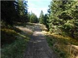 16
16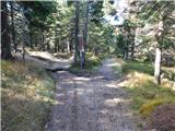 17
17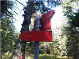 18
18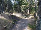 19
19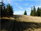 20
20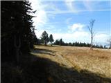 21
21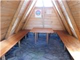 22
22 23
23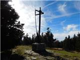 24
24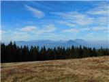 25
25
Discussion about the trail Ribniška koča - Črni vrh
|
| andrej jerina27. 10. 2008 |
Čudovita pot, ki smo jo prehodili s prijatelji v minulem vikendu. Kdor si zares želi odpočiti noge od zahtevnejših terenov, se le naj poda na Pohorje. Priporočam, še posebno je pot primerna za naše najmlajše ali pa najstarejše. LP Andrej
|
|
|
|
| Holcar221. 07. 2012 |
Kdor gre na Črni vrh, pa tudi na ostale višje predele Pohorja, naj za božjo voljo obuje visoke čevlje in dolge hlače, če se le da, kajti količina mravelj je neverjetna.Kar med hojo so se mi povzpele na gojzar in mi lezle po nogi,da sem se moral nonstop stresati.  Drugače zelo lepa pot, lep izlet!
|
|
|
|
| rs5622. 07. 2012 |
ma daj ne pretiravaj, drugič pa raje ostani doma, da te ne požrejo
|
|
|
|
| Holcar217. 02. 2013 |
Kolk je kaj snega na Črnem vrhu? 
|
|
|
|
| fika17. 02. 2013 |
informacija je od 8.2., snega je ponekod tudi 1m vendar pa je urejena tekaška steza in ni problema glede pešačenja.
|
|
|
|
| pohodnik3829. 06. 2015 |
V četrtek na državni praznik sem se podal na Pohorje.Začel sem v Ribnici na Pohorju ki je nam najbližje izhodišče za pohod do Ribniške koče in naprej na Črni vrh.Je pa ovršni del Pohorja precej zanimiv in razgleden in je fino pot podaljšat še do Velike Kope več pa na spodnji povezavi. Ribniško Pohorje in Velika Kopa v sliki in besedi. Lp! Tone 
|
|
|