Ribnica na Pohorju - Ribniška koča
Starting point: Ribnica na Pohorju (714 m)
| Lat/Lon: | 46,5332°N 15,2669°E |
| |
Time of walking: 2 h 10 min
Difficulty: easy marked way
Altitude difference: 793 m
Altitude difference po putu: 793 m
Map: Pohorje 1:50.000
Recommended equipment (summer):
Recommended equipment (winter):
Views: 22.350
 | 1 person likes this post |
Access to the starting point:
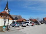
a) From the road Maribor - Dravograd, before the village of Brezno, turn left in the direction of Podvelka, Ribnica na Pohorju and Ribniška hut. After the bridge over the Drava River, we arrive at Podvelka, and we continue along the road in the direction of Ribnica na Pohorju. After about 10 km from the bridge over the Drava, we reach the centre of Ribnica na Pohorju, where we turn left and then park a little further on in the parking lot in the centre of the village. The parking lot is located a little further from the parish church of St. Jernej.
b) From Dravograd drive towards Maribor, after Radlje ob Dravi leave the main road at the roundabout towards Maribor and continue driving towards Vuhred, Ribnica na Pohorje and Ribniška koča. After the bridge over the Drava River, we arrive at Vuhred, and we continue along the road in the direction of Ribnica na Pohorje. After about 10 km from the bridge over the Drava we reach the centre of Ribnica na Pohorju, where we turn right and then park a little further on in the parking lot in the centre of the village. The parking lot is located a little further from the parish church of St. Jernej.
Path description:
From the Ribnica na Pohorju centre, initially continue along the ascending asphalt road, from which you will soon turn right in the direction of Koča na Pesniku. You will quickly reach the foot of the ski slope, where you will leave the road and continue your ascent to the left along the edge of the ski slope. When you reach the top of the ski slope, you will cross another lane of forest, and then reach a dirt road where the trail ends. Continue along the road for some time, which leads through the forest, and higher up you will reach a crossroads from which you continue straight on the footpath towards the Hut na Pesniku. This is followed by about 15 minutes of moderate ascent and the path leads us out of the forest, where we can already see the mountain hut in front of us, which is only a few minutes' easy walk away.
From the hut, we walk to the road leading to Ribniška koča, and we follow it to the left, walking only a few steps, as from the nearby crossroads we continue on the footpath that climbs between the two roads. The ascent follows cart track, which has a couple of forks higher up, where we follow the fairly frequent markings. Higher up, cart track, which runs through the forest most of the time, turns into a footpath which starts to climb steeply. During the ascent, the path leads past a hunting lodge, and above it you reach the ski slope of the Ribniško Pohorje ski resort. Continue along the edge of the ski slope and the increasingly scenic route leads to Ribniška koča at Pohorje.
Ribnica to Pohorje - Koča na Pesniku 1:05, Koča na Pesniku - Ribniška koča 1:05.

Pictures:
 1
1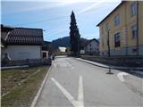 2
2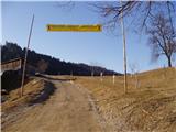 3
3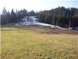 4
4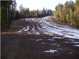 5
5 6
6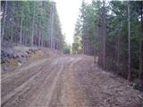 7
7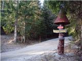 8
8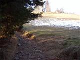 9
9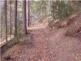 10
10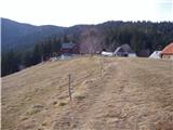 11
11 12
12 13
13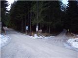 14
14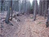 15
15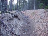 16
16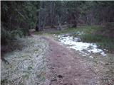 17
17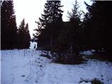 18
18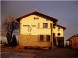 19
19
Discussion about the trail Ribnica na Pohorju - Ribniška koča
|
| pohodnik3823. 01. 2012 |
V nedeljo 22.januarja opravil tole pot malo po cesti polovico pa po markirani poti...snega na poti malo je pa mestoma poledenelo...lep dan in lepi razgledi z Črnega vrha-najvišje točke Pohorja...nekaj slik pa na tej povezavi.
|
|
|
|
| jprim24. 01. 2012 |
Čestitke za enkratno stran.
LP!
|
|
|
|
| izidor226. 01. 2012 |
Jutri se podam na to pot!
|
|
|
|
| izidor227. 01. 2012 |
Danes odnesel pete na Črni vrh , vreme bilo čudovito nobenega vetra , pot lepo uhojena le zadnjih 100m pred Ribniško kočo je veter nanesel nekaj snega zraven še je bilo ojužnelo tako da sem se pogrezal do kolen kar me je stalo zadnjih moči. Drugače je bil lep pohod.
|
|
|
|
| pohodnik3810. 09. 2018 |
Včeraj sem se podal na Ribniško kočo potem pa še naprej na Črni vrh in Kope.Pot je brez posebnosti le malo blatna tu in tam kar pač letos tako pogosto dežuje. SLIKE in osebni vtisi z poti Lp! Tone 
|
|
|
|
| krpak30. 08. 2021 12:50:06 |
Zelo dobro označena pot od Ribnice do Ribniške koče
|
|
|
|
| Mašika18. 12. 2022 18:25:27 |
Bila danes, res je dobro označena pot - saj mora biti, vsaj za zimske razmere...po poti sneg, ampak je shojeno. Koča pa obnovljena, lepo, moderno.
|
|
|
|
| felix19. 12. 2022 16:18:23 |
Kako pa je s potjo Ribniška - Kope, ali je tudi kaj shojena?
|
|
|
|
| Amadej21. 12. 2022 23:19:49 |
Ali kdo ve ali je na črnem vrhu kaj snega? Hvala za odgovor
|
|
|
|
| mornar3. 10. 2023 17:23:29 |
Prosim za informacijo kje se nahaja žig od koće,ker le ta ni stalno odprta.Hvala in lep pozdrav.
|
|
|
|
| turbo3. 10. 2023 20:34:26 |
|
|
|