Remšendol - Šober / Monte Sciober Grande (via 518)
Starting point: Remšendol (880 m)
| Lat/Lon: | 46,4833°N 13,6121°E |
| |
Name of path: via 518
Time of walking: 3 h
Difficulty: partly demanding marked way
Altitude difference: 965 m
Altitude difference po putu: 965 m
Map: Julijske Alpe - zahodni del 1:50.000
Recommended equipment (summer): helmet
Recommended equipment (winter): helmet, ice axe, crampons
Views: 6.765
 | 1 person likes this post |
Access to the starting point:
Cross the Rateče border crossing and head towards Trbiz/Tarvisio. Just a few metres before the town (just after a long underpass under the railway line), the road turns sharp left towards Koprivnik/Ortigara and Male Rovte/Rutte piccolo. Take this road, which leads you through Male Rovte to a crossroads above the village. Continue left (right Pliči/Plezzut) along a slightly narrower road, which goes higher, and after a short descent leads to the next crossroads, where you park near it (park so as not to obstruct the forestry work).
It is also possible to access the forest via the Predel border crossing (turn right here in Pliči/Plezzut and then join the road described above).
Path description:
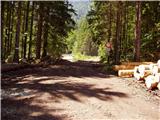
From the crossroads, turn right onto the forest road closed to traffic in the direction of "Bivio, La Portella and Cave del Predil". After about 15 minutes' walking, the road, which climbs only slightly, leads to a crossroads where the 511 trail branches off to the right (it is also possible to climb up this trail), and we continue straight on along the 'main' road, which leads us just a little further out of the forest and onto the vast gravel areas of the Remsendol valley.
Cross the gravel paths and continue along the right-hand side (here the markings are less frequent due to the torrential deposits), and then notice the markings which direct you slightly to the right on the initially gently sloping mountain path (path No 518).
The path continues to climb steeply parallel to the valley and then, after crossing a ravine, passes into the lane of the forest. A short steep climb through the forest follows, and then the path leads us to the foot of the steep cliffs (danger of falling rocks), where we also step on an unexposed and exposed shelf after which we continue the climb. There follows a folded cross-climb on an occasionally exposed slope (high risk of slipping in wet conditions), and then the path leads us to a mighty ravine. We cross the ravine (with the high water level it is impossible to cross!) and then on the other side we start to climb very steeply up along the ravine (high risk of slipping). Higher up the steepness eases and the path, which runs through the forest all the time, leads us after about 2 hours of walking from the starting point to the Rifugio Cinque Punte hut or bivouac, from which we have a beautiful view of the walls of the Rabeljski Špice.
From the hut, walk to the other side of the clearing, then continue left into the forest along the marked path (No 520), which begins to climb at the foot of the Rabeljski Špice. The path soon becomes a gentle slope and then continues on a switchback towards the Sella della Malga saddle.
The crossing offers a fine view of Poldnik (2063 m), Mangart (2678 m) and the other peaks that surround the Remsendol valley. After a short crossing, we reach the aforementioned saddle, from which the first view opens up towards the Više Group (we have to go slightly off the marked path to get a view).
At the saddle, the path turns left and gradually starts to climb steeper and steeper. Higher up, the path gradually passes out of the forest and onto slopes covered with dwarf pines. A little further on, we reach the main ridge, where the path turns slightly to the right, descends for a few steps, and then leads us under the summit itself, which is only a short steep climb away. Starting point - Rifugio Cinque Punte 2:00, Rifugio Cinque Punte - peak 1:00.

Pictures:
 1
1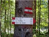 2
2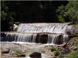 3
3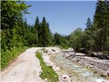 4
4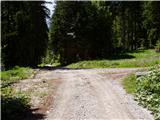 5
5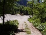 6
6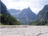 7
7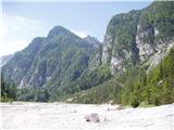 8
8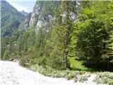 9
9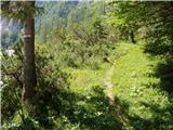 10
10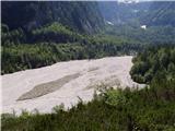 11
11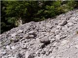 12
12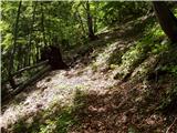 13
13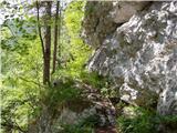 14
14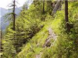 15
15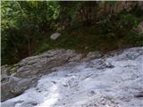 16
16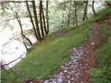 17
17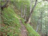 18
18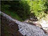 19
19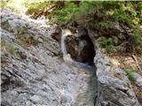 20
20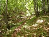 21
21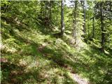 22
22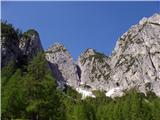 23
23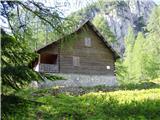 24
24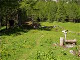 25
25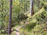 26
26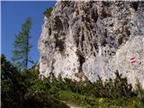 27
27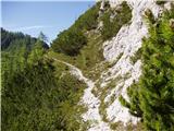 28
28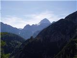 29
29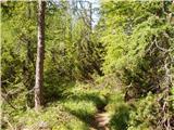 30
30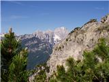 31
31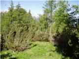 32
32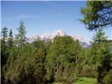 33
33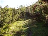 34
34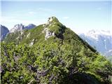 35
35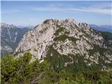 36
36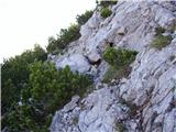 37
37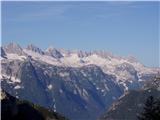 38
38 39
39
Discussion about the trail Remšendol - Šober / Monte Sciober Grande (via 518)
|
| cybee27. 05. 2023 22:50:30 |
Danes sem opravil krožno pot, gor po 511 in dol po 518. Odlična tura. Rad bi opozoril, da je pot 518 v spodnjem delu na nekaterih delih v zelo slabem stanju, neočiščena in kar je najhuje posamezni deli poti so načeti oz. že zdrsnili v prepad, ki je na nekaterih mestih 10 in več metrov. Zanimivo, da je 511 v dobrem stanju, tudi 518 v zgornjem delu. Vsekakor je potrebno biti zelo pazljiv. Oznake so še kar vidne, ampak steza sama je nevarna, predvsem zadnjih 300-400m (vidno na fotografiji št. 6).
|
|
|
|
| darinka411. 10. 2023 07:20:08 |
Ko si prvič v teh koncih je vse zanimivo. Saj tudi je bila celotna desturna tura. Ki smo jo podaljšali na oba Grintovca , poleg Šoberja, kjer zaviješ na vrh mimogrede. Če prav pomislim , nisem bila ravno sigurna , da bomo po tistem skalnatem razdrapanem svetu prišli na Grintavca. Če bi imeli še malo časa , bi se povzpeli še na Vršič, ki je bil na nasprotni strani Grintavcev. Srečali pa res nism prav nikogar. Si ogledali čudovite tolmunčke ob vzponu in sestopu . Krožno nam je uspelo prehodit.Lepi razgledi z grebena , kjer se lepo vidi Rajbelj. Ob bivaku, si lahko natočiš vodo.
|
|
|
|
| keti120. 03. 2024 10:13:41 |
A kdo morda pozna stanje poti 520 iz Remšendola do koče Cinque Punte kot alternativo poti 518, če je ta v precej slabem stanju?
|
|
|
|
| turbo21. 03. 2024 16:04:26 |
|
|
|
|
| darinka421. 03. 2024 17:21:57 |
Lani smo hodili po tej poti. Tako kot je napisal Bojan. Je brez posebnosti. Pred bivakom je voda. Pot naprej na oba Grintovca , kjer smo šli je tudi lepo vidna. Razgledna . Sej obiska niti nima ravno dosti. Sestop tam kjer jo je odneslo , so namestili vrv, da si pomagaš . V glavnem mi nismo imeli nobenih težav.
|
|
|
|
| keti123. 03. 2024 21:53:55 |
Hvala obema za informacije. Lp
|
|
|