Reklanska dolina - Bivouac Marrusich
Starting point: Reklanska dolina (700 m)
| Lat/Lon: | 46,3937°N 13,4405°E |
| |
Time of walking: 4 h
Difficulty: difficult marked way
Altitude difference: 1341 m
Altitude difference po putu: 1341 m
Map: Julijske Alpe - zahodni del 1:50.000
Recommended equipment (summer): helmet
Recommended equipment (winter): helmet, ice axe, crampons
Views: 3.288
 | 1 person likes this post |
Access to the starting point:
From Kranjska Gora, drive through the Rateče border crossing to Trbiž / Tarvisio. In Trbiz, turn left towards Bovec and follow the road to the crossroads near Lake Rabelj. Here, turn right towards the Nevea Pass / Sella Nevea. From the pass, follow the road through numerous tunnels and galleries to the Reclano side. About 1km after the last tunnel or gallery, park in one of the roadside car parks.
From Bovec, drive to the Predel border crossing, from which you descend to the Italian side. Just after Lake Rabelj, you will reach a crossroads where you turn left towards the Neveje Pass / Sella Nevea. Continue as described above.
Path description:
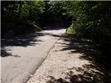
From the roadside parking lot, descend a few dozen metres to where you will see the mountain signs for mountain pasture Gorjuda (Casera Goriuda) on the left-hand side of the road. The path immediately leads into the forest, where it climbs steeply at first and then steeply. After a good 20 minutes of walking, the path leads to the first more difficult part, where a wide and protected artificial ledge is crossed with the help of a rope. A similar crossing is then repeated twice more, all accompanied by gushing water chutes, so that we are quite wet. The path then climbs steeper up the steep and slip-prone slope. All the key places, especially the ravine crossings, are well protected. The only problem arises if the route is taken after a heavi rain or thaw, when the ravines are full of water and crossing is impossible. The steepness then eases a little and the rather overgrown path then takes us through the forest to the rocky cliffs, where the path turns sharp left. With the help of a rope we cross another short slightly exposed spot, and then the problems disappear. Next, the path leads us quickly out of the forest and we see in front of us an old shepherd's hut (converted into a bivouac) at mountain pasture Gorjuda, where the crossroads of the path is.
Continue along the right-hand side of the hut in the direction of the Marrusich bivouac along a rather overgrown path which, after a short climb, leads us back into the forest. The rather overgrown path crosses a torrential stream with the help of a small bridge and leads us into a rare, mostly larch forest. Here the path comes quite close to the mighty scraped slabs, then retreats slightly to the right and continues to climb parallel to them. When the path briefly lays down, the entrance to the ice cave can be seen on the right. Here you can cool down a little, but the ice can make the climb into the cave potentially dangerous. Next, an increasingly scenic route through a series of valleys leads us to the high mountain world of the Kanin mountain range. After a few more minutes of walking on the plateau, we arrive at a less well-marked crossroads, where we continue to the left (Tamaroz on the right). The way ahead climbs through a karst world full of scrapes and potholes, so we carefully follow the path, which, after a good 20 minutes of climbing from the crossroads, leads us to the path Rifugio Giberti - Žrd. Here, continue to the right and follow the relatively winding path to the Marrusich bivouac, which is reached after a few minutes.
Starting point - mountain pasture Gorjuda 2:00, mountain pasture Gorjuda - Marrusich bivouac 2:00.

Pictures:
 1
1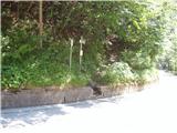 2
2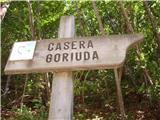 3
3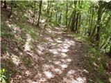 4
4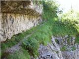 5
5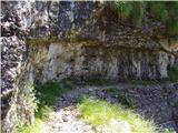 6
6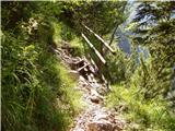 7
7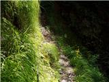 8
8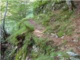 9
9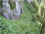 10
10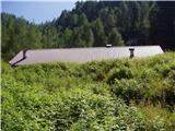 11
11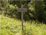 12
12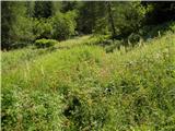 13
13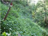 14
14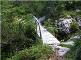 15
15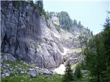 16
16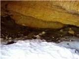 17
17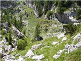 18
18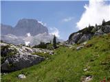 19
19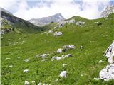 20
20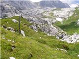 21
21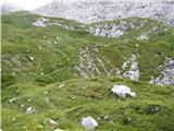 22
22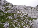 23
23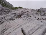 24
24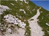 25
25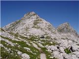 26
26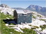 27
27
Discussion about the trail Reklanska dolina - Bivouac Marrusich