Starting point: Rakitnica (490 m)
| Lat/Lon: | 45,6877°N 14,7573°E |
| |
Time of walking: 3 h
Difficulty: easy marked way
Altitude difference: 764 m
Altitude difference po putu: 825 m
Map:
Recommended equipment (summer):
Recommended equipment (winter): crampons
Views: 8.486
 | 1 person likes this post |
Access to the starting point:
a) Leave the Ljubljana Ring Road at the Ljubljana - South exit and continue driving in the route Kočevje. Just after Ribnica, near Dolenje vas, leave the main road leading to Kočevje and turn right towards Gotenica and Kočevska Reka. Shortly after leaving the main road, we see signs for Rakitnica pointing us to the right, but we continue straight on here and turn towards Rakitnica at the next junction, where we take a sharp right off the main road (there is a sign for Rakitnica just on the opposite side). Continue past a few houses and then you will see a dirt road that turns slightly left from the asphalt road. Take the dirt road and park alongside it in a suitable place. At the starting point there is also an information sign for the Rudeževa cesta and a mountain direction sign for Jelenov žleb.
b) From Kočevje we drive towards Ljubljana, and just before Dolenja vasja we turn left towards Kočevska Reka and Gotenice. Shortly after leaving the main road we see signs for Rakitnica pointing us to the right, but we continue straight on here and turn towards Rakitnica at the next junction, where we take a sharp right turn off the main road (there is a sign for Rakitnica just on the opposite side). Continue past a few houses and then you will see a dirt road that turns slightly left from the asphalt road. Take the dirt road and park alongside it in a suitable place. At the starting point there is also an information sign for the Rudeževa cesta and a mountain direction sign for Jelenov žleb.
Path description:
From the starting point, head towards Rudeževa cesta, along which you will also see signs for Jelenov žleb. The road goes quickly into the forest, through which it climbs moderately to the first crossroads. Here, bear slightly right and continue in the direction of Jelenův Žleb. The road starts to climb steeply, and in a sharp right turn, the marked path from Grčarice and Grčarske Raven joins us from the left. Continue along the "main" road for a few minutes, and then, at a sharp left turn, continue straight on to a slightly narrower road (the turn-off is not marked). Continue on a gentle to moderate climb on a dirt road, which turns left at a higher altitude and turns into a wide cart track. At the point where the road becomes a dirt track, a marked track branches off slightly to the right, or straight ahead (leave the road at a slight left turn), which after a few metres turns slightly further to the right and then climbs cross-country to another forest road. Follow this road to the right and after a few metres it splits into two parts. This time continue on the upper road on the left (the lower road leads to Zadolje), and we follow it on a slight to moderate incline to its end.
Just a few metres before the end of the road, a marked track branches off to the left, which takes about 15 minutes to ascend to the next road, which is reached just by the NOB monument.
At the monument there is a marked crossroads, where you continue to the right in the direction of Sten. Walk along the road for only 10 m and then the signs for Stene point you right downhill, where after a minute's further walking you reach a registration box.
From the sign-in box, you can follow an exposed path down to a nearby viewpoint.
From the Walls, return to the marked crossroads by the monument, and then continue your ascent along the marked path towards Rezinski vrh. The path then climbs steeply along the narrower cart track, then lays down and slowly begins to disappear. The ascent continues along a less visible but well-marked path which turns slightly to the left and begins to climb steeply towards Rezinski vrh. Just above the "wedges" (memorial memorial) the path is laid and then leads us in a few minutes to the forested Rezinski vrh. There is a short descent to a nearby forest road, which is followed to the right, and we walk along it to the place where the signs for Turn direct us to the left onto the cart track. We then climb a short way up the grassy cart track, and then the signs direct us left onto a steep track which takes us up to the Turn in a few minutes.

Pictures:
 1
1 2
2 3
3 4
4 5
5 6
6 7
7 8
8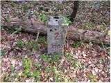 9
9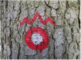 10
10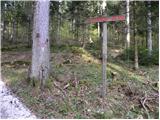 11
11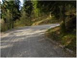 12
12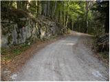 13
13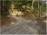 14
14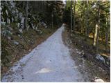 15
15 16
16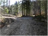 17
17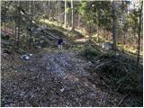 18
18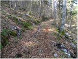 19
19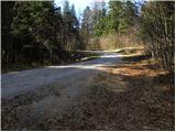 20
20 21
21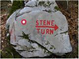 22
22 23
23 24
24 25
25 26
26 27
27 28
28 29
29 30
30 31
31 32
32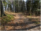 33
33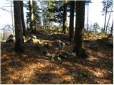 34
34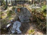 35
35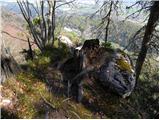 36
36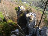 37
37 38
38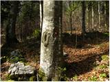 39
39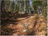 40
40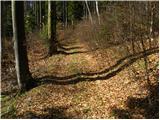 41
41 42
42 43
43 44
44 45
45 46
46 47
47 48
48 49
49 50
50 51
51 52
52 53
53 54
54 55
55 56
56 57
57 58
58 59
59 60
60 61
61 62
62 63
63 64
64
Discussion about the trail Rakitnica - Turn