Rakitna (Rakiško jezero) - Rakitna (Forest and archaeological learning trail Rimski zid - Rakitna)
Starting point: Rakitna (Rakiško jezero) (789 m)
| Lat/Lon: | 45,8872°N 14,4321°E |
| |
Name of path: Forest and archaeological learning trail Rimski zid - Rakitna
Time of walking: 1 h
Difficulty: easy marked way
Altitude difference: 0 m
Altitude difference po putu: 75 m
Map: Ljubljana - okolica 1:50.000
Recommended equipment (summer):
Recommended equipment (winter):
Views: 11.950
 | 1 person likes this post |
Access to the starting point:
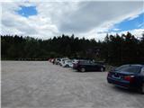
a) From the Ljubljana - Koper motorway, take the Brezovica exit and then continue in the direction of Podpeč (Podpeč can also be reached from Črna vas or Ig). In Podpeč, continue in the direction of Borovnica, Krima and Rakitna and continue along the edge of the Ljubljana Moor for a short distance before the signs for Rakitna direct you left onto a steeply ascending road. The road then leads through Preserje, where it also begins to descend. After a short descent, continue left in the direction of Krima and Rakitna, and we then follow the mostly ascending road to Rakitna (after the turnoff for Krim, the road starts to descend), where we park in the parking lot at Rakiška jezero (parking is payable).
b) First drive to Cerknica, then continue in the direction of Begunje, and when you arrive in Begunje follow the signs for Rakitna. When you arrive at Rakitna, park in the parking lot at Rakiška jezero (parking is payable).
Path description:
The Roman Wall - Rakitna forest and archaeological trail starts on the eastern side of the lake, or where the access to the Rakitna Hotel is. At the beginning of the trail, there is an information board with a map with all 22 teaching boards. At first you walk along the lakeside, where you can already see the first markings, but the trail quickly turns to the south side of the lake, where you first cross a wetland and then walk to an asphalt road, which you follow to the left. Walk along the road for a short distance, then at the left-hand bend turn slightly right onto cart track, which continues the trail. The path continues along the right-hand edge of the meadow, climbing gently to reach information board No 6, where the path splits into two parts.
Continue left over the top edge of the meadow, and when you enter the woods the path reappears. Through the woods, first climb moderately and then enter the next hayfield, where the track begins to disappear. The path first turns left, where it leads past a bench, and then slowly in a semicircle begins to turn right. At this point, the real path is a little more difficult to follow, but if you follow the mapped route and the occasional markings carefully, you will be on the right track. When the trail becomes easier to follow again, it leads past a boulder and then across another meadow to teaching board No 10, after which you enter the forest. Through the woods, the path climbs more visibly for a short distance, then turns right and passes signposts 11 to 13, leading to the 'animal tracks' in the concrete. A little further on, you reach a dirt road, which you follow to the left, and follow it to a left turn. From the bend at signpost No 15, go straight on to cart track, which is usually followed by a small stream, and after a few steps go left into the woods. The path climbs steeply for a few minutes through the forest, and then, as the path flattens out, the signs point to the right, where you quickly reach signpost No 17 (3rd-century Schengen system). Here the path first turns left, then turns right in a semicircle and leads to cart track, which is usually a small stream. After the cart track, descend back to signpost No 15, where you enter the road you have already walked along, and walk along it until you reach the road in the "up" direction, then follow the footpath to signpost No 14, where you turn left after the bench and descend to the meadow by signpost No 6, from where you follow the "ascent" path back to the starting point. Description and figures refer to the situation in 2016 (July).

Pictures:
 1
1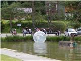 2
2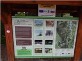 3
3 4
4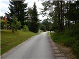 5
5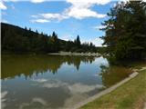 6
6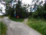 7
7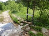 8
8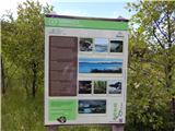 9
9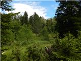 10
10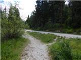 11
11 12
12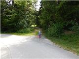 13
13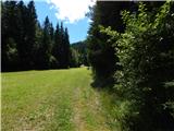 14
14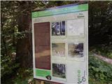 15
15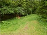 16
16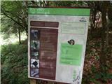 17
17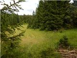 18
18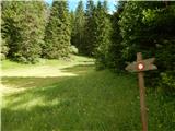 19
19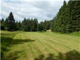 20
20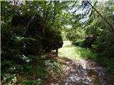 21
21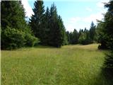 22
22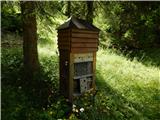 23
23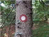 24
24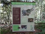 25
25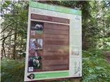 26
26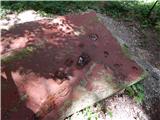 27
27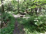 28
28 29
29 30
30 31
31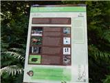 32
32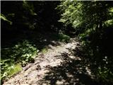 33
33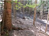 34
34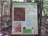 35
35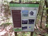 36
36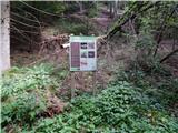 37
37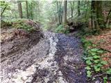 38
38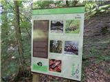 39
39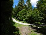 40
40 41
41 42
42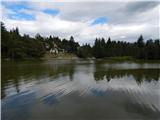 43
43
Discussion about the trail Rakitna (Rakiško jezero) - Rakitna (Forest and archaeological learning trail Rimski zid - Rakitna)
|
| nejcf23. 09. 2018 |
V rahlem rosenju in megli sva šla danes po tej krožni poti. Ponekod je malo slabše označena, drugače pa kratka in razgibana. V gozdu je bilo polno močeradov.
|
|
|
|
| egg4. 05. 2020 |
Z družino (od 4 letnikov naprej) prehodili 2.5. Pot je sedaj lepo označena, table so še vedno vzdrževane in dobro vidne.
En od otrok je na poti pozabil zelen Deuter nahrbtnik z sliko lisičke. Dan kasneje ga ni bilo več... bo vesel, če ga morda dobi nazaj. Najditelju bomo hvaležni. moj gsm 040 504 pet šest štiri
|
|
|