Starting point: Radlje ob Dravi (374 m)
| Lat/Lon: | 46,6144°N 15,225°E |
| |
Time of walking: 30 min
Difficulty: easy marked way
Altitude difference: 134 m
Altitude difference po putu: 134 m
Map: Pohorje - izletniška karta 1:50.000
Recommended equipment (summer):
Recommended equipment (winter):
Views: 679
 | 2 people like this post |
Access to the starting point:
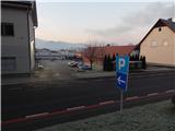
a) Drive to Dravograd, then continue to Maribor. When you arrive in Radlje ob Dravi, turn left at the junction between the Hofer and Lidl stores in the direction of the Radelj Pass and the centre of Radelj ob Dravi. Continue along the road that leads through the centre of the town (left Austria via the Radlje Pass) and follow it to the parish church of St. Michael, where you will see red mountain signs along the road. Park in one of the car parks in Radlje ob Dravi, but be careful, as some car parks only allow parking for up to 2 hours.
b) From Maribor, follow the Drava Valley towards Dravograd, leaving the main road before Radlje ob Dravi, where the signs for this place direct you to the right. Continue past the cemetery, the health centre and the police station, and then you will see the red mountain signs on the right near the parish church. Park in one of the car parks in Radlje ob Dravi, but be careful as some car parks only allow parking for up to 2 hours.
Path description:
From the starting point, take the path in the direction of Župank and Kapunar, where you will first pass a signboard and the parish church of St. Michael, and a little further on you will pass the Rosenhof. The road you are climbing soon turns left, and just a few steps further on the signs direct you to a sharp right onto a narrower road, and from there you will immediately turn left onto the originally marked path. After a few minutes of climbing, we reach a dirt road, and we follow it to the right, bypassing the water tower on the lower right-hand side.
Continue towards Župank and Kapunar (slightly left unmarked path to Kapunar, leading west from Perkolica (600 m), a steeper marked path), where we quickly change from the dirt road to the asphalt road, and climb up it to the NOB memorial at the Župank homestead.
Description and pictures refer to the situation in 2018 (December).
Pictures:
 1
1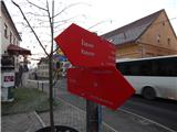 2
2 3
3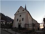 4
4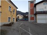 5
5 6
6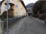 7
7 8
8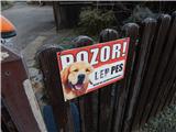 9
9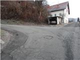 10
10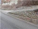 11
11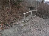 12
12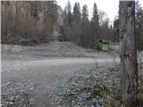 13
13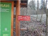 14
14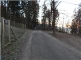 15
15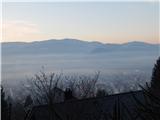 16
16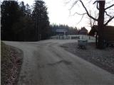 17
17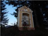 18
18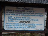 19
19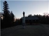 20
20
Discussion about the trail Radlje ob Dravi - Župank