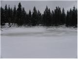
Račevsko jezero - Vrh Svetih Treh Kraljev
Starting point: Račevsko jezero (681 m)
| Lat/Lon: | 46,0155°N 14,1812°E |
| |
Time of walking: 45 min
Difficulty: easy marked way
Altitude difference: 203 m
Altitude difference po putu: 203 m
Map: Škofjeloško in Cerkljansko hribovje 1:50.000
Recommended equipment (summer):
Recommended equipment (winter):
Views: 6.585
 | 1 person likes this post |
Access to the starting point:
a) From the motorway Ljubljana - Koper take the exit Vrhnika and then continue along the parallel old road towards Logatec. Soon you will see signs for Stara Vrhnika, which will direct you to the right. Follow the road to Stara Vrhnika and on to Podlipa and Veliki Ligojna. After Stara Vrhnika, leave the main road and continue driving to the left in the direction of Podlipa and Smrečje. After Podlipa the road starts to climb steeply, and higher up the road from Horjul joins from the right. Here, continue slightly left, and we occasionally follow a slightly narrower road to Smrečje. The road then begins to descend, and we follow it to a junction where the road to Lavrovec branches off to the right. Park in a suitable place along the road
b) From Horjul, drive past Vrzdenec towards Gorenjska vas. At the first sharp right turn, the road to the village of Šentjošt nad Horjul branches off to the left. Take this road and follow it to the next crossroads where you turn right (left down Vrhnika). The road then soon leads to the village Smrečje. The road then starts to descend and we follow it to the crossroads where the road to Lavrovec branches off to the right. Park in a suitable place on the roadside
c) From Škofja Loka take the regional road to Žiri and from there take the road that goes up along the river Račeva towards the villages Smrečje and Žirovski Vrh. Follow the road towards Smrečje and the Peak of the Holy Three Kings. Shortly before you reach Račevsko jezero, you will come to a crossroads where the road to the left turns off towards the village of Lavrovec. Park in a suitable place at the crossroads.
Path description:
From the crossroads, follow the marked path southwards (the opposite side of the road leading to Lavrovec). The marked path immediately crosses a small stream over a small bridge and turns right into the forest, through which it begins to climb more steeply. Higher up, the path makes a sharp left turn and joins the slightly wider cart track. Continue ascending along the above-mentioned cart track for some time, then join the tarmac road, which you follow to the right. Just a little higher up, the road splits into two parts, and we continue on the left (right Vrh Svetih Treh Kraljev past Petač), which quickly leads us to a small hamlet in the village. We walk past the houses, and the road quickly leads us to the bowling green, where we are joined on the left by the marked path from Rovt. Continue to the right and walk past Rupnikova linija to the mountain hut at the top of Sveti Treh Kraljev in a minute.
From the mountain hut, continue along the marked mountain trail, which begins to climb steeply through increasingly sparse forest. The path then lies down and leads to an asphalted road, which takes a few minutes of further walking to reach the scenic summit.

Pictures:
 1
1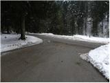 2
2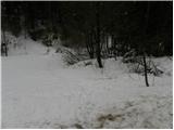 3
3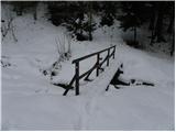 4
4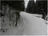 5
5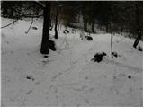 6
6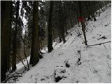 7
7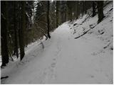 8
8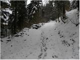 9
9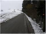 10
10 11
11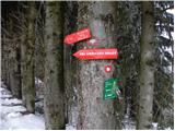 12
12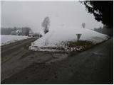 13
13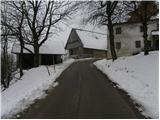 14
14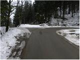 15
15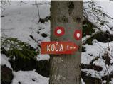 16
16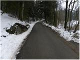 17
17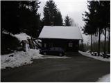 18
18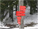 19
19 20
20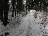 21
21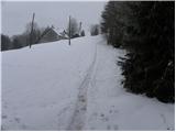 22
22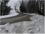 23
23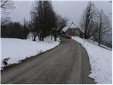 24
24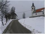 25
25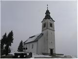 26
26 27
27
Discussion about the trail Račevsko jezero - Vrh Svetih Treh Kraljev
|
| navrhu1. 11. 2014 |
Ali je na Vrhu ali ob poti od Račevskega jezera do Vrha kaj za pojesti? Kakšna planinska koča, Turistična kmetija, ipd?
|
|
|