Puščava - Klančnik (Glančnik)
Starting point: Puščava (354 m)
| Lat/Lon: | 46,55013°N 15,4236°E |
| |
Time of walking: 2 h 15 min
Difficulty: easy marked way
Altitude difference: 523 m
Altitude difference po putu: 565 m
Map: Pohorje 1:50.000
Recommended equipment (summer):
Recommended equipment (winter): ice axe, crampons
Views: 170
 | 1 person likes this post |
Access to the starting point:
a) From the Maribor - Dravograd road, between the Fala HPP and the Ožbalt HPP, turn left towards Lovrenc na Pohorju (from the route of Dravograd turn right). On the other side of the Drava, start climbing along Radoljna, and at the marked crossroads go left towards Rušy and Činžat. Continue past the Puščava bus station, and a little further on there is a suitable parking space on the right.
b) Drive into Ruše, then follow the road towards Lovrenec na Pohorju. In the village of Činžat you will reach a pass where the road starts to descend, and lower down the road continues along the Lampreht stream, where you will see a parking space on the left.
Path description:
From the starting point, continue along the asphalt road downhill, and when you reach the Puščava bus stop, turn left onto the marked path, which continues along the wider cart track. Soon you will reach a small pass, where you will see the Church of St Mary Help of Christians on your left. Just a little further on, you reach a small crossroads, where you go left over a bridge (St Anne's Chapel on the right 3 minutes), and after the bridge you reach a wider tarmac road by the church, which you follow carefully for a few minutes.
Leave the road to Lovrenc na Pohorju at the crossroads where the chapel is located and continue to the right in the direction of Lehn, Kohove and Podvelka. The way ahead leads along a slightly narrower asphalt road, which first descends slightly and then continues past a few houses without any major changes in elevation. After crossing the Slepnice River, turn slightly right, onto the road towards the hunting lodge. Continue ascending cross-country, and at the crossroads continue straight ahead or in the direction of the markings and the hunting lodge. Higher up, after crossing a stream, the road turns sharp left and continues through the forest. Leave the forest for a few minutes in front of the Permavsl homestead and a beautiful view of Pohorje opens up. When we return to the forest, we reach another crossroads where the road branches off to the right to a few more homesteads, and we continue straight ahead, leaving the forest again. A few minutes of scenic crossing follows, and at the homestead Kapus, the path from Lovrenec na Pohorju joins us from the left.
We continue between the outbuildings and the house, and behind the farm the road turns into the forest, through which it continues all the way to Cigelnica, where there is a marked crossroads.
Continue left on the footpath in the direction of Klančnik and St Ignatius (straight ahead to HE Ožbalt), where you ascend cart track. Higher up, cross a dirt road and follow cart track for a while. Higher up, cart track narrows, and signs direct you left, where you emerge from the woods, and then along the edge of the woods, within a few minutes, you reach the summit of Klančnik.
Starting point - Puščava 0:05, Puščava - Klančnik 2:10.
Description and pictures refer to the situation in February 2022.

Pictures:
 1
1 2
2 3
3 4
4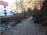 5
5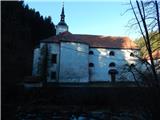 6
6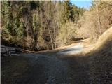 7
7 8
8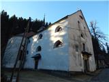 9
9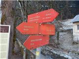 10
10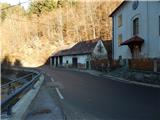 11
11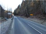 12
12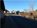 13
13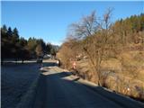 14
14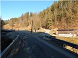 15
15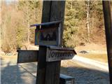 16
16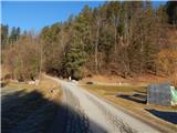 17
17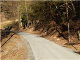 18
18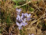 19
19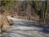 20
20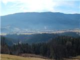 21
21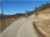 22
22 23
23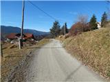 24
24 25
25 26
26 27
27 28
28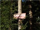 29
29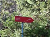 30
30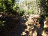 31
31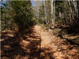 32
32 33
33 34
34 35
35 36
36 37
37 38
38 39
39 40
40 41
41 42
42 43
43
Discussion about the trail Puščava - Klančnik (Glančnik)