Pševo - Sveti Jošt above Kranj (Sodar way)
Starting point: Pševo (530 m)
| Lat/Lon: | 46,2396°N 14,319°E |
| |
Name of path: Sodar way
Time of walking: 45 min
Difficulty: easy marked way
Altitude difference: 315 m
Altitude difference po putu: 315 m
Map: Škofjeloško in Cerkljansko hribovje 1:50.000
Recommended equipment (summer):
Recommended equipment (winter):
Views: 80.732
 | 1 person likes this post |
Access to the starting point:
a) Take Medvode, then take the old road to Kranj, where you turn left at the first traffic light in the direction of Stražišče and Šmarjetna gora. From the roundabout, where the road to Šmarjetna gora turns off to the right, continue "straight on" (second exit). Continue along Škofjeloško, then from a slightly larger junction turn right towards Sv. Jošta above Kranj and Čepulje. When Kranj ends, first pass the starting point of the Friends of St. Josht trail, and then a little further on reach the starting point of the Sodarjeva trail, where you park in the parking lot on the left side of the road before the beginning of the settlement of Pševo.
b) From the motorway Jesenice - Ljubljana, take the exit Kranj West and then follow the old road towards Ljubljana. Towards the end of Kranj, at the last traffic light, turn right in the direction of Stražišče. From the roundabout where the road to Šmarjetna gora turns right, continue "straight on" (second exit). Continue along Škofjeloško road, then from a slightly larger junction turn right towards Sv. Jošta above Kranj and Čepulje. When Kranj ends, first pass the starting point of the Friends of St. Josht trail, and then a little further on reach the starting point of the Sodarjeva trail, where you park in the parking lot on the left side of the road before the beginning of the settlement of Pševo.
c) From the motorway Ljubljana - Jesenice take the exit Kranj east, then follow the signs for Škofja Loka. Leave the road towards Škofja Loka at the point where the signs for Stražišče and Šmarjetna gora direct you to the right. Continue along the Škofjeloško road, which you leave at a slightly larger junction and continue left in the direction of Sv. Jošto above Kranj and Čepulje (the road signs are only from the opposite direction). When Kranj ends, you first pass the starting point of the Friends of Sv. Jošto trail, and then a little further on you reach the starting point of the Sodar's trail, where you park in the parking lot on the left side of the road before the start of the settlement of Pševo.
d) Drive to Škofja Loka, then continue to Kranj. When Zgornje Bitnje ends, turn left in the direction of Stražišče and Šmarjetna gora. Continue along the Škofjeloško road, which you leave at a slightly larger junction and continue left in the direction of Sv. Jošto above Kranj and Čepulje (the road signs are only from the opposite direction). When Kranj ends, you first pass the starting point of the Friends of Sv. Jošto trail, and a little further on you reach the starting point of the Sodarjeva trail, where you park in the parking lot on the left side of the road before the start of the settlement of Pševo.
Path description:
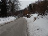
From the parking lot, first cross the road carefully, then turn onto Sodarjeva cesta (Sodarjeva cesta), which initially climbs parallel to the road, but after a small meadow turns slightly right and enters a dense forest. Before leaving the wods and entering a slightly larger meadow, the Friends of St. Jost trail joins from the right, and above the meadow the trail returns to the wods. In the forest the path splits, and we take the left, steeper path (straight ahead past the chapel, the valley path and Rakovica), which splits again after a few minutes' ascent.
We take the left path again, which is marked "stairs", and we start to climb cross-country, including a short section with a few steps.
Higher up, we reach the wide cart track, where most of the above-mentioned paths join, and we follow the wide path, which offers beautiful views just below the summit, all the way to the top, where the Dom na Joštu and the Church of St. Joštu are located.
Description and pictures refer to the situation in 2018 (February).

Pictures:
 1
1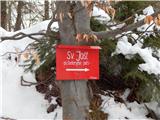 2
2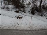 3
3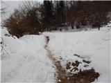 4
4 5
5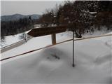 6
6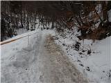 7
7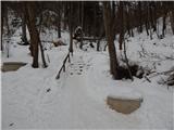 8
8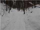 9
9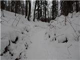 10
10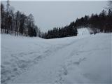 11
11 12
12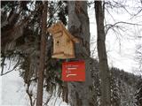 13
13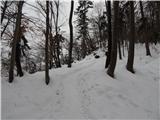 14
14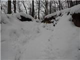 15
15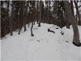 16
16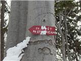 17
17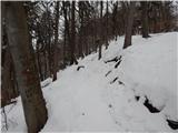 18
18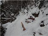 19
19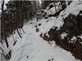 20
20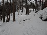 21
21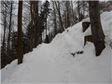 22
22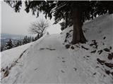 23
23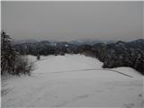 24
24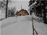 25
25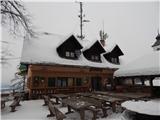 26
26 27
27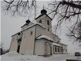 28
28 29
29
Discussion about the trail Pševo - Sveti Jošt above Kranj (Sodar way)
|
| Lucy8. 02. 2011 |
Ker je bil lep topel dan sem se odpravila na Sveti jošt.Pot je lahka in enostavna hkrati pa označena z markacijami tako, da ne moreš zgrešiti.Hrana je odlična, osebje prijazno postrežba pa hitra.Razgled iz Jošta je lep in čudovit.Pridem še kdaj ker je lepa izletniška točka.
|
|
|
|
| hills11. 08. 2011 |
Odločili smo se za lažje pohajkovanje  . Poti na Jošt je veliko, meni ljubša je ko pustimo avto cisto spodaj ( Tičarica ) in se odpravimo navzgor...po poti prijateljev, " na studenec", postanek pri domu, nazaj po sodarjevi  ... Skratka, se ponavljam ampak čudovito je tam gori!!! 
|
|
|
|
| sirt19. 11. 2011 |
Ta pot se pravilno imenuje "sodarjeva smrt".Ko je sodar hodil na Sv.Jošt,je na najbol strmem delu pod Erženovo skalo vedno pojamral:"Tle bo pa moja smrt!"Od tu ime.
Sedlo med Joštom in Šmarjetno,ob vznožju katerega parkirate,pa se imenuje Tičnica.
Pa brez zamere.
|
|
|
|
| janna10. 11. 2011 |
sirt1, super za tole info. Moj najljubši hribček za med tednom po službi.
|
|
|
|
| velkavrh12. 05. 2013 |
Popoldan se je pokazal sonček in sem ga izkoristil za prijeten kratek pohod na Sv. Jošt. Jošt ima vedno veliko obiska, pa naj bo malo dežka prej ali ne. Edino malo pazjivo se je treba po isti poti vračati, ker je malo blatno in drsi.
|
|
|
|
| KARAMELICA16. 11. 2014 |
Danes smo se odpravili na Sv. Jošt nad Kranjem. Šli smo peš iz Stražišča pa kar po asfaltu do vrha, ne vem zdelo se nam je, da bi bilo po gozdu preveč mokro. Že kmalu na začetku poti nas je prehitela množica tekačev (res face), ki so tekli na vrh. Zjutraj najpreje nismo vedeli ali bi šli ali ne, ker je deževalo, vendar nam ni bilo žal, saj se je potem "naredilo" po tolikih dneh dežja  , zares lepo vreme.
|
|
|
|
| Loni17. 11. 2014 |
Kranjska zimska tekaška liga se je začela, včeraj Jošt, nedeljo prej Kališče, to nedeljo Krvavec, sledita še Mohor in Brdo, ter še dva kroga ponovitev. Prijetna popestritev nedeljskih dopoldnevov.
|
|
|