Prigorec - Ivanščica (via Konj (Rajterjeva pot))
Starting point: Prigorec (396 m)
Name of path: via Konj (Rajterjeva pot)
Time of walking: 1 h 30 min
Difficulty: easy marked way
Altitude difference: 665 m
Altitude difference po putu: 665 m
Map:
Recommended equipment (summer):
Recommended equipment (winter): crampons
Views: 5.820
 | 1 person likes this post |
Access to the starting point:
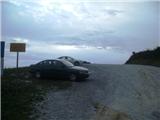
a) Enter Croatia at the Gruškovje / Macelj crossing. Leave the motorway at the first exit and go in the direction of Varaždin. Along the way there are Trakoščan, Bednja, Lepoglava and you arrive in Ivanec. In Ivanec, at the traffic light junction, turn right to the south (now the top of Ivanščice is right in front of us) and just keep going. The path begins to climb and leads to the village of Prigorec. We pass through the village and upwards, and at the highest house we will come to a large but often busy parking lot, where we leave our vehicle.
b) From Prekmurje via Border crossing Petišovci / Murska Stredoce we arrive in Croatia and continue driving through Čakovec and Varaždin, where we will turn in the direction of Ivanec. In Ivanec, at the traffic lights, turn left south and follow description a.
Path description:
From the large parking lot at the end of Prigorec, go back to the last crossroads in the village, where you will see the mountain signs. Go into the parallel street to the end of the asphalt and then left to the last and highest house in the village. You reach cart track, which is usually very muddy, but quickly leave it and start climbing quite steeply up the eastern slope (if you had continued straight ahead, the path would have led you to the unofficial "Po struji" and "Temna dol" trails).
The path now climbs steeply in many switchbacks up a steep slope that slides in the rain. Wooden steps help us on some of the bends. Higher up, we reach the small viewpoint of Mali Konj, where the path becomes more gentle and turns north.
After the lookout we will come to a short rocky section where the ground becomes more cobbly and the forest a little more low-lying. At the end of this section, the path will flatten out for a minute, and then we will be back in higher forest and the path will be steeper.
Now we are climbing up in many curves (there is also a shortcut, which is very steep and goes along the ridge itself) and we will see a 1/2 mark on one of the trees, which indicates that we are halfway up. The trail gets steeper and steeper, and then it lays down for a few minutes.
At the downhill part, you will come to a fork where you can choose either the lower path, which bypasses the top of Konj, or the upper path, which takes you over the beautiful Konj lookout point. The two paths soon merge at a short, gentle part and then soon become very steep.
There is a problem of logging on this part, which is usually very overgrown at this time of year. The usually muddy and rocky surface will also be a problem on the upper part of the path. When the forest becomes visibly mixed we are near the top. We will also come to the supply road, where the paths from Ivanec and Belco join.
Now go right past the ramp and after a minute you will reach the Pasarićev dom mountain hut, where you can have refreshments and spend the night.
From the hut to the summit is still a minute walk. At the top there is a lookout tower, from which you can enjoy an exceptional view, despite the relatively low altitude.

Pictures:
 1
1 2
2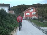 3
3 4
4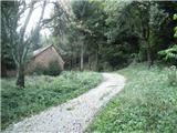 5
5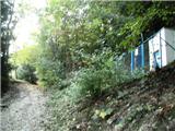 6
6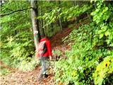 7
7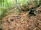 8
8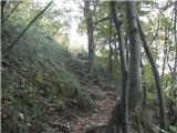 9
9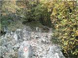 10
10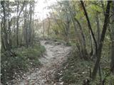 11
11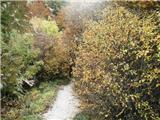 12
12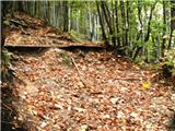 13
13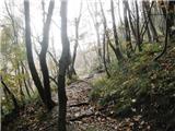 14
14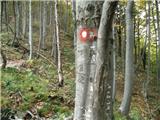 15
15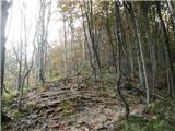 16
16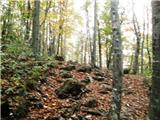 17
17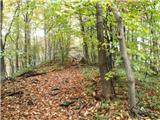 18
18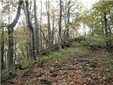 19
19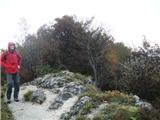 20
20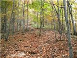 21
21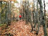 22
22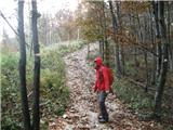 23
23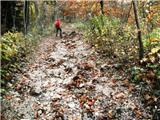 24
24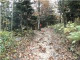 25
25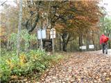 26
26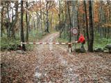 27
27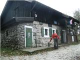 28
28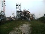 29
29
Discussion about the trail Prigorec - Ivanščica (via Konj (Rajterjeva pot))
|
| Marx2. 11. 2015 |
Uradni začetek te poti (Kot tudi vseh poti na severni strani Ivanščice) je na železniški postaji v Ivancu , ampak od tja do našeg ishodišča je več kot uro hoda in to vse po asfaltu in skoz Ivanec in Prigorec.
Rudolf Rajter je bil pesnik z Ivanca ki je za vzpon vedno izbiral tisto pot. Bil je velik zaljubljenik v Ivanščico. Najdulja ulica v Ivancu , in to ta ki gre iz centra navzgor v Prigorec se kliče po njem.
|
|
|
|
| milesdavis11. 03. 2023 09:58:00 |
V Opisu gore napaki: z vrha se ne vidi niti Triglav niti Dachstein.
|
|
|