Pri Mlinču - Mangartska koča (via Gladki rob)
Starting point: Pri Mlinču (1094 m)
| Lat/Lon: | 46,4234°N 13,5937°E |
| |
Name of path: via Gladki rob
Time of walking: 2 h 30 min
Difficulty: easy unmarked way
Altitude difference: 812 m
Altitude difference po putu: 845 m
Map: Julijske Alpe - zahodni del 1:50.000
Recommended equipment (summer):
Recommended equipment (winter): ice axe, crampons
Views: 2.510
 | 1 person likes this post |
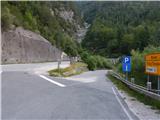
Access to the starting point:
a) Cross Border crossing Rateče into Itali, then turn left at Trbiž / Tarvisio in the direction of Predel / Cave del Predil. After a few 100 m, take another left in the same direction, then at the junction by Lake Rabelais / Lago del Predil, continue straight on the main road towards Slovenia (right Neveje Pass (Na Žlebeh) / Sella Nevea). There are some serpentines and a tunnel, then you reach Border crossing Predel, after which you take the exit to Slovenia again. Just after the crossroads, a side road branches off, where there is a marked parking area.
b) From Primorska, drive to Log pod Mangartom, and from there continue towards Itali. Before reaching Border crossing Predel, turn right after the Predel bridge (bridge over Mangart stream) in the direction of Mangart. Park just after the bridge in the marked parking lot on the side of the road.
Path description:
From the starting point, we continue along the asphalt road leading to Mangartsko sedlo, and we follow it up to the first right turn, or to the place where it crosses the Mangart stream. At this bend, before crossing the bridge, continue straight on the footpath towards Mangart mountain pasture. Continue along the path with a fine view of Mangart, following the path which climbs parallel to the stream, and a little higher up, crossing the Stože landslide, which was triggered in November 2000. As you leave the area of the landslide, you gradually enter the woods, through which you climb moderately to the western edge of Mangart mountain pasture.
Once on mountain pasture, walk to the nearby shepherd's hut, after which follow the slightly overgrown path leading through mountain pasture. After crossing mountain pasture, you reach a strip of woodland, and then quickly reach a narrower strip of meadow where an old abandoned road continues (you can also get here by continuing on the road at mountain pasture and then turning left at the first crossroads in the route Mangartsko sedlo. The minor road or cart track climbs steeply and then, after crossing a torrent, it finally turns into a mountain path. There is a moderate climb for a few minutes, then cross an asphalt road. On the other side of the road, climb up a flight of steps and then reach a clearing where the path turns left and starts to climb quite steeply. After a few minutes of climbing, you will reach the road again, and continue along it until you reach a nearby bend, where the path you are going to follow branches off from the road.
Here the waymarked trail continues along the road, and we continue along an unmarked path that turns into the forest. We continue to climb steeply along the path, which at first still passes through the forest, but then more and more beautiful views open up, reaching towards Rombon, Jerebica. . . Higher up, we return to the road, which, with the exception of a few shortcuts, continues to the part where the longer crossing to the right begins. After crossing the rather mighty gorge of the Nakel torrent, you will soon notice short steps on the left side of the road, which lead up to a nearby grassy slope, where the traceable, but still unmarked, path continues. The path soon turns left and ascends crosswise to the edge of a ravine where there is a metal pole with a pink and yellow ribbon. Here the path turns right again and then climbs cross-country over slightly steeper grassy slopes. The path, from which we have increasingly beautiful views and which runs along an old mulatier, leads us higher up to the ruins, which are situated slightly above the next gully. The old mulatier continues on a steeper slope, which leads us towards the ravine. Just before reaching the ravine, the unmarked path splits into two parts, and we continue straight to the ravine (the left path leads directly to Mangartsko sedlo), along which a small stream flows, and there is also a water catchment. On the other side of the ravine, we first climb steeply up a wide mulatier, which leads us over a steep slope, and then, after a break, the slope flattens out and becomes grassy. The mulatiera starts to descend moderately, then leads to a crossroads where you reach a marked trail leading towards Mangartski sedlo. Go right here (left Mangartsko sedlo), then turn left and descend to the nearby hut.
Description and figures refer to the situation in 2016 (July).

We can extend the trip to the following destinations: Mangart
Pictures:
 1
1 2
2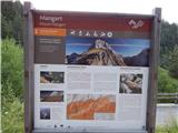 3
3 4
4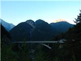 5
5 6
6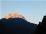 7
7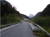 8
8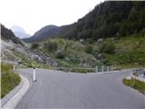 9
9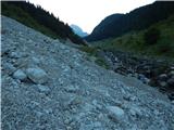 10
10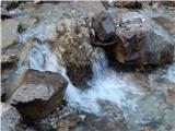 11
11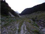 12
12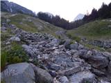 13
13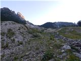 14
14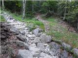 15
15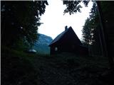 16
16 17
17 18
18 19
19 20
20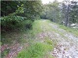 21
21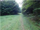 22
22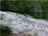 23
23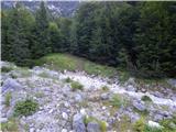 24
24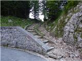 25
25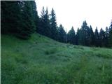 26
26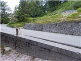 27
27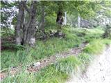 28
28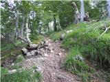 29
29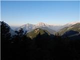 30
30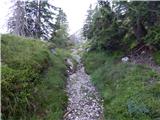 31
31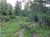 32
32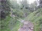 33
33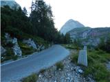 34
34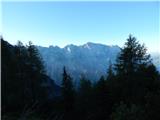 35
35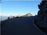 36
36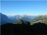 37
37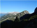 38
38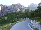 39
39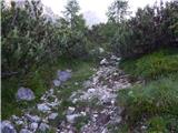 40
40 41
41 42
42 43
43 44
44 45
45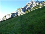 46
46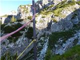 47
47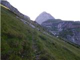 48
48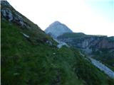 49
49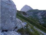 50
50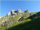 51
51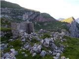 52
52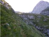 53
53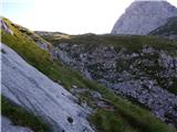 54
54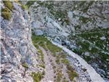 55
55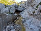 56
56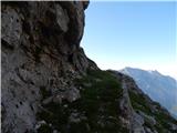 57
57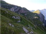 58
58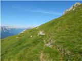 59
59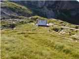 60
60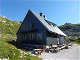 61
61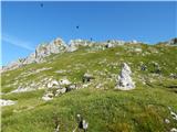 62
62
Discussion about the trail Pri Mlinču - Mangartska koča (via Gladki rob)