Starting point: Preserje (400 m)
| Lat/Lon: | 45,9613°N 14,4205°E |
| |
Time of walking: 20 min
Difficulty: easy marked way
Altitude difference: 84 m
Altitude difference po putu: 84 m
Map: Ljubljana-Okolica 1:50.000
Recommended equipment (summer):
Recommended equipment (winter):
Views: 20.026
 | 3 people like this post |
Access to the starting point:
From the Ljubljana - Koper motorway, take the Brezovica exit and then continue in the direction of Podpeči. In Podpeča, from where the roads from Črna vas and Ig join, turn right in the direction of Krimo, Rakitna and Borovnice. Follow the road towards Borovnica for a short distance, then the signs for Rakitna direct you left up a slightly narrower and mainly steep road, which you then follow to a small pass. Turn left at the pass and after 100 m park in the marked parking area.
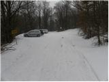
Path description:
From the parking lot, follow the wide and marked path towards Sveta Ana. The path climbs gently at first, then moderately, on the wide cart track. After about 15 minutes of easy walking, the forest ends and the path leads to a small pass where the paths from Podpeč and Jezero join. Continue left here and after 2 minutes of further walking you will reach the top of Sveta Ana, from where you will have a beautiful view of the Ljubljana Marshes and the surrounding hills.
Pictures:
 1
1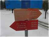 2
2 3
3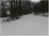 4
4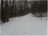 5
5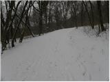 6
6 7
7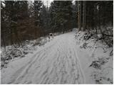 8
8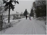 9
9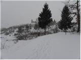 10
10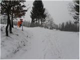 11
11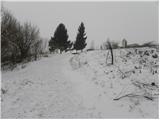 12
12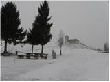 13
13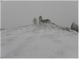 14
14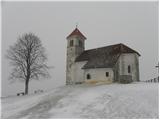 15
15
Discussion about the trail Preserje - Sveta Ana
|
| NUŠA27. 01. 2007 |
Čudovit sprehod za nabiranje energije.
 
|
|
|
|
| hike_mare21. 06. 2020 |
Včeraj opravili sprehod po tej poti. Dobronamerni nasvet za vse, ki še niste šli po tej poti in imate v planu to storiti, priporočam uporabo spreja proti komarjem
|
|
|