Starting point: Praprotno (390 m)
| Lat/Lon: | 46,1955°N 14,2647°E |
| |
Time of walking: 2 h 15 min
Difficulty: easy marked way
Altitude difference: 635 m
Altitude difference po putu: 650 m
Map: Škofjeloško in Cerkljansko hribovje 1:50.000
Recommended equipment (summer):
Recommended equipment (winter): crampons
Views: 18.414
 | 2 people like this post |
Access to the starting point:
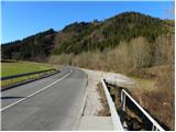
a) First drive to Škofja Loka, then continue driving to Železniki. When the road Škofja Loka - Železniki crosses the Selška Sora River over the bridge for the first time, pay attention, because just after the bridge you park on the right side of the road.
b) From Tolmin or Most na Soči, drive to Podbrdo, then continue to Železniki and Škofja Loka. Just about 100 m after Praprotno, just before crossing the Selška Sora River, you will see a large gravel parking lot on the left side of the road, where you park.
Path description:
From the starting point, walk along the main road for a few 10 m towards Železniki, and then the signs for Praprotno and Lubnik direct you to the left onto a narrower local road, which will quickly take you to the village of Praprotno. Through the village we follow the few signs, and the path, which is always on the road, leads us over the slopes, which are at first still open to the view, and from which we have a beautiful view of Lubnik and Planica. The asphalt road continues through the forest for a short distance and then climbs over a grassy hayfield, over which we can enjoy increasingly beautiful views. The way ahead takes you through the lower part of the village of Sveti Tomaž, where you turn left at a crossroads and then continue climbing along the increasingly scenic road. With views of Storžič, Kočni, Grintovec and other peaks in the Kamnik and Savinja Alps, we then walk to the upper part of the village, where we step onto a viewing ridge.
When you reach the ridge, continue left (right for 3 minutes, St. Tomaž Church) and, overlooking a large part of the Škofjeloško hribovje, walk to the edge of the forest, where there is a marked crossroads.
Continue straight on in the route Lubnik (right Gabrška Gora, Poljane. . . ) and ascend cart track, from which a marked footpath soon branches off to the left. Higher up, the footpath returns to cart track and then leaves it again for a while. Higher up, after regaining the cart track, you join a dirt road which leads to the Zalubnikar homestead.
Above the homestead, the road climbs steeply and leads to a preval, where there is also a marked crossroads. Continue left in the direction of Lubnik, following the path which quickly leads us to the macadam road, after which we continue the folded climb in the direction already familiar to us. The dirt road then goes into the forest, where it crosses the slopes to the right. Slightly higher up, a marked path with Breznica pod Lubnikom joins us from the right, and we continue slightly to the left along a deteriorating, partly rutted road. We continue our ascent on the increasingly worse and gradually steeper cart track, but we also leave this one and continue our ascent on the marked mountain path (due to the numerous cart tracks, orientation is a little more difficult in some places). Higher up, a few more mountain paths join us from the right, and we follow the steeper path in a few places all the way up to the summit of Lubnik, the summit of which opens up a beautiful view.

Pictures:
 1
1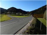 2
2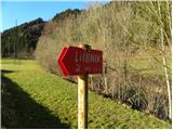 3
3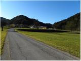 4
4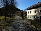 5
5 6
6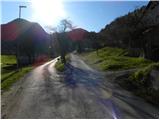 7
7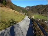 8
8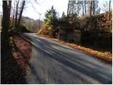 9
9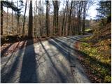 10
10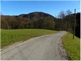 11
11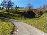 12
12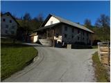 13
13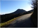 14
14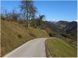 15
15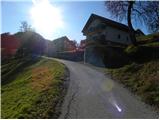 16
16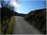 17
17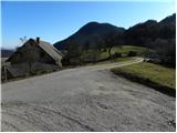 18
18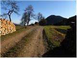 19
19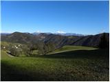 20
20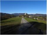 21
21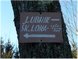 22
22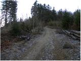 23
23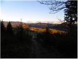 24
24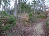 25
25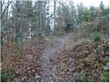 26
26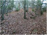 27
27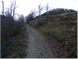 28
28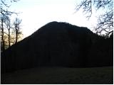 29
29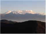 30
30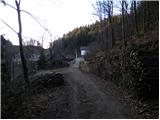 31
31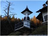 32
32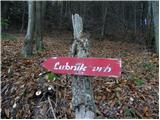 33
33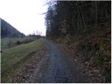 34
34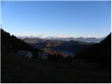 35
35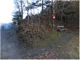 36
36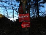 37
37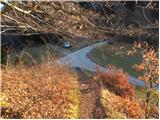 38
38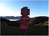 39
39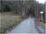 40
40 41
41 42
42 43
43 44
44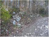 45
45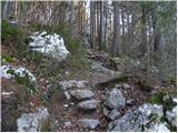 46
46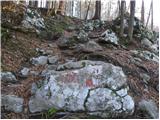 47
47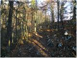 48
48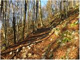 49
49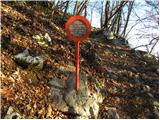 50
50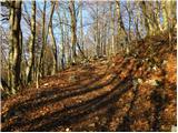 51
51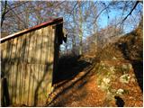 52
52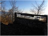 53
53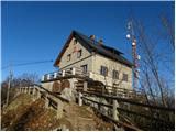 54
54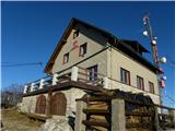 55
55 56
56
Discussion about the trail Praprotno - Lubnik
|
| GregorC9. 12. 2011 |
Lepa pot na Lubnik, ki jo prehodim velikokrat. Samo štartam na Sv. Tomažu (pred gozdom, kjer je označeno razpotje), da se izgnem hoji po asfaltni cesti, ki jo je kar precej.
|
|
|
|
| bats9. 12. 2011 |
po slikah sodeč res lepo, sicer sem jo en del prehodil ponoči na pohodu Pasja ravan-Dražgoše, kot je videti je pa tudi zanimiva za kombinacijo s kolesom do sedla.Bolj ulaufana mi je sicer kolo do Naceta iz Šk.Loke in potem še skok na vrh.
Nazaj pa itak "bonaca".
|
|
|
|
| GregorC9. 12. 2011 |
bats z kolesom se da tudi naprej od sedla. Lahko ga neseš čez prvo strmino do kolovoza (max 5-10 min oz. par sto metrov), od koder je vožnja do Naceta izjemno lepa in popolnoma nezahtevna. Lahko pa greš na sedlu desno in kasneje zaviješ na slabše viden kolovoz in je pot (skoraj) ves čas vozna. Sam ponavadi kolo kar prenesem. Je pa res zanimiva pot tod z kolesom v katerikoli smeri. Tako spust  (tu sem doživel do sedaj svoj najhujši padec s kolesom  ) kot vzpon .
|
|
|
|
| bats9. 12. 2011 |
@GregorC TNX za info, res še nisem vozil tam naprej čez sedlo, bom enkrat res poskusil narediti krog, je pa fina turca brcanja pedal tudi naprej na Stari vrh in do Blegoša po vojaški poti. Jah jah spusti kolikor so fini so tudi nevarni , sploh od Naceta dol je kar prometna cesta.No tole vse bo za drugo leto, bo treba kolo za smučke zamenjat, samo še sneg.
|
|
|
|
| GregorC10. 12. 2011 |
Krog Železniki - Praprotno - Sv. Tomaž - Nace - Stari vrh (Zapreval) - Rovte, od tu pa ali proti Blegošu ali preko Golico nazaj v dolino naredim sigurno vsaj enkrat na leto. In je super krog pa še nabrcaš se kar precej. Priporočam. LP
|
|
|
|
| GregorC11. 12. 2011 |
MajaO tole je pa zelo zanimiva in dobrodošla informacija  Bom šel preverit. Letos verjetno najprej peš, drugo leto pa z kolesom. LP
|
|
|
|
| Strucko25. 12. 2011 |
Zanima me je možno do Sv. Tomaža nad Praprotnim pripeljati z avtom, oz. če je tam parkirišče. Koliko časa še potem hodiš do vrha.
|
|
|
|
| GregorC25. 12. 2011 |
Strucko seveda se da! Iz vasi se pelješ še nekaj sto metrov do sedla, kjer avto pustiš ob poti (kako je ob večjih količinah snega ne vem). Od tu do vrha je približno 1 do 1.5 ure hoje.
|
|
|
|
| krempač21. 02. 2018 |
Lep dober dan vsem !
Prosim za informacijo, ali je cesta do Praprotna prevozna za avtobus in pot od tega izhodišča na Lubnik prehodna ? V soboto vodim en avtobus pohodnikov.
Hvala za odgovor, lep pozdrav in srečno !
|
|
|
|
| Guest21. 02. 2018 |
Krempač Pozdravljen, cesta do Praprotnega je normalno prevozna, seveda tudi za avtobuse. Pot iz Praprotnega do Lubnika je dnevno uhojena in tudi prehodna. Priporočljive so derezice, saj je pot rahlo pomrznjena. (info. so pridobljene v sami koči) Kaj bo pa vreme prineslo v prihodnjih dneh, je pa spet drugo vprašanje. Prilagam vam tel. številko doma na Lubniku in svetujem, da v petek dan pred vodeno turo pokličete v kočo in tako dobite sveže informacije. Tel. št. koče na Lubniku 031/655-556, elektronska pošta: lubnik@pd-skofjaloka.com. Varno pot in lep pozdrav.
|
|
|