Ponikva/Hotunje - Babček (via Sveta Uršula)
Starting point: Ponikva/Hotunje (275 m)
| Lat/Lon: | 46,2497°N 15,4306°E |
| |
Name of path: via Sveta Uršula
Time of walking: 2 h 45 min
Difficulty: easy marked way
Altitude difference: 300 m
Altitude difference po putu: 540 m
Map: Posavsko hribovje Boč - Bohor 1:50.000
Recommended equipment (summer):
Recommended equipment (winter):
Views: 2.164
 | 3 people like this post |
Access to the starting point:
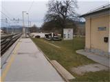
a) By train. . . Ponikva railway station.
b) By car. . . Leave the motorway at exit Dramlje and continue towards Šentjur. After three kilometres at the Dole roundabout, continue in the direction of Ponikva and after a total of about seven kilometres reach the railway line. You can park safely in front of the level crossing. The railway station is on the other side of the line and a little further to the right.
Path description:
Follow the asphalt road along the stream towards the settlement of Zagaja pri Ponikvi. After one and a half kilometres, the asphalt surface turns to macadam and you follow it through the forest. Soon you will reach a small settlement of houses and, if well marked, continue through the yard of one of the homesteads onto a meadow path. The grass path becomes a forest path and then leads along several ponds and through the forest to a chapel. From the chapel, continue through Razbor, to the left, and shortly under the road viaduct, where you cross a small watercourse, cross over to the other side of the motorway. Continue across the meadow, through the farmyard of the homestead and by the wooden horse corral reach the more concrete Vodulee. From the flat part of Vodul, there is a climb along an asphalt road and then along narrower paths surrounded by vineyards/walled houses. Higher up, you reach a crossroads and after a good hundred metres go right and soon you will see the Church of St Ursula and the home of the Dramlje mountaineers in the former forestry.
After the visit, continue along the forest mountain path downhill from Sv. Uršule or the mountain hut in a northerly direction and you will soon reach a crossroads. Cross the Dramlje - Pletovarje road and, passing an interesting painting of the Anton Martin Slomšek chapel, continue straight ahead on the asphalt through the Grušce settlement, higher into the world. Past scattered farmhouses, cottages, etc. , you soon reach a forest path, which you follow slightly to the left to the Babček crossroads. This is a pleasant part of the way through the forest, and the whole path that follows us from Ponikva to the Babček crossroads is also the Slomšek pilgrimage path. From the crossroads, continue right higher up the hill on the tarmac track through the woods, passing a barn (right by the path) and a farmhouse (left by the path) to reach the top of Babček.
The total length of the trail from Ponikva/Hotunj to the summit of Babček is 7700 metres, 540 positive vertical metres and 230 negative vertical metres.

Pictures:
 1
1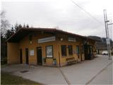 2
2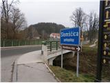 3
3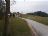 4
4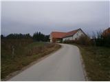 5
5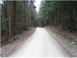 6
6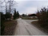 7
7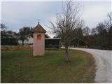 8
8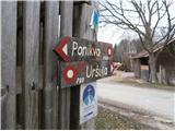 9
9 10
10 11
11 12
12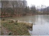 13
13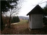 14
14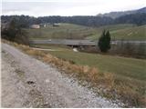 15
15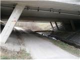 16
16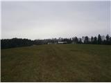 17
17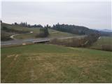 18
18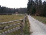 19
19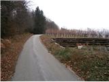 20
20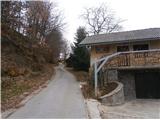 21
21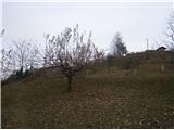 22
22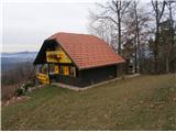 23
23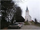 24
24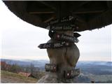 25
25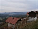 26
26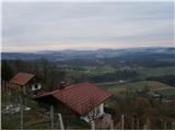 27
27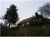 28
28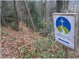 29
29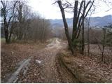 30
30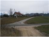 31
31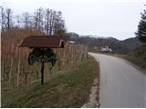 32
32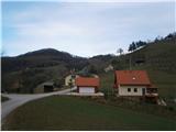 33
33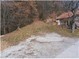 34
34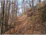 35
35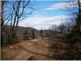 36
36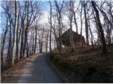 37
37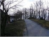 38
38 39
39
Discussion about the trail Ponikva/Hotunje - Babček (via Sveta Uršula)
|
| bruny17. 08. 2014 |
Danes v nedeljo,17.08.2014 kratek odsek v daljši aktivnosti z gorskim kolesom tudi po opisani poti med slikami 36 in 39. Najvišji vrh med Bočem in Konjiško goro, danes iz Špitaliča ob potoku Žičnica... Morda, kaj več v razmerah!?!. Lp
|
|
|