Podpeca (Helenski potok) - Mala Peca (via Mirjanca)
Starting point: Podpeca (Helenski potok) (625 m)
| Lat/Lon: | 46,4701°N 14,8212°E |
| |
Name of path: via Mirjanca
Time of walking: 3 h 20 min
Difficulty: easy marked way
Altitude difference: 1106 m
Altitude difference po putu: 1106 m
Map: Koroška 1:50.000
Recommended equipment (summer):
Recommended equipment (winter): ice axe, crampons
Views: 466
 | 1 person likes this post |
Access to the starting point:
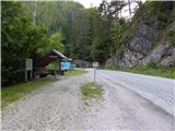
a) Take the Črna na Koroškem exit from the roundabout in the centre of the town towards Koprivna. At the next crossroads, take a slight right to cross the Meža River over a bridge and then continue along the Meža River. Črna na Koroškem then ends, and we drive to the 5. 5 km road marker, where we park in a convenient roadside parking spot before crossing the Heleni brook.
b) Drive into Solčava, then follow the signs for Črna na Koroškem. Then ascend to the Spodnje Sleme pass, and from there descend to Koprivna. At a lower level, follow the Meži River and continue in the direction of Črna na Koroškem. When the road to Podpeca turns off to the left, we continue straight ahead and then park in the roadside parking lot after crossing the Helen's Brook. At the starting point, the road is marked 5. 5 km.
Path description:
From the starting point, walk to the nearby crossroads and continue in the direction of Podpeca, Pece and Pikovy. The asphalt path initially leads along the Helen's Brook, and after about 15 minutes you will reach the mining dwarf - Perkmandeljec.
From the goblin, walk along the road along the Helen's brook only as far as the nearby crossroads, then take a sharp left onto the road in the direction of the Rajzer, Žačen, Štopar and Mihev homesteads (the normal route to Peca, Pikovo, Terčovo, Najbrževo and Okrepčevalnica pri Matjažu). The way ahead leads us along a forest road, along which we see some old, completely worn-out markings. Higher up, the road forks and we continue along the left-hand road in the direction of Pec and the homesteads of Mihev and Žačen (Rajzer, Sajler Vesničar and Lesjak on the right).
Below the Mihev homestead, the forest thins out and we reach the next crossroads. Continue straight on in the direction of Dom na Peci (left Bricman and Žačen, right Mihev) and continue for a few minutes across the meadows. The path soon returns to the forest, and the signs direct us off the road to the left onto a wide cart track, and from there we soon turn right onto a poorly beaten track. The way ahead takes us mostly through the forest, and we follow the not very frequent markings at crossroads. Walking through the dense forest, where there are several fallen trees across the path, is followed by crossing a wider macadam road leading to the Jakobe starting point.
Continue along the grassy cart track, which turns left at a higher altitude and along which it is difficult to see any signposts. When the cart track splits after a few minutes, take the right path, and after a while you will see a marking along the way again. After a few minutes of ascent on the less well-trodden path, you reach Tomaževa bajte (the sign on the hut reads "Ninotova koča"), where you join the better-trodden path from Mitnek.
Before the cottage, go left and climb up to a less good road, where the path from Mežica joins from the right.
Cross the road and continue in the direction of Dom na Peci, which is about 50 minutes' climb away. The way ahead leads us along the wide cart track, which, with the exception of a few serpentines, climbs transversely to the left. During the ascent, we have a few good views in the direction of Uršlja gora, but otherwise the route is mostly through the forest. Higher up, the path lays down, passes the chapel of St Cyril and Methodius on the right, and then climbs in some 10 steps to Dom na Peci. From Dom na Peci continue in the direction of Mala Peca and the Tople valley. The path climbs crosswise to the left and after 5 minutes leads us to a marked crossroads from which we go right towards Mala Peca (left the cave of King Matjaž, straight the Tople valley). There is a shorter climb and the path leads us to the vast peak of Mala Peć.
Starting point - Tomaževa koča 2:20, Tomaževa koča - Dom na Peci 0:50, Dom na Peci - Mala Peca 0:10.
Description and pictures refer to the situation in 2018 (July).

Pictures:
 1
1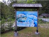 2
2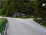 3
3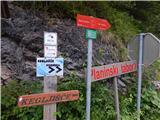 4
4 5
5 6
6 7
7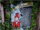 8
8 9
9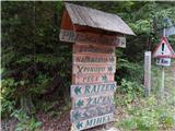 10
10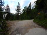 11
11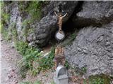 12
12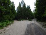 13
13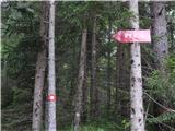 14
14 15
15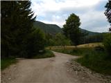 16
16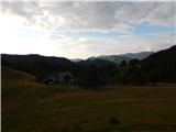 17
17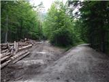 18
18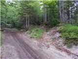 19
19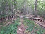 20
20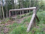 21
21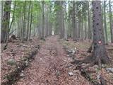 22
22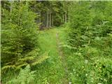 23
23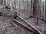 24
24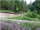 25
25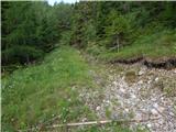 26
26 27
27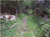 28
28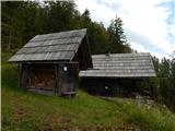 29
29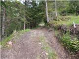 30
30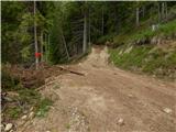 31
31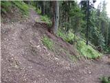 32
32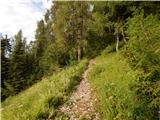 33
33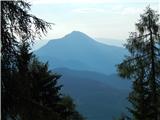 34
34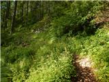 35
35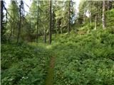 36
36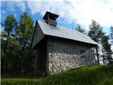 37
37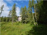 38
38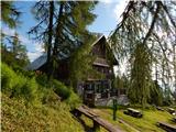 39
39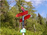 40
40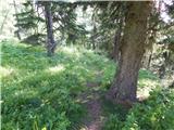 41
41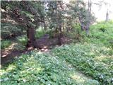 42
42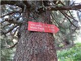 43
43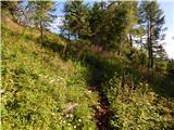 44
44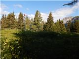 45
45 46
46
Discussion about the trail Podpeca (Helenski potok) - Mala Peca (via Mirjanca)