Podkraj - Sveti Duh (Hrušica)
Starting point: Podkraj (798 m)
| Lat/Lon: | 45,8639°N 14,063°E |
| |
Time of walking: 1 h 15 min
Difficulty: easy marked way
Altitude difference: 423 m
Altitude difference po putu: 423 m
Map: Nanos 1:50.000
Recommended equipment (summer):
Recommended equipment (winter):
Views: 7.877
 | 1 person likes this post |
Access to the starting point:
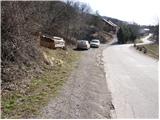
From Logatec, drive towards Idrija. Just after the village Kalce you will see a road heading left towards the villages Podkraj and Col. Take this rather winding road and follow it to the village Podkraj. Park in the small parking lot on the roadside near the signpost for the end of the village Podkraj (there are also mountain direction signs by the parking lot).
From Primorska, take the first road to Col, then continue driving towards Podkraj village. When the road leads to the beginning of the village, do not continue right into the village, but continue along the upper left road, which bypasses the village centre. Near the sign for the start of Podkraj, park in a small parking area by the road.
Path description:
From the starting point, take the ascending cart track in the route Sveti Duh and Javornika. "After a few steps, Cart track turns right and then climbs transversely across a grassy slope. Higher up, the path enters a short lane of wodland, after which it leads to a marked crossroads.
Continue left (Javornik on the right) along the gently sloping path which crosses the slopes towards Križna gora, which is clearly visible ahead. The well-marked path continues along cart track, from which a fairly steep path soon branches off to the right for a short distance. Higher up, the path enters the forest, where it climbs steeply north-westwards. Once out of the wods, the path turns slightly to the right and, with the help of a (easy) cableway, leads to the next crossroads.
Continue straight up in the route Sveti Duh (not left in the direction of Križna gora) along the path, which climbs steeply for a short time and then leads into the forest, where it is laid. After a few minutes of further walking, the path leads us to a marked crossroads, where we continue to the sharp right (left Križna gora) along the cart track, which leads us in a cross-climb and a moderate slope after 10 minutes of further walking to the Church of the Holy Spirit.

Pictures:
 1
1 2
2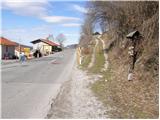 3
3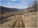 4
4 5
5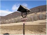 6
6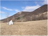 7
7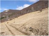 8
8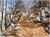 9
9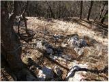 10
10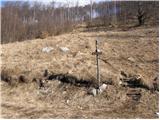 11
11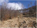 12
12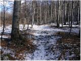 13
13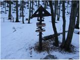 14
14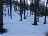 15
15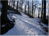 16
16 17
17 18
18
Discussion about the trail Podkraj - Sveti Duh (Hrušica)
|
| grega_p2. 05. 2010 |
Če vas izmuči strmina in toplo pomladansko sonce, si lahko v hladu vršnega gozda privoščite skrite želje ob potrkavanju na cerkveni zvon.
Časovnica je malo pretirana, za pot sem ob lahki hoji porabil 55min.
Srečno pohodniki!
|
|
|