Podgorje - Slavnik (gentle path)
Starting point: Podgorje (518 m)
| Lat/Lon: | 45,5353°N 13,9435°E |
| |
Name of path: gentle path
Time of walking: 1 h 40 min
Difficulty: easy marked way
Altitude difference: 510 m
Altitude difference po putu: 510 m
Map: Slovenska Istra - Čičarija, Brkini in Kras 1:50.000
Recommended equipment (summer):
Recommended equipment (winter):
Views: 180.053
 | 2 people like this post |
Access to the starting point:
a) From the motorway Ljubljana - Koper take the exit Kozina, then follow the old road towards Koper to the settlement Petrinje (a small settlement on the right side of the main road), where you turn left in the route Podgorje. The road, which climbs steeply at first, soon leads to the next junction, where you continue left, again in the route Podgorje. Continue to the village of Podgorje, where you park in a large parking lot near the sports ground.
b) From the motorway Koper - Ljubljana, take the exit Kastelec and then turn right towards Ljubljana, Kozina and Podgorje. There are two more junctions, both going left or straight ahead in the direction of Podgorje (at the first junction, follow the signs for Kozina). Follow this road until you reach a large parking lot near the sports ground, located in the village of Podgorje.
Path description:
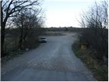
From the parking lot, return to the main road and follow it in the direction of travel. After a few dozen metres, you will reach a crossroads where wooden mountain signs direct you to the left, past a chapel, up the hill. Follow the asphalted road to the next crossroads, where a few benches have been placed. Here we continue straight ahead but only a few metres to a place where a sign for an easy path directs us to the left. The road then leads past the last houses in the village and changes from asphalt to gravel, which is closed to traffic. The road, which climbs steeply, mostly passes through the forest, so that there are no good views during the first hour of walking. A slightly higher marked path leaves the road for a short distance but rejoins it after the first bend. The trail then leads to a signpost along the way, which informs us that we have entered the area of the Slavnik Natural Monument. After a few more steps, you emerge from the forest onto the folded, uncultivated slopes of Slavnik. Here we can already see the transmitters in front of us, which we slowly start to approach. Follow the road for a few minutes and then leave it at the point where the marked path climbs over the meadow towards the cottage. From the hut to the top of Slavnik is only a few steps.

Pictures:
 1
1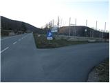 2
2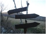 3
3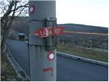 4
4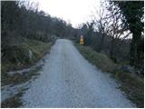 5
5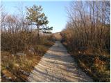 6
6 7
7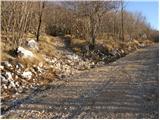 8
8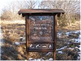 9
9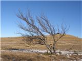 10
10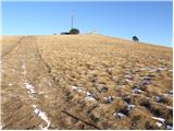 11
11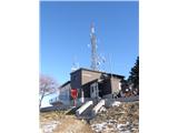 12
12 13
13
Discussion about the trail Podgorje - Slavnik (gentle path)
|
| teabag25. 03. 2009 |
Jaz sem danes videla njegov vrh pobeljen..
|
|
|
|
| Tadej25. 03. 2009 |
V nedeljo je bilo kopno, lahko pa, da je včeraj ali danes padlo nekaj malega snega.
|
|
|
|
| Enka26. 03. 2009 |
Najlepša hvala, bomo za vsak slučaj odložili za kak teden  .
|
|
|
|
| Balky7923. 09. 2011 |
E i tu smo bili treci slovenski vrh osvojen! I Feel SLovenia ) (Nanos, Slavnik, Sneznik...) dajte, kam dalje ?
|
|
|
|
| ales5023. 09. 2011 |
je kej zgodovinskega za videt na tem hribu
|
|
|
|
| tristic24. 09. 2011 |
Pozdravljen ales50,
na tem hribu ni nič zgodovinskega za videt.. so samo lepi razgledi, različno lepe poti in dobra postrežba na vrhu.
Da bo pa obisk bolj zanimiv, predlagam obisk Slavnika v nedeljo, 2. oktobra, ko lokalno PD organizira že 33. spominski pohod na.
Lep dan in srečno!
|
|
|
|
| Balky7927. 09. 2011 |
Ima pogled na sve strane
|
|
|
|
| thalea27. 02. 2013 |
Kako pa je kaj sedaj na Slavniku? A je kaj snega? A koča je odprta?
|
|
|
|
| tristic28. 02. 2013 |
@ thalea
Na Slavniku je zimska idila! Vse je pod snegom, vse poti so shojene. Zasnežene so tudi okoliške vasi, ceste so suhe. Koča pa je odprta vse praznike, sobote in nedelje.. torej, tudi ta vikend je odprta.
Razgledi se odpirajo na vse strani, ker imamo že ves teden sonce in spomladanske temperature.
|
|
|
|
| bojann28. 02. 2013 |
Živjo, mene zanima če je pot iz Prešnice kaj poledenela? V soboto bom šel gor.
Hvala in lep pozdrav!
|
|
|
|
| jax28. 02. 2013 |
Čisto možno, da je. So pa to itak poti, kjer tudi če so poledenele, zadostuje samo določena doza previdnosti, brez posebne opreme.
|
|
|
|
| smatjaz16. 04. 2013 |
Pri četrti fotografiji: na kandelabru ni več usmerjevalne table lažja pot, le še markacija in črta.
|
|
|
|
| Petra8811. 05. 2013 |
Oi, eno vprašanje imam. Ali so že narcise na Slavniku? Hvala
|
|
|