Podbrdo - Dom na Poreznu (via top of Porezen)
Starting point: Podbrdo (515 m)
| Lat/Lon: | 46,2132°N 13,9717°E |
| |
Name of path: via top of Porezen
Time of walking: 3 h 35 min
Difficulty: easy marked way
Altitude difference: 1075 m
Altitude difference po putu: 1150 m
Map: Škofjeloško in Cerkljansko hribovje 1:50.000
Recommended equipment (summer):
Recommended equipment (winter): ice axe, crampons
Views: 959
 | 1 person likes this post |
Access to the starting point:
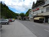
a) First drive to Škofja Loka, then continue to Železniki, Podbrdo and Tolmin. When you arrive in Podbrdo, park in a suitable place in the centre of the town.
b) From the road Idrija - Most na Soči, turn right at Bača pri Modreju, or left if you are coming from the route of Posočje, and drive towards Podbrdo. When you arrive in Podbrdo, park in a suitable place in the centre of the town.
Path description:
From the starting point, continue along the asphalt road towards Tolmin. The path, which runs along a road with no pavement at first, first leads us past the "women's water", a small spring by the roadside. Then you pass under the railway underpass, which comes out of the tunnel under Kobla. After the underpass, the road branches off to the left towards the scattered settlement Porezen (there is a railway station nearby (also a bus station)), and we continue along the main road (we can also continue in the direction of this settlement and join the marked trail a little higher up).
At the crossroads there is also a NOB memorial, and after it the road to Bača pri Podbrdu branches off to the right, and a few steps further on to Trtnik. After the turn-off for Trtnik, a pavement appears along the road, and you continue along it. Walk along the pavement for a few minutes, then turn left at the ecological island and cross the bridge over the river Bača. On the other side of the bridge, continue along the torrential stream, and then cart track turns right before the railway line. A little further on, pass through the underpass to the other side of the railway, where you will see the first mountain direction sign for Porezen. After the signpost, quickly leave the slightly wider cart track and continue left on the narrower cart track (the branch is not marked), along which you are then accompanied by initially sparse markings. In the vicinity of the hunting observation post, which is seen to the left of the path, the path splits again, and we continue on the left one, which continues straight ahead, as the second one turns right just at the crossroads. The path continues into the forest and leads us past a small boulder, which tells us that we are on the right path. From the boulder with the marker, climb through the forest for a short distance before reaching a dirt road, which you follow to the right (at this point you join the road from the railway station in Podbrdo).
Follow the road in a few serpentine ascents below the peak of Štovla, where a short road branches off to the right to a protected water facility, and a few steps further on to a saddle between the peak of Špičnok (1287 m) on the left and the aforementioned Štovla (749 m) on the right.
Behind the saddle we see an information board that we are entering the village Porezen, and we start descending down the road. During the descent, the road leads us past a natural climbing area with overhanging walls and across the Špičnikova grapa stream. After the stream, the road gradually lays down, and then, passing the Štefan homestead, leads us to a small crossroads by the next, this time larger stream. Continue along the right road (on the left the homesteads Matrek and Hejbl) in the direction of Porezno, which ascends crosswise to the next crossroads, where you continue sharp left (straight ahead the homesteads Andrejc, Gašper, Nejc, Torkar, Mlakar. . . ) in the direction of the hut on Porezno. Continue walking along the road, along which the forest is becoming more sparse, or replaced by hayfields higher up, from which we have a beautiful view of the Lower Bohinj Mountains, the mountains above Soriška planina, and in one part also a beautiful view of Porezen.
Leave the road at Porezen 6 and continue left across the meadow towards Porezno. Above the meadow, from which a really nice view of the Lower Bohinj Mountains opens up, the path enters the forest and starts to climb steeply along cart track. Cart track has a couple of forks higher up, where you continue straight on or stick to an undistinguished ridge. When the cart track turns left off the ridge a little higher up, leave the ridge and continue straight up on the marked footpath (the place where you leave cart track is not marked). The footpath soon lays down and leads to a small steel cable, after which it crosses a short steep slope. After crossing, the path returns to an undistinguished ridge and climbs moderately. A small gully is crossed, and the path then begins to climb cross-climbing to the left. After a few minutes' climb, when you reach the western ridge of Porezno, the path from Hudajužna joins from the right.
Continue slightly to the left and after a few steps leave the forest on the top slope of Porezno, where you will reach the next marked crossroads. Here, where the path from Otavnik or Jesenica joins, the path continues to the left, bypassing the top of Porezno and leading directly to Dom na Poreznu, while we continue straight ahead and continue ascending slightly to the left of the ridge. The ridge, which is still quite steep at first, soon becomes quite steep, and the path retreats slightly to the left on the steepest part. A few minutes of steep climbing follow, along a path from which we have beautiful views of the peaks above Baška grapa, the Cerkljansko hills and the Trnovo Forest in the distance, and of course the view towards Triglav, which rises above the Lower Bohinj Mountains. Just below the summit, the path flattens out, but the slope, especially the one on the right, remains very steep. When we take a few 10 steps further on the summit we are rewarded with a beautiful view on all sides. From the top, continue slightly left along the path, which after a few steps from the ridge changes to the left side. Here the path begins to descend moderately and leads us in a few minutes to the mountain home.
Description and pictures refer to the situation in 2015 (May).

Pictures:
 1
1 2
2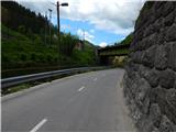 3
3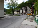 4
4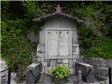 5
5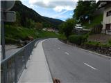 6
6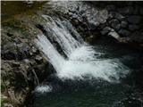 7
7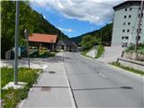 8
8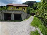 9
9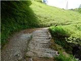 10
10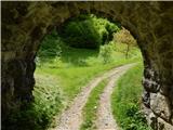 11
11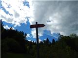 12
12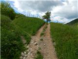 13
13 14
14 15
15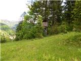 16
16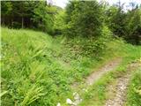 17
17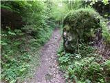 18
18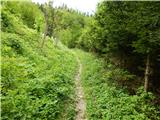 19
19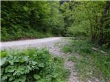 20
20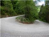 21
21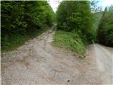 22
22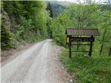 23
23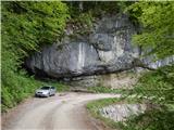 24
24 25
25 26
26 27
27 28
28 29
29 30
30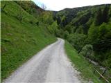 31
31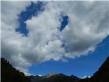 32
32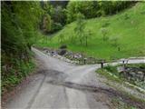 33
33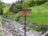 34
34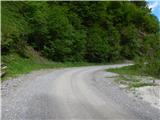 35
35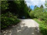 36
36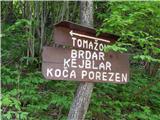 37
37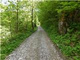 38
38 39
39 40
40 41
41 42
42 43
43 44
44 45
45 46
46 47
47 48
48 49
49 50
50 51
51 52
52 53
53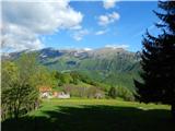 54
54 55
55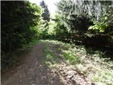 56
56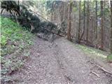 57
57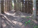 58
58 59
59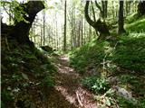 60
60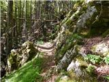 61
61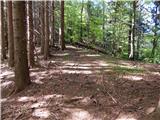 62
62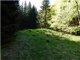 63
63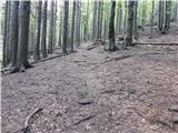 64
64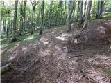 65
65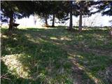 66
66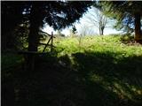 67
67 68
68 69
69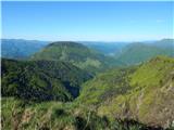 70
70 71
71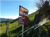 72
72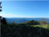 73
73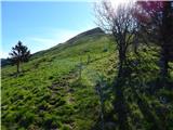 74
74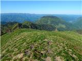 75
75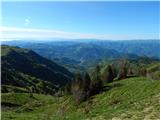 76
76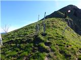 77
77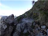 78
78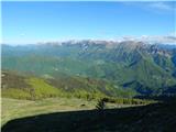 79
79 80
80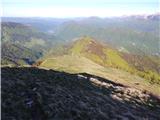 81
81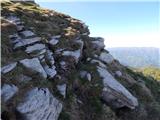 82
82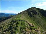 83
83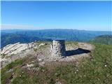 84
84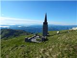 85
85 86
86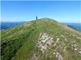 87
87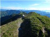 88
88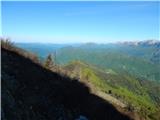 89
89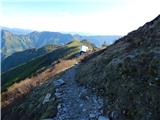 90
90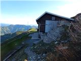 91
91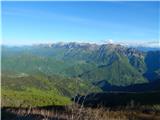 92
92
Discussion about the trail Podbrdo - Dom na Poreznu (via top of Porezen)