Pod Zjabci - Planina Za skalo
Starting point: Pod Zjabci (745 m)
| Lat/Lon: | 46,3261°N 13,6982°E |
| |
Time of walking: 2 h 15 min
Difficulty: easy marked way
Altitude difference: 765 m
Altitude difference po putu: 765 m
Map: TNP 1 : 50.000
Recommended equipment (summer):
Recommended equipment (winter): ice axe, crampons
Views: 15.196
 | 2 people like this post |
Access to the starting point:
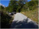
a) First drive to Kranjska Gora, then continue over the Vršič Pass towards Bovec. Shortly after the Berebica Gallery, you will arrive in the village Soča, where you will turn left over the bridge over the Soča River (towards the Jelinčič Tourist Farm and the Korita bivouac). After the bridge, do not turn left towards the bivouac, but continue driving straight ahead on the ascending asphalt road. Continue climbing through vast meadows, in the middle of which stand a few individual huts, and then the road turns into a forest. Higher up, the road turns quite left and leads us to Pod Zjabcev, where we see mountain direction signs for mountain pasture Za skalo, Dom na Komni and Triglav lakes. Park at a suitable place along the road.
b) From the coastal side, first drive to Bovec, then continue driving towards Trenta. Towards the end of the village Soča, turn right in the direction of the Jelinčič tourist farm and the Korita bivouac. After the bridge, do not turn left towards the bivouac, but continue straight on the ascending asphalt road. Continue climbing through vast meadows, in the middle of which stand a few individual huts, and then the road turns into a forest. Higher up, the road turns quite left and leads us to Pod Zjabcev, where we see mountain direction signs for mountain pasture Za skalo, Dom na Komni and Triglav lakes. Park at a suitable place along the road.
Path description:
From Pod Zjabcev, follow the marked trail, which passes the nearby cottage on the right. After the cottages, the path goes into the wods and quickly leads to a small crossroads, where we continue right across the stream. On the other side of the stream, the path turns left and starts to climb moderately through the dense forest. The ascent continues on an old mulatier, which is already fairly loaded in several places, but higher up it leads to a short steep rocky section. A well-maintained and wide mulatier leads us through this part, and the path above this part leads us to a viewpoint from which we have a beautiful view of the Bavški Grintavec.
From the viewpoint, the path returns to the forest and climbs quickly to an old water trough (there is a small spring along the path, which dries up in dry periods). Above the trough, the path turns slightly left and then climbs through the forest in many switchbacks. Higher up, the path bends slightly and leads to a less visible crossroads, where an abandoned path branches off to the left towards mountain pasture Za skalo.
From here we continue straight on, but again a slightly steeper path, after 10 minutes of further walking, leads us to the next, this time completely unmarked crossroads. Here, an unmarked path branches off to the right, leading to a nearby hunting lodge and on towards mountain pasture behind Črni vrh, a hunting trail branches off to the left towards mountain pasture behind the rock, and we continue straight on to the next crossroads nearby, which is slightly better marked.
Here, continue left in the route mountain pasture Za skalo (straight on the trail continues towards Komna and the Triglav Lakes), following the trail that crosses the slopes to the left. Soon we will leave the forest, where the path descends slightly to the left (here another path, not mentioned in the description, joins us from the left), and we continue along the initially visible path, which descends to mountain pasture Za skala and the TNP hut there.

Pictures:
 1
1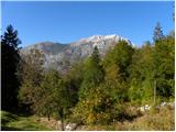 2
2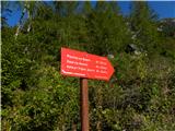 3
3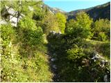 4
4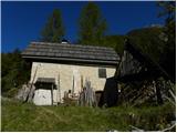 5
5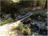 6
6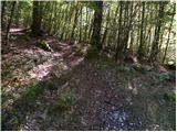 7
7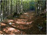 8
8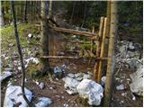 9
9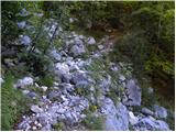 10
10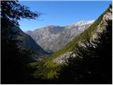 11
11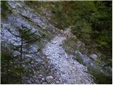 12
12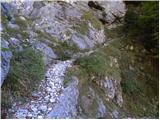 13
13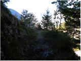 14
14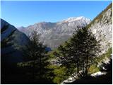 15
15 16
16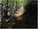 17
17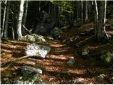 18
18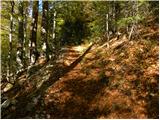 19
19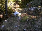 20
20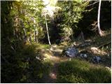 21
21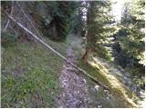 22
22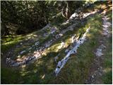 23
23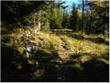 24
24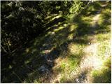 25
25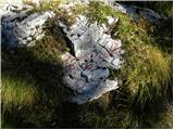 26
26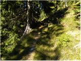 27
27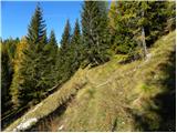 28
28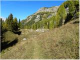 29
29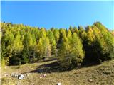 30
30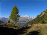 31
31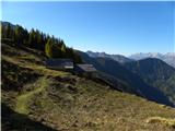 32
32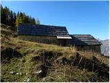 33
33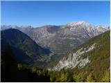 34
34
Discussion about the trail Pod Zjabci - Planina Za skalo
|
| ziga00129. 06. 2013 |
nikjer ne najdem opis poti -> Dom pri Krnskih jezerih - Planina za črnim vrhom - Planina pod skalo. Zanima me zahtevnost in pa čas? hvala
|
|
|
|
| IgorZlodej5. 11. 2015 |
Krnska jezera - Planina za Črnim Vrhom - Planina za Skalo okoli 2,5 do 3 ure. Lepa pot (mulatjera) nezahtevno in neoznačeno. S Planine za Skalo je treba računati še na uro in pol sestopa na Vas na Skali, malo več v Vrsnik (Jeglič).
|
|
|
|
| Loerst2. 07. 2018 |
Kot je že ljubitelj gora pred časom napisal - do Planine pod Skalo se da tudi po lovski stezi (neoznačena, vendar lepo razvidna in vzdrževana) iz Vasi pod Skalo, kakšne 3 km z avtom samo naprej po cesti od tukaj opisanega izhodišča. Ko vidiš zapornico parkiraj. Pot se tako podaljša za kakšen kilometer, vendar zniža za kakšnih 250 višinskih metrov, zaradi česar je precej bolj hvaležna za kolena.
|
|
|