Pod Krnico - Tolsta Košuta - western peak
Starting point: Pod Krnico (1250 m)
| Lat/Lon: | 46,4346°N 14,4083°E |
| |
Time of walking: 2 h 20 min
Difficulty: partly demanding unmarked way
Altitude difference: 789 m
Altitude difference po putu: 830 m
Map: Karavanke - osrednji del 1:50.000
Recommended equipment (summer):
Recommended equipment (winter): ice axe, crampons
Views: 21.418
 | 3 people like this post |
Access to the starting point:
From the Ljubljana - Jesenice motorway, take the Ljubelj exit. The road then quickly leads us to Tržič, and we continue to follow it in the direction of the villages Jelendol and Medvodje. In the village Medvodje turn left towards Kosuta (direction Dolga njiva and Koschutnikturm) onto the forest road which we follow to the crossroads at Košutna (1082 m). Here we turn right and follow the sometimes worse road to the parking area of a small quarry.
Path description:
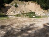
From the parking lot, take the cart track road, which branches off to the left of the road. Cart track goes into the wods and climbs moderately, crossing first a small and then a larger stream. Cart track, which has some shortcuts, makes a few bends and after a good 15 minutes leads to the pastures mountain pasture Lower Long Meadow.
After a short walk along mountain pasture, the path leads us to a crossroads where there are signposts. Bear right in the direction of the Koschutnikturm eastern approach route. After a few dozen steps, the gently sloping path leads to the shepherd's hut at mountain pasture Lower Dolga njiva (open-type shepherd's hut).
Continue on mountain pasture up the middle of which is a wide dirt track which, after a good 15-minute walk, leads out of the wods to mountain pasture Upper Long Meadow.
The steepness of the path, which has been moderate until now, eases and the path soon leads us through a beautiful grassy area to the central part of mountain pasture, where the markings end. Continue straight ahead (left Koschutnikturm) along a gently ascending path that runs alongside a small but very distinct torrential gully. A little further on, the unmarked path splits into two parts.
Continue left (slightly right Mala Košuta) on a path that begins to climb through the dwarf pines zone. If you lose the right path here, you will have to go through the dwarf pines lane or find a better passage lower down. Above dwarf pines the path leads to a pasture fence, where a nice view of the Austrian side opens up (you can also get here by a nice passage through a gully or a ravine). The path ahead, like the ridge, turns slightly to the left and starts to climb steeply over increasingly steep grassy slopes. The path continues to climb along the edge of the eastern ridge of Košuta on the steep southern slopes of Tolsta Košuta. The very steep path, which is a slip hazard in the wet, turns left a little higher up (giving way to the cliffs above) and after a further short climb leads to the eastern summit of Tolste Košuta. From the eastern summit of Tolsta Košuta, continue west along a less traceable path. The way forward initially descends a steep grassy slope to a saddle between the two Tolstima Košutama. Here you can see a small natural window behind which the path starts to climb again. After a few minutes of further walking, however, without any major problems, we reach the western summit of Tolsta Košuta.
On hot days, a large number of snakes can be seen on the trail or along the trail (caution).
Starting point - Spodnja Dolga njiva 20 minutes, Spodnja Dolga njiva - Zgornja Dolga njiva 25 minutes, Zgornja Dolga njiva - Tolsta Košuta (eastern peak) 1:20, Tolsta Košuta (eastern peak) - Tolsta Košuta (western peak) 15 minutes.

Pictures:
 1
1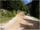 2
2 3
3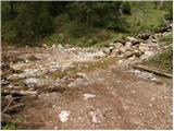 4
4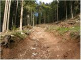 5
5 6
6 7
7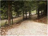 8
8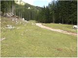 9
9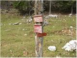 10
10 11
11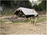 12
12 13
13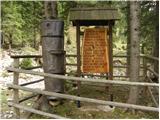 14
14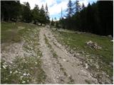 15
15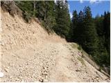 16
16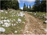 17
17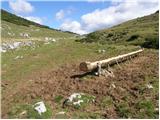 18
18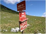 19
19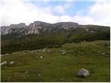 20
20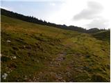 21
21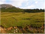 22
22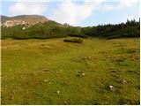 23
23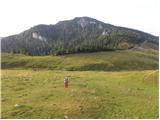 24
24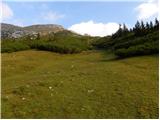 25
25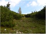 26
26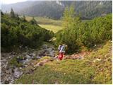 27
27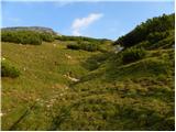 28
28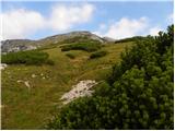 29
29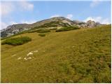 30
30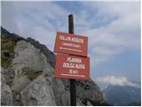 31
31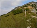 32
32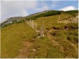 33
33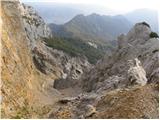 34
34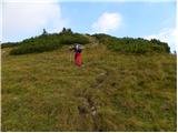 35
35 36
36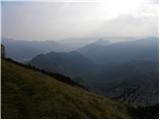 37
37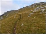 38
38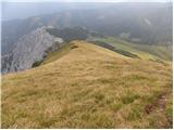 39
39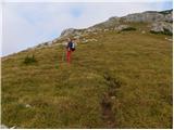 40
40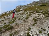 41
41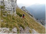 42
42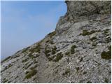 43
43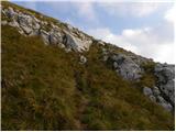 44
44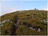 45
45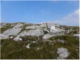 46
46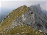 47
47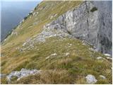 48
48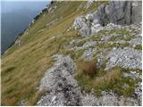 49
49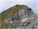 50
50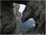 51
51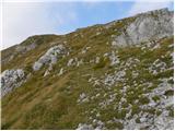 52
52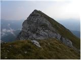 53
53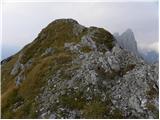 54
54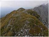 55
55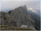 56
56
Discussion about the trail Pod Krnico - Tolsta Košuta - western peak
|
| sergejom2. 10. 2010 |
Koliko časa se hodi po grebenu z Z vrha Tolste košute na Košutnikov turn?
|
|
|
|
| klm3. 10. 2010 |
Grebensko prečenje Košutnikov turn - Tolsta Košuta sem pred leti opravil po navedeni poti. Zahteva plezanje do II. težavnostne stopnje (na enem mestu). S katere strani opravljamo turo navsezadnje ni pomembno, ker so tehnične težave z obeh strani približno enake. Lahko jo začnemo z vrha Tolste Košute in od tam naprej proti Košutnikovemu turnu (in naprej vse do Velikga vrha).
Skratka, na sedlu nad krušljivo Vzhodno grapo Košutnikovega turna je potrebno zaviti desno in se po travnatem pobočju povzpeti do 30-metrske skalne zapore zahodne Gamsovke (Freibachwand, 2065 m; Gamsovke so štiri in jih predstavljajo štirje izrazitejši skalni stolpi). Nanjo se povzpnemo v lažjem plezanju II. težavnostne stopnje čez jugozahodno steno (mejni kamen XXIV / 43, klin za varovanje; ta pride v poštev le če gremo v obratni smeri). Sledi krajši sestop in po ozkem grebenu na drugo Gamsovko, ki jo je treba preplezat čez njeno jugozahodno krušljivo pobočje. Na njenem grebenu je potem treba iti ves čas po južni strani. Kmalu sledi sestop v manjšo škrbino, iz katere čez krajši skalni skok splezamo na ozek travnat greben, po katerem gremo proti tretji Gamsovki. Za njo se skriva še četrti - zadnji - stolp. Za njim sledi še 10-metrska skalna zapora, ki jo je treba premegat, nato pa sledi samo še valovito travnato pobočje. Tu je konec plezalnega dela. V blagih vzponih in sestopih nadaljuješ čez strma travnata in deloma skalnata pobočja zahodnega (2026 m), srednjega (2005 m) in vzhodnega Obliča (Doborwaspitzen, 2015 m; mejni kamen XXIV / 42) do zahodnega vrha Tolste Košute. Z nje gremo mimo naravnega okna na vzhodni vrh. To je to. Čas pa je odvisen od več determinant, ampak zakoličimo ga med 1:45 in 2:15 h.
|
|
|
|
| Tere9. 09. 2022 12:06:59 |
Pozdrav, molila bi informaciju, dali se može proći od Tolste Košute do Košutnikovog turna bez opreme za alpinizam, i dali ima sajli i klinova? Unaprijed hvala na informacijama. 
|
|
|
|
| garmont9. 09. 2022 12:22:38 |
“Pot”, oziroma greben med obema omenjenima vrhovoma je lažja alpinistična smer in kot taka, seveda ni opremljena z zajlami in klini. Vrv je priporočljiva…
|
|
|
|
| Tere9. 09. 2022 12:28:49 |
garmot hvala za info, s obzirom da idem sama, onda bolje da se spustim po stazi, makar sam mislila proći grebenom da se ne spuštam......
|
|
|