Planina Vodol - Knezova planina (Planina Bela peč)
Starting point: Planina Vodol (1324 m)
| Lat/Lon: | 46,4234°N 14,7769°E |
| |
Time of walking: 15 min
Difficulty: easy marked way
Altitude difference: 26 m
Altitude difference po putu: 40 m
Map: Kamniške in Savinjske Alpe 1:50.000
Recommended equipment (summer):
Recommended equipment (winter): crampons
Views: 3.674
 | 1 person likes this post |
Access to the starting point:
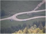
a) From the Ljubljana - Maribor motorway, take the Šentrupert exit and then continue to Mozirje, Ljubno ob Savinji and the Logar valley. From Ljubno, follow the main road for about 6 km, then in Strmec, signs for Raduha and Snežna jama direct you to the right onto a narrower and initially still asphalted road. At the crossroads follow the signs for Snežna jama, and we follow the road, which loses its asphalt surface higher up, to mountain pasture Vodol. Park at the junction where a minor road branches off to the right in the middle of a left-hand bend, leading to the upper part of mountain pasture Vodol.
b) From the motorway Ljubljana - Jesenice take the exit Vodice and then continue towards Kamnik. In Kamnik, follow the signs for Gornji Grad and the Črnivec Pass, and just 1 km before the pass, turn left in the direction of Kranjski Rak and Podvolovljek. From Kranjski Rak (Volovljek Pass) we start descending towards Luce, where we turn right towards Mozirje. From Luce, drive towards Mozirje for about 3 km, then in Strmec, signs for Raduha and Snežna jama direct you left onto a narrower and initially still asphalted road. At the crossroads follow the signs for Snežna jama, and we follow the road, which loses its asphalt surface higher up, to mountain pasture Vodol. Park at the junction where a minor road branches off to the right in the middle of a left-hand bend, leading to the upper part of mountain pasture Vodol.
Path description:
From the bend where you parked, take the side road which leads quickly up to the top of the mountain pasture Vodol. Here, at a small crossroads, continue right and walk to the nearby hut, which the marked path passes on the left. Next, cross over mountain pasture, and then the path takes you into the forest, through which you climb steeply for a short distance. The path quickly lays down and leads to the Bela peč pass, from which you descend to the nearby Knezova mountain pasture.
Pictures:
 1
1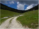 2
2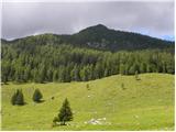 3
3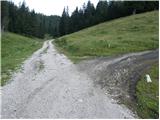 4
4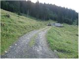 5
5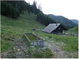 6
6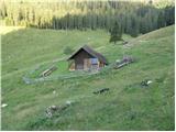 7
7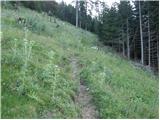 8
8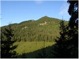 9
9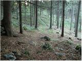 10
10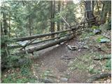 11
11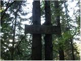 12
12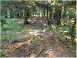 13
13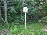 14
14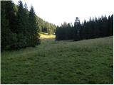 15
15
Discussion about the trail Planina Vodol - Knezova planina (Planina Bela peč)