Planina Ravne - Molička peč (via Zelene trate)
Starting point: Planina Ravne (1500 m)
| Lat/Lon: | 46,3493°N 14,6997°E |
| |
Name of path: via Zelene trate
Time of walking: 2 h 25 min
Difficulty: easy pathless terrain
Altitude difference: 529 m
Altitude difference po putu: 550 m
Map: Kamniške in Savinjske Alpe 1:50.000
Recommended equipment (summer):
Recommended equipment (winter): ice axe, crampons
Views: 34.010
 | 3 people like this post |
Access to the starting point:
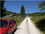
a) First drive to Kamnik, then continue to Stahovica and the Črnivec Pass. A few 100 metres before the Črnivec Pass, leave the main road leading to Gornji Grad and drive sharp left in the direction of the Volovljek Pass (Kranjski Rak). From the above-mentioned pass, continue straight ahead (on the left the road leading to Velika planina, on the right the Štajerski Rak) and start descending towards Luče. Lower down, the road bends slightly and leads to the Podvolovljek valley. In the following, you first pass the road branch leading to the Lučka Bela valley, and then the bar at Gams. After the bar, pay attention, because just a few 100 metres further on, a road branches off to the left, leading to mountain pasture Podveža and mountain pasture Ravne and the Planinšek farm (at the point where you leave the main road, the road marking is approximately 11 km). Continue along the initially still asphalted road, which climbs further towards the Dleskovská plateau. Higher up, the road to Planinšek branches off to the right, and here we continue along the upper left road, which a few 100 metres further on from the turnoff to the Planinšek farm becomes macadam, and this road leads us a little further on to the next crossroads, where we continue straight on in the direction of mountain pasture Ravne (to the left, mountain pasture Podveža). Continue on a slightly less favourable road, then follow to the start of mountain pasture Ravne, where you park in a suitable place on the roadside.
From the main road to mountain pasture Ravne is about 10 km, of which about 4 km are macadam.
b) First drive to Luce, then continue driving towards Kamnik. When you see the road sign by the side of the road indicating 10,5 km, pay attention to the right fork, as just a little further on the road will branch off to the right towards mountain pasture Podveža and Ravne and the Planinšek farm. Continue along the initially still asphalted road, which climbs further towards the Dleskovški plateau. Higher up, the road to Planinšek branches off to the right, and here we continue along the upper left road, which a few 100 metres further on from the turn-off to Planinšek Farm becomes macadam, and this road leads us a little further on to the next crossroads, where we continue straight on in the direction of mountain pasture Ravne (to the left of mountain pasture Podveža). The road to the right is the road to Planinšek Farm, and the road to Planinšek Farm becomes macadam. Continue on a slightly less favourable road, then follow to the start of mountain pasture Ravne, where you park in a suitable place on the roadside. From the main road to mountain pasture Ravne is about 10 km, of which about 4 km are macadam.
Path description:
From the starting point, walk via mountain pasture to the shepherd's hut, which you go around on the right by continuing in the direction of Molička mountain pasture and mountain pasture Polšak (the path on the left side of the hut leads across the Dolgo trata). After the hut the path is a bit harder to follow at first, but the markings help us, and a little further on we join the cart track, which branches off the road on the mountain pasture straight at a right-hand bend.
Once on cart track, continue left, initially walking without any significant change in elevation, and then starting a gentle to moderate climb. After a few minutes, you will reach a faint saddle between Dleskovec on the left and Smrekovec on the right. Here a path joins us from the end of the road on the right, and we continue straight ahead over a pasture fence. After the grazing fence there is a short crossing, and then we arrive at the next marked crossroads, where we continue to the left in the direction of Lučka hut, straight mountain pasture Polšak.
The way forward continues in a series of several small valleys, and then leads us to the NOB memorial, next to which there are two benches with a table. From here on, the path climbs slightly steeper, and slightly higher up, the first beautiful views towards Križevnik, Raduha and the surrounding mountains open up. Higher up, we climb moderately for a while through the dwarf pines bands, and then the trail lays down and leads us to Sedelce, where the trail over the Long Lawn joins us from the left.
Continue straight ahead here and for a short distance continue along the marked path towards Korošice and Molička mountain pasture, then continue right in the direction of the marked path to Velika vrh. The way ahead leads along an unmarked valley to the east, then north-east of Velika vrh. When the marked trail to Velika summit turns left up the slope, we continue straight ahead on a lesser track or partly trackless path. Here we see the Cave bivouac on the right, which is a good 10 minute descent, and we continue crossing the slopes of Velika Zelenica. After a few minutes, we reach a slightly wider path, and continue along it to the notch between Velika Zelenica on the left and Molička peč on the right. From the notch, which offers a fine view, the path first climbs moderately and then crosses the slopes of Molička peč. In the second part of the crossing, before the path starts to descend, a beautiful passage opens up on the left towards the summit of Molička peč, which is about 10 minutes' climb up a moderately steep slope surrounded by dwarf pines. Description and figures refer to the situation in 2016 (August).

Pictures:
 1
1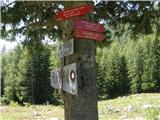 2
2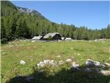 3
3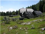 4
4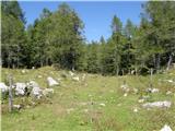 5
5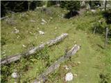 6
6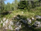 7
7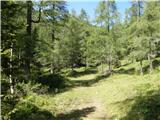 8
8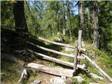 9
9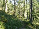 10
10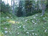 11
11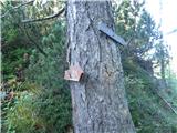 12
12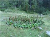 13
13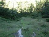 14
14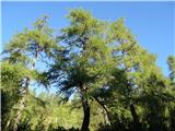 15
15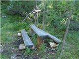 16
16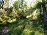 17
17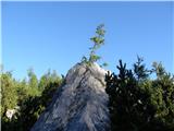 18
18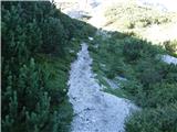 19
19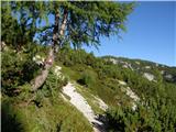 20
20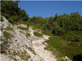 21
21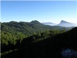 22
22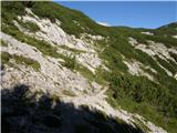 23
23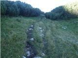 24
24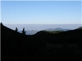 25
25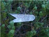 26
26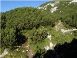 27
27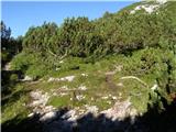 28
28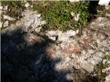 29
29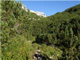 30
30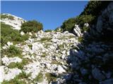 31
31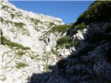 32
32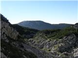 33
33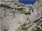 34
34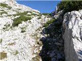 35
35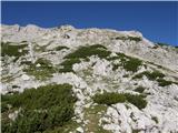 36
36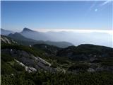 37
37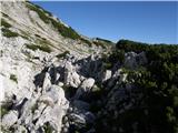 38
38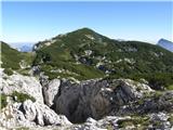 39
39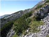 40
40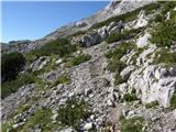 41
41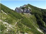 42
42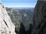 43
43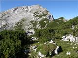 44
44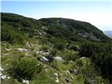 45
45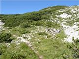 46
46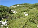 47
47 48
48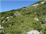 49
49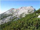 50
50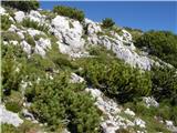 51
51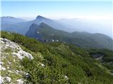 52
52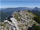 53
53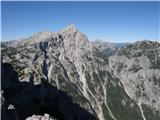 54
54
Discussion about the trail Planina Ravne - Molička peč (via Zelene trate)
|
| Stingray28. 08. 2010 |
GPS kordinate tega vrha so 300 metrov zahodneje od navedenih in znašajo: 46.364449°N / 14.672131°E Prilagam še sliko GPS izvoza zgoraj omenjeni poti v Google Earth: SLIKA
|
|
|
|
| Irina31. 12. 2012 |
In zopet se je zgodila nesreča. Gornika sicer nista šla iz Sedelca, ampak vseeno. Še enkrat premislite kam se boste odpravili, če te dni nameravate obisk visokogorja. Bodite previdni in se srečno vrnite v dolino.
Prepis članka
Planica je plaz odnesel včeraj popoldne okoli 17.30 na poti iz Robanovega kota proti Molički peči. Rešili so ju pripadniki gorske reševalne službe Celje in ju predali reševalcem nujne medicinske pomoči Celje, ki so ju odpeljali v bolnišnico Celje, so sporočili iz Uprave RS za zaščito in reševanje.
|
|
|
|
| tropine10. 11. 2015 |
POZDRAVLJENI LJUBITELJI GORA
Zanima me,če je cesta Podvolovjek- Planina -podvežak in ravne proti Molički odprta ker bi od tu startal na moličko peč -kapelico in Ojstrico.Bila je zaprta zaradi udora ceste ?L.P.
|
|
|
|
| slainter10. 11. 2015 |
Pozdrav,
Cesta do planine Podvežak ali planino Ravni je prevozna in do kmetije Planinšek od junija letos asfaltirana. Le korajžno na pot in srečno!
|
|
|
|
| otiv10. 11. 2015 |
Zaprta je cesta Kranjski Rak ( Volovljek ) - Podvolovljek.
|
|
|
|
| potka10. 11. 2015 |
Pri zapori ceste smo mi obrnili in šli čez Gornji grad, Luče..malo več vožnje, ampak se je izplačalo 
|
|
|
|
| Otzi21. 05. 2017 |
Ima morda kod GPS sled za to pot ali vsaj vrisano na karto. Danes sem namreč sel s Krizevnika na Molicko pec nato pa pri skrbini namesto bolj visoko pod Veliko Zelenico zavil prevec navzdol. Nato se mi ni dalo hoditi nazaj in sem se spustil do jamarskega bivaka, dol cez kamniti most in proti Zelenim Tratam.
Bi pa vseeno rad vedel za tukaj opisano pot, ker je najbrz lazje prehodna.
|
|
|
|
| garmont22. 05. 2017 |
Saj si sam dobro ugotovil. Od škrbine nadaljuješ po slabši stezi navzgor proti vrhu Velike Zelenice. Višje se pot cepi, en del gre po grebenu malce izpostavljeno na vrh, drugi del pa preči skoraj vodoravno do stika z markirano potjo na Veliki vrh.
|
|
|
|
| 30625. 06. 2017 |
Pozdravljeni. Dajem informacijo, da je cesta do izhodišča zaprta zaradi sezonske paše. Priporočam izhodišče Podvežak.
Lp
|
|
|
|
| lepenatka25. 06. 2017 |
Do kje pa je še dovovoljena vožnja?
LpR
|
|
|
|
| kati190925. 06. 2017 |
Lepenatka; ne vem v čem je problem. Z avtom se lahko pripelješ na planino Ravni; preverjeno v četrtek (22.t.m.)!
|
|
|
|
| lepenatka25. 06. 2017 |
Torej problema ni Hvala. Saj se mi je zdelo čudno, ker bi bilo to nekaj novega.Odzvala sem se na gornji zapis 306. Veliko užitkov v gorah želim. Regina
|
|
|
|
| garmont25. 06. 2017 |
No, če želiš parkirati na Ravneh moraš odpreti ( in zapreti ) leso, ki je na cesti. Po moje je tam z razlogom... 
|
|
|
|
| geppo26. 06. 2017 |
Parkiranje pri planini se je kolegu končalo malo žalostno. Lak na avtomobilu je bil precej poškodovan od drgnjenja živali, ki jih je zanimalo parkirano "čudo"!!!
|
|
|
|
| lepenatka26. 06. 2017 |
Ja, to se lahko zgodi. Na naših planinah je "priložnosti" za take dogodke kar nekaj. Srečno na poteh, z avtom ali peš . Regina
|
|
|
|
| mirank26. 06. 2017 |
Ne samo na naših planinah; sem gledal bika z obročkom v nosu kako liže roso na finem terencu na Viški planini. Je prav lepo zvončkljalo po plehu 
|
|
|
|
| dr_63526. 06. 2017 |
Kdo se boji za avto naj parkira pred leso. Pa ne na sred ceste, ampak trdo za robom.  Od lese do parkirišča je 500-600 m.
|
|
|
|
| 3061. 07. 2017 |
Lep pozdrav. Komentar z zaprtjem je bil samo kot info. Ja, verjetno se da odpret in odpeljat dalje vendar se mi ni zdelo pametno z avtom riniti naprej med bikece ...Komur pa to odgovarja pa kamot. Sej lahko ima žival tudi svoj mir.
|
|
|