Planina Polog - Vrh Planje (via planina Dobrenjščica)
Starting point: Planina Polog (457 m)
| Lat/Lon: | 46,238°N 13,7232°E |
| |
Name of path: via planina Dobrenjščica
Time of walking: 5 h 30 min
Difficulty: easy pathless terrain, partly demanding marked way
Altitude difference: 1514 m
Altitude difference po putu: 1514 m
Map: Julijske Alpe - zahodni del 1:50.000
Recommended equipment (summer):
Recommended equipment (winter): ice axe, crampons
Views: 3.207
 | 2 people like this post |
Access to the starting point:
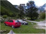
First, go to Tolmin, and from there follow the road in the direction of Zatolmin (leave the main road at the traffic lights). In Zatolmin, you will see the mountain signs for Javorca, which will direct you to the ascending road towards Javorca. After about 8 km of driving, the sometimes quite narrow and sometimes precipitous road leads us to a small crossroads where the road to Javorca branches off to the left upwards. We continue straight ahead, following the road for only about 100 m, where we then park at a suitable place next to the ramp.
Path description:
From the starting point, continue along the dirt road (the road is closed to public traffic), which after a few minutes of easy walking leads to the central part of mountain pasture, where there are a few huts. After mountain pasture, the road gets a little worse, but after a few minutes of further walking, it leads to a crossroads where the path to mountain pasture to Prodih branches off to the right (the access to mountain pasture is very interesting, as you have to cross the river Tolmin, which is facilitated by a hand-carried cable car). Continue straight ahead, and the road eventually turns into cart track and higher up into a well-preserved mulatier. The path then becomes a little steeper and leads past two benches and a fresh rock peak higher up (earthquake in Posočje 1998) to a pasture fence, over which you enter the southern edge of mountain pasture below Osojnica. Just a few metres further on, the path splits into two parts. Continue along the lower right path, which descends gently to the hunting hut at the spring Tolmin.
From the source of the Tolminka River, we continue our ascent through the mountain pasture below Osojnica, and the upper path, which is exposed to an active rocky peak, soon joins us from the left.
Continue in the direction of "Planina Prode in Prehodci" along the path which leads us to a mighty torrent where there is a crossroads again.
At the crossroads, continue to the right, following the signs for "Planina Prode", and cross the broad channel of the torrent at the dam. On the other side of the riverbed is another crossroads. This time continue to the left and the path to the right leads to Mountain pasture Prode. The path then leads through the forest parallel to the torrent bed for a short distance, then turns right and starts to climb. Later, the path leads us to a small clearing, and then begins to climb a little more steeply through the forest. We continue to climb for some time in keys through the forest. Higher up, the forest becomes a little thinner in some sections and more and more beautiful views begin to open up. The path then turns to the right and crosses the slopes to the south-east as it climbs. Out of the forest we reach slopes slightly overgrown with nettles and shrubs and then the last climb to the hunting lodge at Mountain pasture Dobrenjščica. At the hunting lodge, continue left to the north-west and the path soon leads to a marked crossroads. The path to the right leads up to Koča na planini Razor, and we continue left and continue to cross the slope to the north-west. We will then soon see a less visible path along the path, which leads down to the left towards a small spring (marked "Water 40m"). From here we continue along the path for a further 100m, and then we will see a narrow lane to the right, which is not covered with dwarf pines. Leave the marked path here and head straight up along dwarf pines. Continue steeply uphill along dwarf pines until you reach a less well-trodden track. Continue right on the track and then start to climb up in the keys. The path here is marked with some cairns and leads from dwarf pines to rocky slopes. The path becomes slightly less visible and turns slightly right to the east. Just below the ridge you will see a military bunker which you climb towards. From here it is a short climb to the saddle between the Kser and Vrh Škrli peaks, where you join the marked path leading to the Tolmin Kuk.
Continue right along the ridge towards Tolminski Kuk and the trail soon leads to an indistinct peak called Kser.
The path continues slightly down the ridge and leads to a small saddle. We then start to climb again, and the path follows the left side of the ridge. A fairly steep path, which is slightly exposed in a few places, then leads us to the ridge. There is a short climb along the ridge and the path leads us to the next peak (Vrh Planja 1971 m) from which we have a beautiful view of Tolmin Kuk.

Pictures:
 1
1 2
2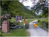 3
3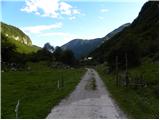 4
4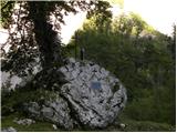 5
5 6
6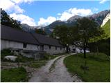 7
7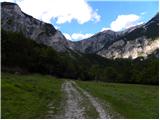 8
8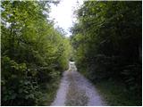 9
9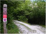 10
10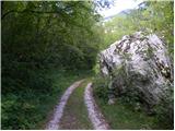 11
11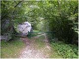 12
12 13
13 14
14 15
15 16
16 17
17 18
18 19
19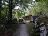 20
20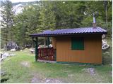 21
21 22
22 23
23 24
24 25
25 26
26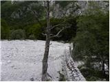 27
27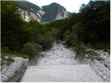 28
28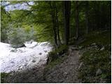 29
29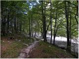 30
30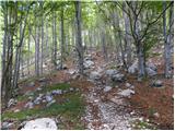 31
31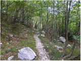 32
32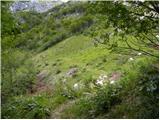 33
33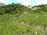 34
34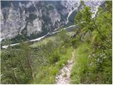 35
35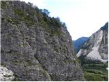 36
36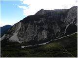 37
37 38
38 39
39 40
40 41
41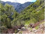 42
42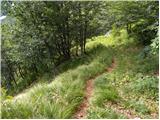 43
43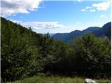 44
44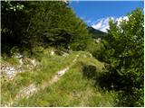 45
45 46
46 47
47 48
48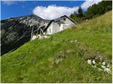 49
49 50
50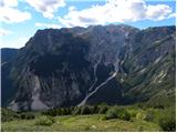 51
51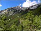 52
52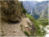 53
53 54
54 55
55 56
56 57
57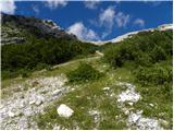 58
58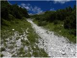 59
59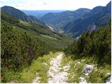 60
60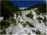 61
61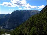 62
62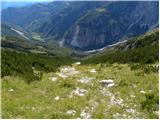 63
63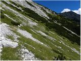 64
64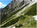 65
65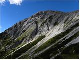 66
66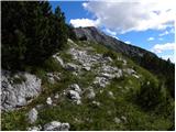 67
67 68
68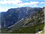 69
69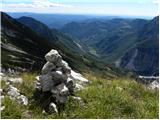 70
70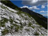 71
71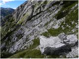 72
72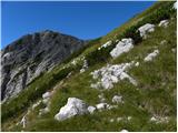 73
73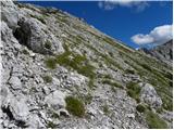 74
74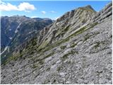 75
75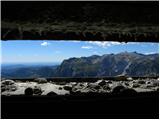 76
76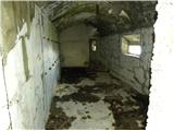 77
77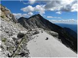 78
78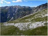 79
79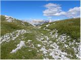 80
80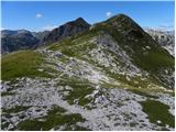 81
81 82
82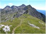 83
83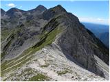 84
84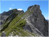 85
85 86
86 87
87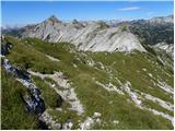 88
88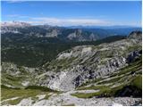 89
89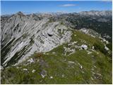 90
90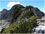 91
91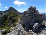 92
92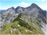 93
93
Discussion about the trail Planina Polog - Vrh Planje (via planina Dobrenjščica)
|
| oraigo25. 08. 2020 |
Pozdravljeni.
Imam vprašanje glede prehodnosti nemarkiranega odseka od mulatjere do Vrha škrli. Namreč pred kratkim sem hotel narediti pot od Prehodcev - skozi Vrh Škrli - planina Govnjač - do Komne.
Vendar sem na delu, kjer bi moral zagristi v strmino (slika 58) naletel na kup skal in kamenja. Ker nisem bil prepričan o pravilni poti, sem se raje obrnil nazaj do prehodcev. Hvala za odgovore in bodite lepo. Igor
|
|
|
|
| mirank25. 08. 2020 |
Pred leti sem tudi jaz iskal odcep mulatiere kot jo v svojem opisu navaja Mihelič-seveda je nisem našel, saj je spodaj vse zaraščeno z ruševjem. Gor se najlažje povzpneš tako kot je opisano-to je pač po tej grapci-vrzeli v ruševju. Čim pokukaš ven iz zelenja je stara mulatiera lepo vidna in vodi do velikega bunkerja tik pod grebenom. Kako je prehodno v kopnem na bohinjski strani pa ne vem 
|
|
|
|
| pinkerton26. 08. 2020 |
Tako je kot pravi mirank.
Lani sem šel tu gor in dol. Moraš se držati točno tega gruščnatega jezika, sploh pri spustu, ker se vsi ostali končajo slepo v obupnem rušju.
Tu je šla široka italijanska mulatjera, ki pa je že popolnoma zaraščena in neprehodna. Za primerjavo orto posnetek in lidar, kjer se še krasno vidi njen potek
|
|
|
|
| pinkerton26. 08. 2020 |
Žal jih ne morem naložiti 
|
|
|
|
| oraigo26. 08. 2020 |
Najlepša vam hvala.
Bom v kratkem ponovil.
|
|
|