Planina Polog - Mahavšček (via planina Dobrenjščica)
Starting point: Planina Polog (457 m)
| Lat/Lon: | 46,238°N 13,7232°E |
| |
Name of path: via planina Dobrenjščica
Time of walking: 5 h
Difficulty: easy pathless terrain
Altitude difference: 1551 m
Altitude difference po putu: 1575 m
Map: Julijske Alpe - zahodni del 1:50.000
Recommended equipment (summer):
Recommended equipment (winter): ice axe, crampons
Views: 8.439
 | 2 people like this post |
Access to the starting point:
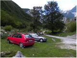
First, go to Tolmin, and from there follow the road in the direction of Zatolmin (leave the main road at the traffic lights). In Zatolmin, you will see the mountain signs for Javorca, which will direct you to the ascending road towards Javorca. After about 8 km of driving, the sometimes quite narrow and sometimes precipitous road leads us to a small crossroads where the road to Javorca branches off to the left upwards. Turn left here and follow the road for another 100 m to a marked parking area.
Path description:
From the starting point, continue along the dirt road (the road is closed to public traffic), which after a few minutes of easy walking leads to the central part of mountain pasture, where there are a few huts. After mountain pasture, the road gets a little worse, but after a few minutes of further walking, it leads to a crossroads where the path to mountain pasture to Prodih branches off to the right (the access to mountain pasture is very interesting, as you have to cross the river Tolmin, which is facilitated by a hand-carried cable car). Continue straight ahead, and the road eventually turns into cart track and higher up into a well-preserved mulatier. The path then becomes a little steeper and leads past two benches and a fresh rock peak higher up (earthquake in Posočje 1998) to a pasture fence, over which you enter the southern edge of mountain pasture below Osojnica. Just a few metres further on, the path splits into two parts. Continue along the lower right path, which descends gently to the hunting hut at the spring Tolmin.
From the source of the Tolminka River, we continue our ascent through the mountain pasture below Osojnica, and the upper path, which is exposed to an active rocky peak, soon joins us from the left.
Continue in the direction of "Planina Prode in Prehodci" along the path which leads us to a mighty torrent where there is a crossroads again.
At the crossroads, continue to the right, following the signs for "Planina Prode", and cross the broad channel of the torrent at the dam. On the other side of the riverbed is another crossroads. This time continue to the left and the path to the right leads to Mountain pasture Prode. The path then leads through the forest parallel to the torrent bed for a short distance, then turns right and starts to climb. Later, the path leads us to a small clearing, and then begins to climb a little more steeply through the forest. We continue to climb for some time in keys through the forest. Higher up, the forest becomes a little thinner in some sections and more and more beautiful views begin to open up. The path then turns to the right and crosses the slopes to the south-east as it climbs. Out of the forest we reach slopes slightly overgrown with nettles and shrubs and then the last climb to the hunting lodge at Mountain pasture Dobrenjščica. At the hunting lodge, continue left to the north-west and the path soon leads to a marked crossroads. The path to the right leads up to Koča na planini Razor, and we continue left and continue to cross the slope to the north-west. We will then soon see a less visible path along the path, which leads down to the left towards a small spring (marked "Water 40m"). From here we continue along the path for a further 100m, and then we will see a narrow lane to the right, which is not covered with dwarf pines. Leave the marked path here and head straight up along dwarf pines. Continue steeply uphill along dwarf pines until you reach a less well-trodden track. Continue right on the track and then start to climb up in the keys. The path here is marked with some cairns and leads from dwarf pines to rocky slopes. The path becomes slightly less visible and turns slightly right to the east. Just below the ridge you will see a military bunker which you climb towards. From here it is a short climb to the saddle between the Kser and Vrh Škrli peaks, where you join the marked path leading to the Tolmin Kuk.
Do not follow the marked trail in the direction of Kuk, but continue straight down, where after a few steps of descent you will arrive at a marked crossroads.
Continue left in the direction of Bogatin (right down Govnjač mountain) along the old military causeway, which crosses the slopes of Škrli Peak. A little further on, the path leads us to the main ridge of the Lower Bohinj Mountains, and the path continues to climb quite gently for some time. Higher up, the ridge narrows slightly, and the path begins to climb steeply towards Mahavščko, the summit of which is reached after a few minutes of further walking.

We can extend the trip to the following destinations: Bogatin
Pictures:
 1
1 2
2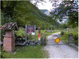 3
3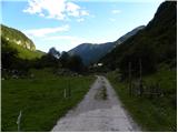 4
4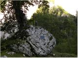 5
5 6
6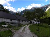 7
7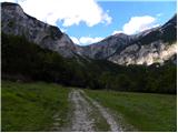 8
8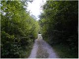 9
9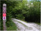 10
10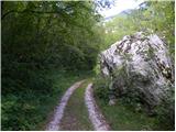 11
11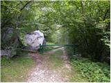 12
12 13
13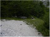 14
14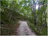 15
15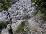 16
16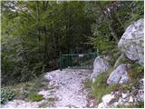 17
17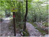 18
18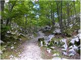 19
19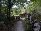 20
20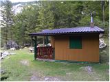 21
21 22
22 23
23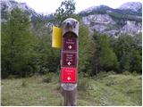 24
24 25
25 26
26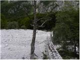 27
27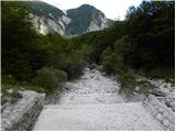 28
28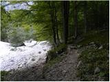 29
29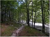 30
30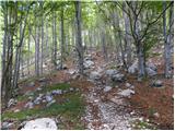 31
31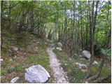 32
32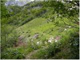 33
33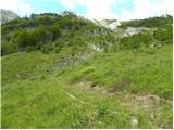 34
34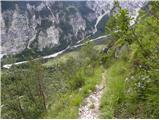 35
35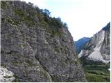 36
36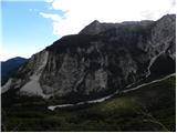 37
37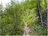 38
38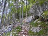 39
39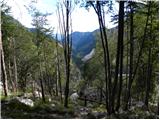 40
40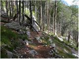 41
41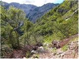 42
42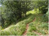 43
43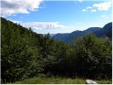 44
44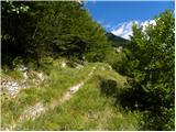 45
45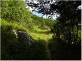 46
46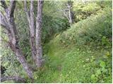 47
47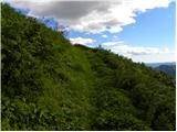 48
48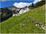 49
49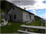 50
50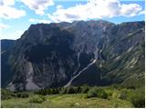 51
51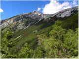 52
52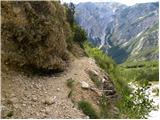 53
53 54
54 55
55 56
56 57
57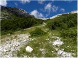 58
58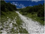 59
59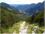 60
60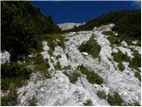 61
61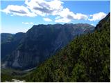 62
62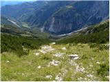 63
63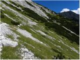 64
64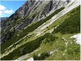 65
65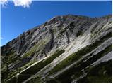 66
66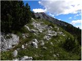 67
67 68
68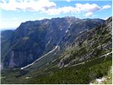 69
69 70
70 71
71 72
72 73
73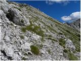 74
74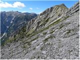 75
75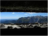 76
76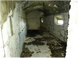 77
77 78
78 79
79 80
80 81
81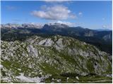 82
82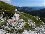 83
83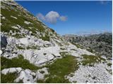 84
84 85
85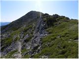 86
86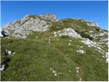 87
87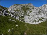 88
88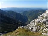 89
89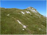 90
90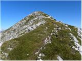 91
91 92
92
Discussion about the trail Planina Polog - Mahavšček (via planina Dobrenjščica)
|
| mirank16. 06. 2014 |
Opozorilo uporabnikom tega dostopa; tista oznaka na drogu-26 sl je zavajajoča namreč odcep poti na Prehodce (pl Lašco, zg Prode..)je na drugi strani hudourniške struge, ki ima tam zelo široko prodišče. Po izgledu-glej sl 29-30 je popolnoma enak tistemu "ta pravemu".Da je temu tako vam bo jasno takoj ko boste našli pravi odcep, ki se nahaja še kakih 100m naprej v smeri ki je označena s Prode.Torej še enkrat- na drugi strani hudourniške struge nikar levo na lepo vidno stezo ampak še par min naprej in potem levo.
|
|
|
|
| lubadar6. 07. 2014 |
Strugo je treba prečit ob pregradi do konca da najdete pot na planino Dobrenjščico... v kolikor pa kdo uporabi to pot za sestop pa to vsekakor ni lahko brezpotje 
|
|
|
|
| mirank6. 07. 2014 |
Še enkrat da ne bom slabo razumljen: Ko prečkamo strugo ob pregradi nikar levo na prvo stezo ki je po izgledu identična s tisto na sl 29-30; ta vodi proti Prehodcem. Če hočete na Dobrenjščico morate še malo naprej v smeri Prode, šele nato se odcepi levo prava steza. Pravo brezpotje pa je po mojem samo v delu, ki je prikazan od 58-64 sl, kajti tu je mulatiera tako zaraščena v rušju, da je dostop kar naravnost navzgor . Za sestop sva jo z Dobrenjščice ubrala po komaj sledljivi stezici direktno na Prode in tam pa je kar zahtevno predvsem spodaj prek grape.
|
|
|
|
| vulpes8. 07. 2014 |
Se strinjam s predhodnikoma, da pridemo na pravo pot je potrebno strugo prečiti čisto do konca. Potem pa se takoj vidi prava pot. Je pa melišče za direktno pot navzgor kar zahtevno, zato ne bi poti štel kot lahko brezpotje.
|
|
|
|
| ljubitelj gora21. 09. 2015 |
Gor šel čez Prehodce, sestopal po opisani poti, možiclji so redki, za gor ali dol, v vsakem primeru je naporno. Pl.Dobrenjščico sm izpustil in se še po melišču spustil do označene poti.
|
|
|
|
| ljubitelj gora19. 07. 2021 12:57:15 |
18.7 opravil pot gor čez Prehodce-Bogatin-Mahavšček. In po sestopu z Mahavščka poiskal najlažji sestop do melišča. Bolje je po zgoraj opisani poti sestopit.
|
|
|