Starting point: Planina (737 m)
| Lat/Lon: | 45,6218°N 15,1075°E |
| |
Time of walking: 45 min
Difficulty: easy marked way
Altitude difference: 310 m
Altitude difference po putu: 320 m
Map: Dolenjska - Gorjanci, Kočevski Rog 1:50.000
Recommended equipment (summer):
Recommended equipment (winter):
Views: 35.712
 | 1 person likes this post |
Access to the starting point:
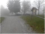
a) From the Ljubljana - Brežice motorway, take the Ivančna Gorica exit, then continue driving towards Črnomelj. After Črmošnjice, the road climbs for a short time and then begins to descend steeply. When you reach Vrčice, the signs for Mirna gora direct you to the right onto an initially still asphalted road, which you gradually start to climb. Soon after the asphalt ends, the road splits in two. Continue along the left-hand road (the right-hand road is for those who intend to climb Mirna gora on foot) and after a while you will reach the old village of Mountain pasture / Stockendorf (737 m). Here, continue to the right and then after a few 10 m park in the parking lot next to the numerous direction and information signs.
b) From the motorway Brežice - Ljubljana, take the Novo mesto exit and then continue in the direction of Dolenjske Toplice and Podturna near Dolenjske Toplice. In Podturno, join the main road Ivančna Gorica - Črnomelj, and follow it to the left in the direction of Črnomelj. After Črmošnjice, the road climbs for a short time and then starts to descend more steeply. When we reach Vrčice, the signs for Mirna gora direct us to the right onto the initially still asphalted road, which we gradually start to climb. Soon after the asphalt ends, the road splits in two. Continue along the left-hand road (the right-hand road is for those who intend to climb Mirna gora on foot) and after a while you will reach the old village of Mountain pasture / Stockendorf (737 m). Here, continue to the right and then after a few 10 m park in the parking lot next to the numerous direction and information signs.
c) From Bela Krajina, first drive to Semič, then continue to Črmošnjice and Soteska. Before the road starts to descend, we arrive at Vrčice, where the signs for Mirna gora direct us to the left onto an initially still asphalted road, which we gradually start to climb. Soon after the asphalt ends, the road splits into two. Continue along the left-hand road (the right-hand road is for those who intend to climb Mirna gora on foot) and after a while you will reach the old village of Mountain pasture / Stockendorf (737 m). Here, continue to the right and then after a few 10 m park in the parking lot next to the numerous direction and information signs.
Path description:
From the starting point, continue in the direction of Mirna gora and start along the forest trail, which leads us past a few houses. Above the houses, the trail continues past an abandoned water trough, then gradually passes into the forest, through which it climbs moderately to occasionally steeply. The well-marked path, along which there are numerous educational boards, turns slightly to the right at a higher altitude and leads to the mountain Dom na Mirni gori.
From the Doma na Mirna gora, continue right towards the summit of the same name, and the path leads past a lookout tower into the forest, through which you then climb to the nearby transmitters. At the transmitters, the trail turns slightly left, descends gently, and then climbs to one of the highest peaks in the White Landscape, which is reached after a two-minute walk.
We can extend the trip to the following destinations: Mirna gora
Pictures:
 1
1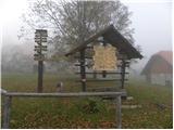 2
2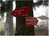 3
3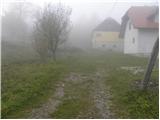 4
4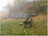 5
5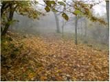 6
6 7
7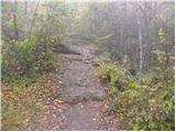 8
8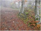 9
9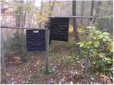 10
10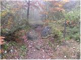 11
11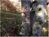 12
12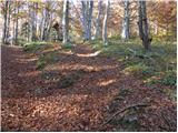 13
13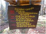 14
14 15
15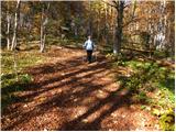 16
16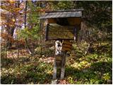 17
17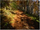 18
18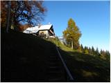 19
19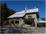 20
20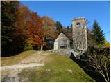 21
21 22
22 23
23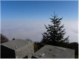 24
24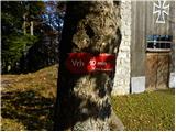 25
25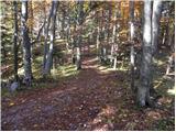 26
26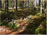 27
27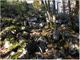 28
28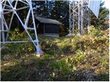 29
29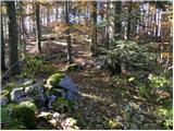 30
30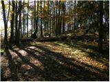 31
31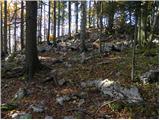 32
32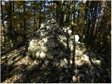 33
33 34
34
Discussion about the trail Planina - Mirna gora
|
| baza218. 06. 2016 |
Spoštovani upravljalec planinskega doma. Bil bi skrajni čas, da ponovno namestite spletno kamero, da bi si potencialni dnevni pohodniki lahko ogledali vreme in druge razmere na MG. Menim, da bi takšno kamero moral imeti vsak dom, kjer razmere in pogoji to omogočajo in da bo kamera tudi prispevala k boljšemu obisku doma.
Upam, da PRIJATELJI MG ne bomo predolgo čakali!
LpM
|
|
|