Planina Kuninja - The lake Jezero v Lužnici
Starting point: Planina Kuninja (991 m)
| Lat/Lon: | 46,2413°N 13,663°E |
| |
Time of walking: 3 h
Difficulty: easy marked way
Altitude difference: 810 m
Altitude difference po putu: 850 m
Map: TNP 1:50.000
Recommended equipment (summer):
Recommended equipment (winter): ice axe, crampons
Views: 20.629
 | 3 people like this post |
Access to the starting point:
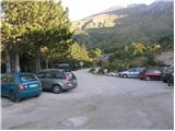
From Tolmin, drive towards Kobarid or vice versa, but only until you reach the point where the signs for Kamno direct you to the right (or left from Kobarid) across the bridge. Follow the relatively narrow and ascending road towards the village Vrsno and higher up Krn. From the village Krn, continue in the direction of the Hut at mountain pasture Kuhinja. When you reach a large parking lot, where the road continues slightly to the left towards Koča na planini Kuhinja, park in the large parking lot.
Path description:
From the parking lot at the small quarry, continue along the upper right-hand road in the direction of mountain pasture Kašina (left mountain pasture Kuhinja 3 minutes). The road, which continues to climb moderately, after a few steps of further walking leads us to the next junction, where we continue to the right again (left mountain pasture Zaslap). The relatively winding road, which gradually turns into cart track, soon leads to vast grassy slopes, where you enter the pastures of mountain pasture Kašina.
Here the road or cart track turns even more to the right, then makes a sharp left turn, and then continues crossing the slopes to the right. After about 45 minutes (from the starting point) of moderate ascent, the relatively scenic route leads to the nettle-covered mountain pasture of Leskovec.
From the above-mentioned mountain pasture, continue slightly to the left along a marked and initially rather gently sloping mountain path. The path, which turns to the western and increasingly steep grassy slopes, is joined higher up on the right by a slightly less beaten path with mountain pasture Sleme. Continue left along the already very steep path, which climbs at the foot of the steep walls of Maselnik (1906 m). A little higher up, a second path with mountain pasture Sleme joins the path, which is exposed to falling rocks due to its considerable steepness. Continue straight on along the path, which descends a little higher and then turns quite left into a small valley. There is a short, slightly steeper climb and you see the lake at Lužnica (1801 m) slightly below you on the left. You descend to it along a short unmarked path.

Pictures:
 1
1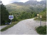 2
2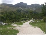 3
3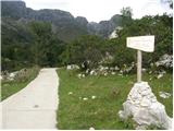 4
4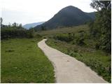 5
5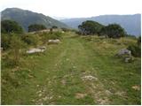 6
6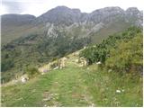 7
7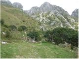 8
8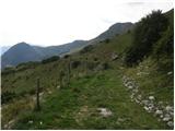 9
9 10
10 11
11 12
12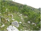 13
13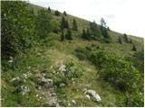 14
14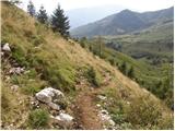 15
15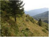 16
16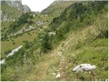 17
17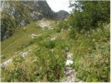 18
18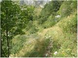 19
19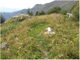 20
20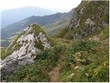 21
21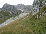 22
22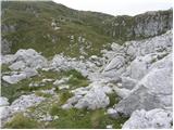 23
23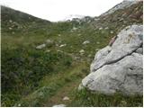 24
24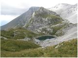 25
25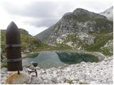 26
26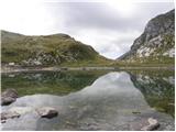 27
27
Discussion about the trail Planina Kuninja - The lake Jezero v Lužnici
|
| Jimy6. 10. 2007 |
Ta del poti sem prehodil sredi avgusta v nasprotni smeri.Z ženo sva se vračala s Krna proti planini Kuhinja,kjer sva zgodaj zjutraj štartala.Zelo lepa in razgledna pot,omenil pa bi padajoče kamenje in skale z Maslenika,ki se je nevarno valilo proti strmi stezi pod njim.Po krajšem postanku se je stvar umirila tako,da sva nevarni odsek poti na hitro zapustila in se dvignila levo v travnato pobočje in se spustla proti planini Leskovca.Na planini Kašina sva kupila tudi dober sir in skuto.
|
|
|
|
| lecy22. 07. 2013 |
zanima me, koliko je še hoje od jezera v lužnici do vrha nad peski?
|
|
|
|
| B222. 07. 2013 |
Malo več kot uro ne prehitre hoje...
|
|
|
|
| Melita111. 09. 2017 |
Lep in zelo natančen opis pristopa s planine Kuhinja za 3/4 poti. Potem se pa natančnost kar izgubi. Nikjer ni omenjeno križišče za Rdeči rob. Tu nadaljujete v smer Krna. Mogoče je to boljša informacija kot zgolj 'levo', 'desno'.
|
|
|
|
| Janez Seliškar11. 09. 2017 |
Križišče ne more biti omenjeno, ker ga ni, saj na Rdeči rob ne vodi markirana pot.
|
|
|
|
| keti111. 09. 2017 |
Glede na to, da je pot dobro vidna, se meni zdi opis čisto dovolj natančen. Odcep za Rdeči rob je sicer označen, vendar je tista potka bistveno slabša kot glavna pot proti Lužnici in Krnu, zato ni nevarnosti, da bi človek zašel tja. Sicer je pa vedno treba imeti tudi dobro karto, ne samo opisa in potem ni nobenih težav.
|
|
|