Planina Blato - Kanjavec (via Dolina za Mišelj vrhom)
Starting point: Planina Blato (1147 m)
| Lat/Lon: | 46,3112°N 13,8501°E |
| |
Name of path: via Dolina za Mišelj vrhom
Time of walking: 6 h 15 min
Difficulty: easy pathless terrain
Altitude difference: 1422 m
Altitude difference po putu: 1720 m
Map: TNP 1 : 50.000
Recommended equipment (summer):
Recommended equipment (winter): ice axe, crampons
Views: 10.933
 | 3 people like this post |
Access to the starting point:
From the Ljubljana - Jesenice motorway, take the Lesce exit and follow the road towards Bled and on to Bohinjska Bistrica. Continue towards Bohinjsko jezero (Ribčev laz), at which you will come to a crossroads where you will turn right towards Stara Fužina. At Stara Fužina, at the crossroads by the chapel, turn sharp left onto the ascending road towards mountain pasture Blato, mountain pasture Vogar and the Voja valley. The road continues to the place where the toll and parking fees are collected, and we follow it to the next crossroads, where we continue to the left (right Voje). We then follow the road to the next crossroads (we drive for some time), where we take a sharp right in the direction of mountain pasture Blato (straight ahead mountain pasture Vogar). Follow this road to the parking lot above mountain pasture Blato.
Path description:
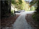
From the parking lot, continue along the road ahead, which leads to a right-hand bend over a roadblock. Here the road starts to descend and after two minutes of descent leads us to a crossroads, where we turn right to cart track. "Follow Cart track, which climbs moderately, for about 15 minutes to the faintly visible start of a hunting trail towards mountain pasture Krstenica (the start of the trail is visible on the left). Like most hunting trails, this trailhead has been erased so that we may have some difficulty finding the trailhead (if we cannot find it, we can continue along cart track, keeping to the left-hand directions). The hunting trail continues through the forest with some short steep climbs and after a good hour's walk leads to a small hunting lodge on the left-hand side of the trail. Here, a minute-long path branches off to the left to a viewpoint where we can see mountain pasture Blato below us. From the hunting lodge onwards, the path soon leads us out of the forest, where we rejoin the cart track. It is only a good five-minute walk to mountain pasture Krstenica, where we have a beautiful view of Ogradi, Krn and the Lower Bohinj Mountains.
From mountain pasture continue along the path, which is initially slightly less visible on the west (left) side of mountain pasture. After a few tens of metres, several smaller paths merge into one clearly visible path. The path continues with a few short ascents and descents, crossing the slopes of the Malá and Jezerski Stog. After about half an hour's walk from Krstenica, the path leads into the grassy world of the abandoned mountain pasture Jezerce. Here our path turns right into the grassy slopes. The path climbing under the slopes of Adam and Eve becomes steeper and steeper and after 45 minutes leads us to Jezerski preval, where we have a view of Triglav.
From the saddle, descend to the north side. The path turns slightly to the right at the beginning and after a few minutes to the left into a sparse larch forest. The path continues to descend and leads to a crossroads where the marked path to Mišeljski Preval branches off to the left. Continue along the right-hand path, which you leave shortly before Planina pod Mišelj vrhom and turn left onto the unmarked path towards the valley below Mišelj vrh (westwards). The path begins to climb and is well beaten, passing under the southern slopes of Mišelj vrh. When you reach the north side of Škednjovec (2309m), the path becomes slightly less visible and runs on flat terrain strewn with rocks and boulders. We start climbing again and as we approach the Mišelj end (2464m) the valley turns to the left. Here we walk along the left side of the valley, which becomes quite steep in the upper part and leads us to the saddle between Vrh Hribaric (2388m) and Mišeljski konce. From the saddle, descend a few metres and join the unmarked path that leads through the valley behind Debeli vrh. After a few minutes of walking, you will reach a crossroads at Hribarice, where you are back on the marked path. Head straight in the direction of Kanjavac. The trail climbs quite steeply and follows an undistinguished valley between the eastern and western peaks of Kanjavac. At the saddle between the two peaks, turn right and reach the summit in a few minutes.

Pictures:
 1
1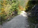 2
2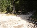 3
3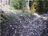 4
4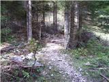 5
5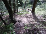 6
6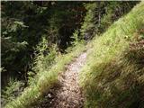 7
7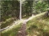 8
8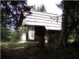 9
9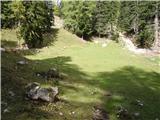 10
10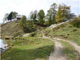 11
11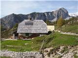 12
12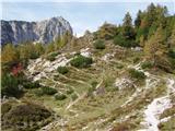 13
13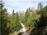 14
14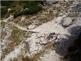 15
15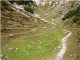 16
16 17
17 18
18 19
19 20
20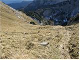 21
21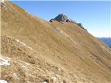 22
22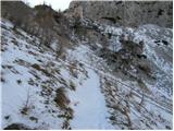 23
23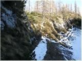 24
24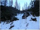 25
25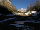 26
26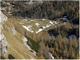 27
27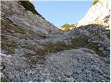 28
28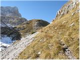 29
29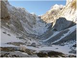 30
30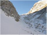 31
31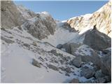 32
32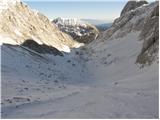 33
33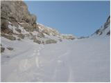 34
34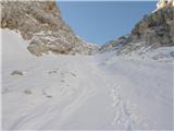 35
35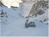 36
36 37
37 38
38 39
39 40
40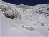 41
41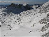 42
42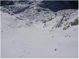 43
43 44
44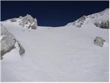 45
45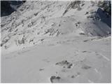 46
46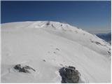 47
47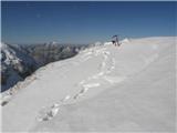 48
48
Discussion about the trail Planina Blato - Kanjavec (via Dolina za Mišelj vrhom)