Pian dei Spiriti - Cima Cadin Nord Est (Via Ferrata Ceria Merlone)
Starting point: Pian dei Spiriti (1840 m)
| Lat/Lon: | 46,59096°N 12,26319°E |
| |
Name of path: Via Ferrata Ceria Merlone
Time of walking: 3 h 20 min
Difficulty: very difficult marked way
Ferata: C
Altitude difference: 948 m
Altitude difference po putu: 970 m
Map: Tabacco 03 1:25.000
Recommended equipment (summer): helmet, self belay set
Recommended equipment (winter): helmet, self belay set, ice axe, crampons
Views: 2.110
 | 1 person likes this post |
Access to the starting point:
a) Access from Gorenjska: Via Border crossing Rateče drive to Trbiž / Tarvisio, where you take the motorway towards Udine. Leave the motorway at the exit for Tolmezzo and follow the road to the above-mentioned place. From Tolmezzo, continue in the direction of Ampezzo and the Passo della Mauria mountain pass. The road then begins to descend and leads into the Cadore valley, where you continue to the right (Belluno and Cortina d'Ampezzo on the left) in the direction of Auronzo. After a few more km of driving, you reach the next major crossroads, where you turn right towards the Misurina Pass and Tre Cin / Tre Cime (left Tre Crocci Pass). From the Misurina Pass, the road starts to descend and quickly leads to a crossroads where signs for Tre Cine / Tre Cime direct you right onto the mountain road towards the Auronzo hut. Follow this road to a crossroads where a dirt road marked "Rifugio Fonda Savio" branches off to the right. You can park in the gravel parking area at the beginning of the road. There is also another parking lot a little higher up, if you continue along the dirt road. The mountain road to here is toll-free.
b) From the Primorska side: Take the motorway towards Venice/Venezia. At Portogruaro, leave the motorway towards Venice and turn right on the motorway towards Pordenone. At the next motorway junction near Conegliano, turn right towards Belluno. Near Belluno the motorway ends and we continue towards Cortina d'Ampezzo and Auronzo. When the road enters the Cadore valley, you will come to a large junction where the road towards Cortina d'Ampezzo goes left and the road towards Auronzo goes right. Here we continue to the right towards Auronzo. Continue as described above.
Path description:
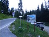
From the parking lot continue along the macadam road, which begins to climb through the forest and at a small clearing on our left joins an unmarked path from a slightly higher starting point. The road turns right here and then leads to mountain pasture Pian dei Spiriti where there is another parking lot.
At mountain pasture where there are signs, turn slightly left on footpath 115 towards hut Rifugio Fonda Savio. The path leads us back into the forest through which we then climb for some time. The forest becomes thinner and thinner and a little higher up the path turns to the right. The path then crosses a slope to the south-east in an ascent and leads to more scenic slopes below the cargo cableway. The path turns left here and then climbs for some time in the keys below the cableway. Higher up, the terrain levels out and the view opens up towards hut Rifugio Fonda Savio and the surrounding precipitous peaks. The trail turns left again and leads along relatively level and mostly grassy terrain to the north-east. When you reach the base of the precipitous slopes of the summit of Cima Ciadin dei Toce, the path turns slightly to the right and then climbs up the valley on the left. The path then climbs on increasingly rocky terrain and just before the hut it leads to a marked crossroads.
The path branches off to the right towards the Forcella del Diavolo and the Rifugio Col de Varda, and we head left towards the Rifugio Fonda Savio. There is then only a short, slightly steeper climb to the hut. The last climb is aided by a zip wire, which is not strictly necessary. At the hut, which is located on the Passo dei Tocci saddle below the slopes of Torre Wundt, we also have a view to the north-east.
At the hut where the crossroads are, continue to the right, following the signs for 'Ferrata Merlone', and to the left the path leads down to the Forcella Rinbianco notch and on to the Rifugio Auronzo hut. From the hut, our route begins to climb southwards below the slopes of the Cadin peaks. The path then leads into a valley surrounded by precipitous peaks and the steepness eases. Here we will soon come to a crossroads at which we will see an old signpost.
At the crossroads, we leave the path towards the Forcella della Neve, and we turn slightly to the left and follow the blue markers. The path is not very visible here and at first descends a little and crosses a valley where snowdrifts linger long into the summer. The valley is relatively level so that, despite the possibility of snowfields, crossing it is not difficult. After crossing the valley, continue slightly to the right and then look out for the blue markers pointing left towards the wall. Near the start of the protected route, you will also notice a large blue sign in the wall "1966", which is the year when the protected route Via Ferrata Ceria Merlone to the top of Cima Cadin Nord Est was made. Before entering the protected part of the trail, equip yourself with a helmet and a self-protection kit. In the initial part, the protected path first crosses the slope to the left at the ascending steel cable, then turns to the right and the slope becomes a shade less steep. The path is not protected in this part, so caution is still needed when ascending. Follow the many blue markings which lead you back to the rope ladders and soon to the first ladders. We continue climbing for a long time on a number of ladders, which make the climb up the otherwise very steep slope a little easier. Higher up, the slope is not equipped with ladders, which makes the climb a little more difficult. In the upper part, the steepness then eases and there is a climb up a short scree slope, where we must be careful not to break rocks. Then climb up again with the help of the ropes, which leads us to the ridge from where the view to the east opens up. Continue left on the ridge and quickly reach the summit.
There is only one path to the summit, so you have to descend by the ascent route.

Pictures:
 1
1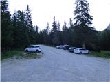 2
2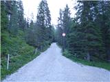 3
3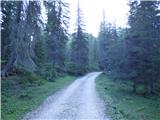 4
4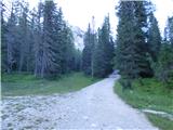 5
5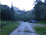 6
6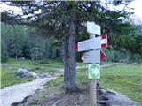 7
7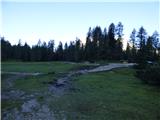 8
8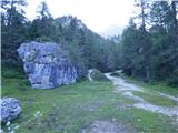 9
9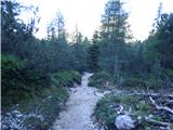 10
10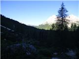 11
11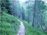 12
12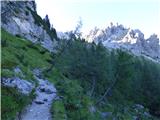 13
13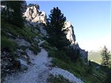 14
14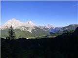 15
15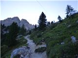 16
16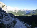 17
17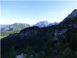 18
18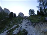 19
19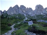 20
20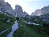 21
21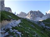 22
22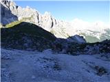 23
23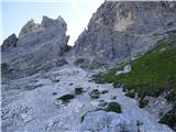 24
24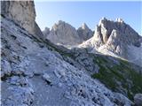 25
25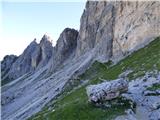 26
26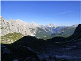 27
27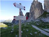 28
28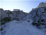 29
29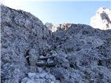 30
30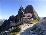 31
31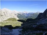 32
32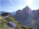 33
33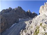 34
34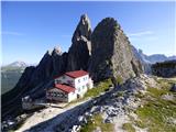 35
35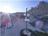 36
36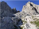 37
37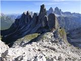 38
38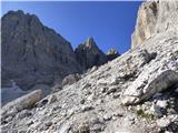 39
39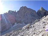 40
40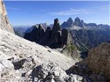 41
41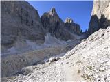 42
42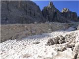 43
43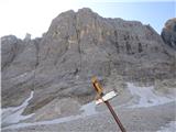 44
44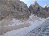 45
45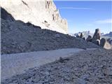 46
46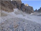 47
47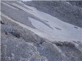 48
48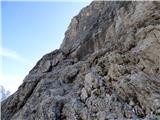 49
49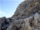 50
50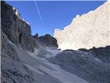 51
51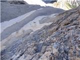 52
52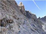 53
53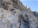 54
54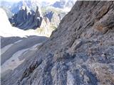 55
55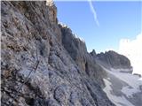 56
56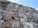 57
57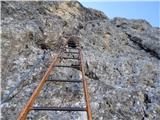 58
58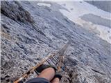 59
59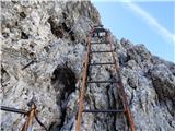 60
60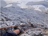 61
61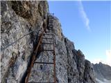 62
62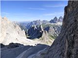 63
63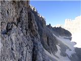 64
64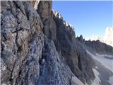 65
65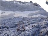 66
66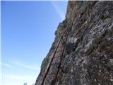 67
67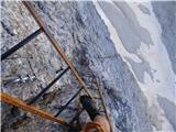 68
68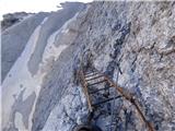 69
69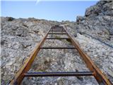 70
70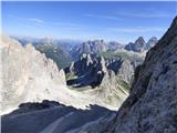 71
71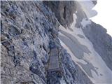 72
72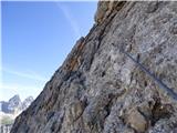 73
73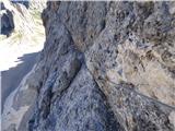 74
74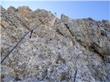 75
75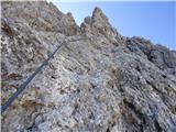 76
76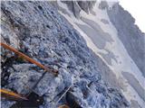 77
77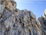 78
78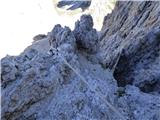 79
79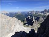 80
80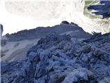 81
81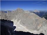 82
82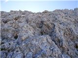 83
83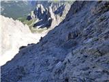 84
84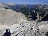 85
85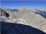 86
86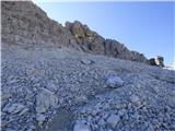 87
87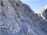 88
88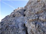 89
89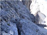 90
90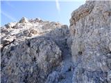 91
91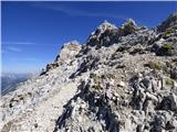 92
92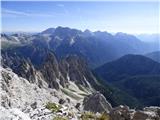 93
93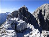 94
94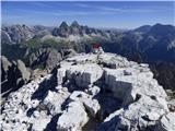 95
95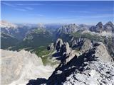 96
96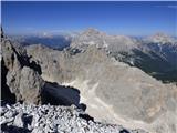 97
97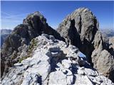 98
98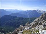 99
99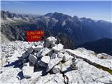 100
100
Discussion about the trail Pian dei Spiriti - Cima Cadin Nord Est (Via Ferrata Ceria Merlone)
|
| mirank4. 11. 2018 |
Pravilno ime ferate je Merlone; pot Ceria-Merlone je v Julijcih
|
|
|
|
| Rok4. 11. 2018 |
Mislim, da imata obe poti enako ime. Še bolj točno pa je Ferrata Ruggero Merlone - Celestino Ceria.
Obe imeni sta zapisani tudi na plošči pri vstopu v ferato. Tudi na zemljevidu, ki ga imam Tabacco 03 sta obe imeni.
Na smerokazih pa res piše samo Ferrata Merlone.
|
|
|
|
| mirank5. 11. 2018 |
Ne samo na smerokazih, tudi v literaturi in na internetu (It) je samo Merlone. Je pa res, da imenovana alpinista ponavadi nastopata skupaj; skupaj sta žal tudi zaključila. Kaj piše na tabli ne vem, ker se mi nismo podali na to ferato, ampak smo šli mimo po dolini navzgor po poti 112 in preko forcelle della neve do oče Carpi.
|
|
|