Pecol - Cima Verde / Vrh Brda
Starting point: Pecol (1510 m)
| Lat/Lon: | 46,4092°N 13,4376°E |
| |
Time of walking: 3 h 10 min
Difficulty: very difficult unmarked way
Altitude difference: 1151 m
Altitude difference po putu: 1160 m
Map: Julijske Alpe - zahodni del 1:50.000
Recommended equipment (summer): helmet, self belay set
Recommended equipment (winter): helmet, self belay set, ice axe, crampons
Views: 18.586
 | 3 people like this post |
Access to the starting point:
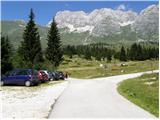
a) From Kranjska Gora, drive through the Rateče border crossing to Trbiž / Tarvisio. In Trbiz, turn left towards Bovec and follow the road to the crossroads near Lake Rabeljsko. Here, turn right towards the Neveje Pass (Na Žlebeh) / Sella Nevea. As the road starts to descend towards the Reclan valley, a sharp left turn to the right leads to a narrow and steep road towards the Jôf di Montasio high plateau / Altopiano del Jôf di Montasio (there are signs in Italian at the crossroads). Follow this road to a large marked parking area located a few 100 m in front of the Pecol cheese cottage (no further driving).
b) From Bovec, drive to the Predel border crossing, from which you descend to the Italian side. Just after Lake Rabelj, you will reach a crossroads where you turn left towards Neveje Preval (Na Žlebeh) / Sella Nevea. As the road starts to descend towards the Reclana valley, a sharp left-hand bend turns off to the right onto a narrow and steep road towards the Jôf di Montasio high plateau / Altopiano del Jôf di Montasio (there are signs in Italian at the crossroads). Follow this road to a large marked parking lot located a few 100 m before the Pecol cheese cottage (no further driving).
Path description:
From the parking lot at mountain pasture Pecol, take the narrow road on the right towards the Rifugio di Brazza. Soon, signs direct you left onto a footpath which takes you across meadows to reach the hut in just over 15 minutes. At the crossroads, which is only a few tens of metres above the hut, take the left path, which leads to the saddle Forca dei Disteis (2201m), and the right path leads to Cima di Terrarossa (2420m). From the crossroads, first descend a few metres, then cross the meadows below the walls of Jôf di Montasio in a gentle ascent, and if you are lucky you may also spot the alpine marmots, which are abundant around here. Soon, a direct trail with mountain pasture Pecol joins from our left, which is a few minutes shorter than the one past the hut. Here the path climbs a little steeper and soon leads us to the aforementioned saddle where there are usually many ibex. It takes about two hours to reach the saddle from the starting point. At the saddle, the path turns to the right across the scree and we soon come to the crossroads again. The left path, which is less frequented and slightly more difficult, leads to the Suringar bivouac (2430m). We take the right path, which continues to cross the scree and leads us to the memorial slabs, where we enter the rocky part of the trail. Here the route becomes more difficult, some easy climbing is required, and we also have a few ropes to help us. The path then turns slightly to the left, where we cross a small scree slope and soon reach a slightly less visible crossroads in front of Pipan's ladder. We continue to the right and start climbing up the steep grasses. The slope is very steep and the path is not protected and is therefore dangerous to slip on. In the last part of the climb there is also some rubble on the path, so we have to be careful not to push rocks through, as there is a very well-trodden path below us leading to Montaž.

Pictures:
 1
1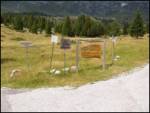 2
2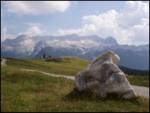 3
3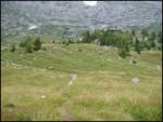 4
4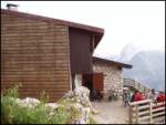 5
5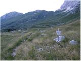 6
6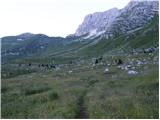 7
7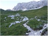 8
8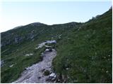 9
9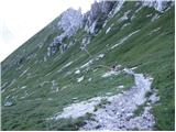 10
10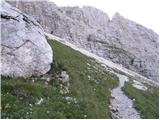 11
11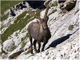 12
12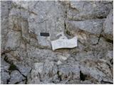 13
13 14
14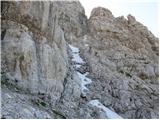 15
15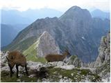 16
16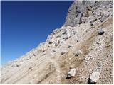 17
17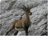 18
18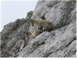 19
19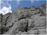 20
20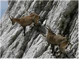 21
21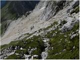 22
22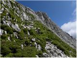 23
23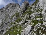 24
24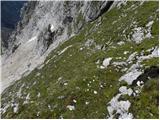 25
25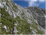 26
26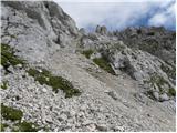 27
27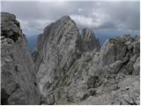 28
28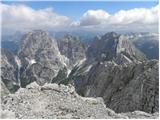 29
29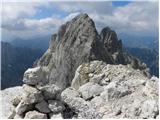 30
30
Discussion about the trail Pecol - Cima Verde / Vrh Brda
|
| Jacek26. 08. 2009 |
Druga varianta je ta, da greš gor po Pipanovi l. in ko na grebenu pot zavije levo proti Montažu, zestopiš desno nekaj metrov in prideš do majhne škrbine. Prehod čez njo je malo neroden. Pozneje nadaljuješ po neoznačeni stezi proti vrhu.
|
|
|
|
| umetnik00731. 08. 2019 |
Pot je dobro vidna, na trenutke celo označena z obledelimi rdečimi pikami. Od razcepa v celoti nevarovana, zato primerna za ljudi z gorniškimi izkušnjami. Povečini se da lepo hoditi po travnatih poličkah, opazil sem le nekaj metrov dokaj ozke in izpostavljene poti, ki sem jo raje obšel oz. sekal desni ovinek. Razgled res krasen.
|
|
|