Passo Campolongo - Lago Boe
Starting point: Passo Campolongo (1860 m)
| Lat/Lon: | 46,5193°N 11,87393°E |
| |
Time of walking: 1 h 10 min
Difficulty: easy marked way
Altitude difference: 392 m
Altitude difference po putu: 410 m
Map: Tabacco 03 1:25.000
Recommended equipment (summer):
Recommended equipment (winter):
Views: 1.500
 | 2 people like this post |
Access to the starting point:
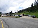
Drive through the Karavanke Tunnel into Austria, then continue to Spittal and on to Lienz (the motorway ends a little after Spittal). We continue along a relatively nice and wide road through the Drava Valley, which leads us into Itali. The road continues past Dobbiaco/Toblach and Brunico/Bruneck. Just after the last-mentioned town, which is passed by a bypass road, we turn left into the Val Badia valley. Continue along the valley past La Vila and Corvara. Then climb up to the Passo Campolongo. A few hundred metres before the pass, you will see a gravel parking area on your left. The parking lot is located behind the Hotel Laguscei, opposite the bus stop. The lower station of the chairlift is also along the road. There is also a smaller parking lot on the right hand side of the road in front of the bus station.
Path description:
From the parking lot, continue along the main road (south) to the Hotel Boe, which is on the right west side of the road. At the hotel, where there are also signs, turn right onto the dirt road after the signs "Rifugio Lago Boe". After the hotel, the road turns right and descends a little, then starts to climb and crosses the ski slope. The road then climbs briefly through the woods and then leads to mountain pasture Malga Plan Fisti.
Continue on the road via mountain pasture and just after mountain pasture you will reach a marked crossroads where a footpath branches off to the left towards the Kaiser Hütte hut. We continue to the right and continue to climb up the road. After a short climb, the 638A trail then branches off to the right towards the summit of Crep de Munt. We continue left along the road, which offers beautiful views towards the Marmolada and the mountains above the Val Badia valley. The road climbs a little steeper here and leads us back to the ski slopes. A little higher up, the road turns to the right and continues to climb along the mostly grassy slopes. The road then becomes flatter and soon leads to the Rifugio Lago Boe hut. The hut is also reached by a circular cable car from Corvara in Val Badia. Near the hut, there is also the lower station of the chairlift leading to the Vallon peak (2530m). Both lifts are also in operation during the summer months.
Near the hut where there is a crossroads, continue left along the ski slope to the signs for Lech de Boe lake and the Ütia Franz Kostner hut. The path follows the right edge of the ski slope and after a short climb leads to the lake, which is located to the right of the ski slope under a rocky ridge.

Pictures:
 1
1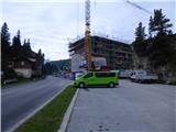 2
2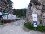 3
3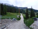 4
4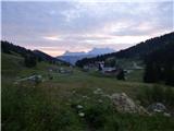 5
5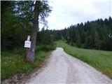 6
6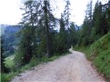 7
7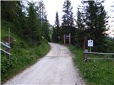 8
8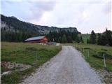 9
9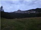 10
10 11
11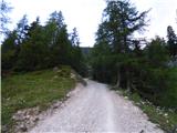 12
12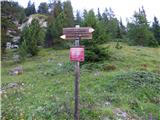 13
13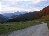 14
14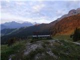 15
15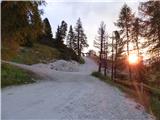 16
16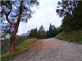 17
17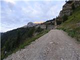 18
18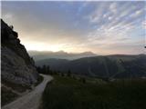 19
19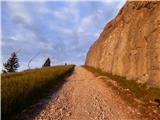 20
20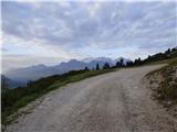 21
21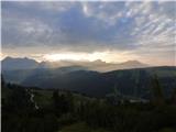 22
22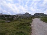 23
23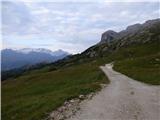 24
24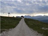 25
25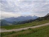 26
26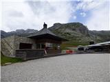 27
27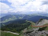 28
28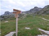 29
29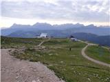 30
30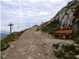 31
31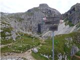 32
32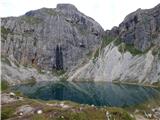 33
33
Discussion about the trail Passo Campolongo - Lago Boe
|
| Savinja1130. 07. 2022 20:27:46 |
27.7.2022 sva se po opisani poti vrnila od jezera Boe na izhodišče - prelaz Campolongo (1875m). Pot pa sva začela po makadamski cesti nasproti hotela Monte Sherz, ki se nahaja ob cesti v bližini opisanega izhodišča. S parkiranjem na prelazu Campolongo ni težav, ni gneče in je zastonj. Po makadamski cesti, ki sva jo izbrala, se vzpnemo do koče Bec de Roces (2187m) in nadaljujemo po poti 636 po nezahtevnem, slikovitem, travnatem in skalnatem terenu proti jezeru Boe (2275m). S poti se odpirajo lepi razgledi na gore med Col di Lano in Sassongherjem. Vrnemo se po dobro vidni in opisani poti oz. makadamski cesti, ki vodi po smučiščih. Pot je primerna za vse starosti. Za 8 km dolgo lahkotno pot sva potrebovala tri ure in pol.
|
|
|