Parking below Polinikhütte - Ebeneck (Kreuzeck Hohenweg)
Starting point: Parking below Polinikhütte (1350 m)
Name of path: Kreuzeck Hohenweg
Time of walking: 3 h
Difficulty: easy marked way
Altitude difference: 781 m
Altitude difference po putu: 781 m
Map: Kompass 49 NP Hohe Tauern Sud 1:50000
Recommended equipment (summer):
Recommended equipment (winter):
Views: 4.061
 | 2 people like this post |
Access to the starting point:
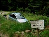
Follow the motorway through the Karavanke Tunnel past Belzec to the turn-off to Lienz, where you turn right after Lendorf towards Obervellach. Here, turn right at the petrol station, left into the centre after a few metres by the swimming baths and left again at the end of the short main street into the underpass (670 m). Follow the many signs for Polinikhutte: over a narrow iron bridge, through an alley, past the 5 km/h speed limit and into the forest. The tarmac soon runs out and the steep dirt road ends after a few kilometres at a small parking lot by a ramp (about 1350 m). The postal bus from Obervellach also comes here. One bend earlier, there is a turn-off to the Wunzenalm, where there used to be a cargo cableway to the hut. The cable car no longer exists, but the track remains.
Path description:
After the ramp, walk along the road for a while (it is number 328 on the map, but there are no numbers on the ground), then follow the signs into the forest. The path, carpeted with larch and spruce needles, crosses the road several times and leads to the mountain pasture Stampferalm, where the romantic Polinik hut is situated on a lookout point at 1873 m. 90 minutes to get here.
From the hut, follow the signs (on the map this is route 326) through the wods for a while, then onto the wide slopes covered with rhododendron and blueberries. After an hour, just before the ruins of the hut, a track branches off to Ebeneck, which is half an hour away (on the map this is route 329). Continue in a gentle ascent, crossing the slopes of the higher heads of the Mornigkopfe ridge, until you reach the lowest of these heads, our viewpoint summit, where the cross with the register stands.
Pictures:
 1
1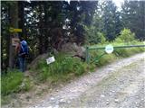 2
2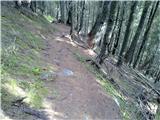 3
3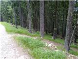 4
4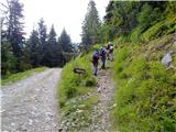 5
5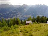 6
6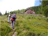 7
7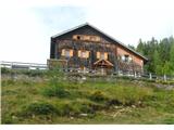 8
8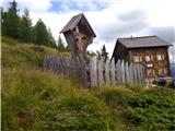 9
9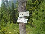 10
10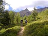 11
11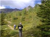 12
12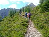 13
13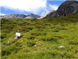 14
14 15
15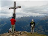 16
16
Discussion about the trail Parking below Polinikhütte - Ebeneck (Kreuzeck Hohenweg)