Ozeljan - Veliki Rob (via sekulak)
Starting point: Ozeljan (95 m)
| Lat/Lon: | 45,941°N 13,7329°E |
| |
Name of path: via sekulak
Time of walking: 4 h 20 min
Difficulty: easy unmarked way
Altitude difference: 1142 m
Altitude difference po putu: 1300 m
Map: Goriška - izletniška karta 1:50.000
Recommended equipment (summer): helmet
Recommended equipment (winter): helmet, ice axe, crampons
Views: 1.090
 | 1 person likes this post |
Access to the starting point:
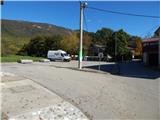
a) From the Vipava expressway, take exit Vogrsko and then continue in the direction of Tolmin and Ozeljana. When you reach the old Ajdovščina - Nova Gorica road, turn right at the traffic lights towards Ajdovščina. When you reach Ozeljan, in the hamlet of Otava, turn left onto a slightly narrower road that leads between houses. After a few 100 metres, when you reach a small crossroads by Zavarovalnici Triglav, Pošta Slovenije and Ozlinka, continue straight ahead and park in the parking lot by the ecological island. You can also park in the cemetery parking lot about 100 metres away, to the left of the junction.
b) From Nova Gorica, take the old road towards Ajdovščina, and then at the hamlet of Tri Hiše (the hamlet is located at the semaphoreised crossroads where the road to Vogrsko branches off to the right), continue straight ahead. When you reach Ozeljan, in the hamlet of Otava, turn left onto a slightly narrower road that leads between houses. After a few 100 metres, when you reach a small crossroads by Zavarovalnici Triglav, Pošta Slovenije and Ozlinka, continue straight ahead and park in the parking lot by the ecological island. You can also park in the cemetery parking lot about 100 metres away, to the left of the junction.
Path description:
From the starting point, continue east (in the route of the description to the starting point from the crossroads where we parked on the right), where the path leads us past the Konem Color company, and then we arrive at a crossroads where we continue left (right Lepenje) on the ascending asphalt road. The road continues past a few more houses, and then continues along the "main" road at the next few junctions. When you reach a crossroads higher up, near the hamlet of Opade, you continue straight up onto a dirt road, with a road sign "telling" you that you will continue along the fire road. Continue along the dirt road, which climbs gently to moderately, occasionally offering some views of the surrounding hills. Higher up, at the next sign for the firebreak, continue straight ahead or slightly to the right. Some 10 paces further on, the road starts to descend, and we continue left at this point on cart track, which climbs to a marked crossroads.
From the crossroads go right (left Vodice), and then quickly reach the next worse macadam road, where you reach the path from Vitovlje (the path from Križišče).
This road is reached at the 7th stop of the crossroads, and we follow the road up through the forest. At a left turn a few minutes away, we pass a beautiful view of Vitovski hrib, and we follow the road to the next crossroads, which is located just before the 12th station of the Stations of the Cross.
From this crossroads continue left in the route of Kopitnik, Čavno and Veliki Rob (straight ahead Vitovski hrib - 5 minutes) and follow the narrower cart track. A few minutes further on you reach the next crossroads, where you continue in the route of Čavno and Krnice (Skozno on the left, St. Lucija on the sharp right).
The Napoleon's Way, which continues on a winding path, soon leads us to the steep cliffs of the High Wall. The wide path leads us over an artificially carved lookout ledge (danger of falling rocks), after which the path returns to the forest and leads us to a place where the path to Kopitnik branches off to the left.
Continue slightly right in the route of Čavna and Sekulak along a slightly narrower path, which initially leads us through some small clearings to a steeper part. The way ahead climbs steeper and leads us only slightly higher to the next crossroads, where we continue to the right in the route of the viewpoint (Kopitnik on the left). The ascent continues along the gently sloping path, which leads us in 5 minutes of further walking to the lookout point Sekulak, from which we open a view over a large part of the Vipava valley. From Sekulak continue left along the marked path, which continues along the ridge, which is initially very scenic. The trail goes higher into the forest and only a short distance afterwards leads to a small leveling-off point, where there is a noticeably less well-marked crossroads.
The path to the left continues towards Kopitnik, and we continue to the right, where after a few metres we see the markers for Veliki Rob. We continue our ascent towards Veliki Rob, following a path that is at first unrecognisably less visible. The path higher up becomes more distinct and after a while leads us to a lookout point from which we have a view of the Vipava Valley, Trstelj, the Gulf of Trieste and the Dolomites.
We continue along the marked path, which begins to climb steeply, and leads us to a steeper part below the peak of Čavna (1185 m). The path then lays down and continues with a few short descents and ascents to the east. After a few minutes of further walking, we can see the peak of Velika Roba in front of us. The path continues from the ridge, turns slightly left and retreats to steep cliffs. The path climbs through a short lane of a forest and leads to the top slope of the mountain, from where it is only a few 10 steps to the summit.
Ozeljan - Sekulak 2:50, Sekulak - Veliki Rob 1:30.

Pictures:
 1
1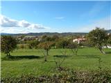 2
2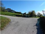 3
3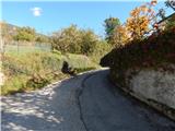 4
4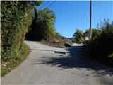 5
5 6
6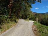 7
7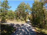 8
8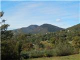 9
9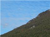 10
10 11
11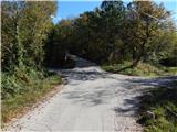 12
12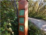 13
13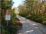 14
14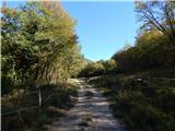 15
15 16
16 17
17 18
18 19
19 20
20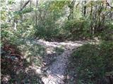 21
21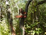 22
22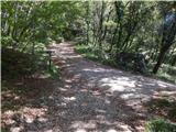 23
23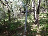 24
24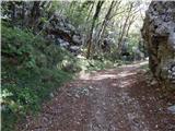 25
25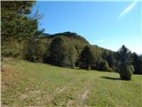 26
26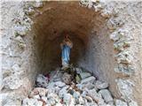 27
27 28
28 29
29 30
30 31
31 32
32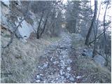 33
33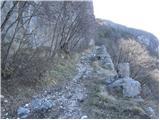 34
34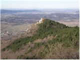 35
35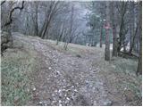 36
36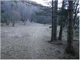 37
37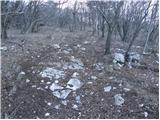 38
38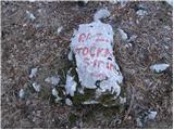 39
39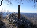 40
40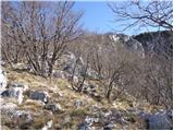 41
41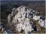 42
42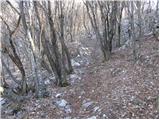 43
43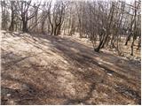 44
44 45
45 46
46 47
47 48
48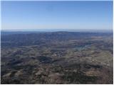 49
49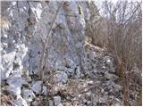 50
50 51
51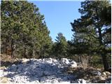 52
52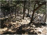 53
53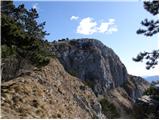 54
54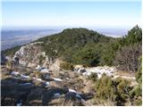 55
55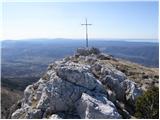 56
56 57
57
Discussion about the trail Ozeljan - Veliki Rob (via sekulak)